
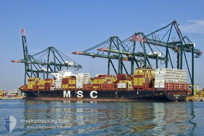
MSC MAXINE
Cargo A
Current Trip
| Time Travelled | 11 days |
|---|---|
| Remaining Time | 1 h, 33 mins |
| Distance Travelled | 3614.57 nm |
| Remaining Distance | 12.01 nm |
| AVG Speed | 14.1 Noeuds |
| MAX Speed | 16.9 Noeuds |
| AVG Wind | 12.6 knots |
| MAX Wind | 23.8 knots |
| MIN Temp | 19°C / 66.2°F |
| MAX Temp | 27.4°C / 81.32°F |
| Tirant d eau | 13.8 m |
| Position reçue | 1 h, 8 m depuis |
Current Position
| Longitude | -34.76237° |
|---|---|
| Latitude | -8.31255° |
| Etat | Under way using engine |
| Vitesse | 3.6 Noeuds |
| Parcours | 99° |
| Zone | South Atlantic Ocean |
| Station | T-AIS |
| Position reçue | 1 h, 8 m depuis |
Info
Information
The current position of MSC MAXINE is in South Atlantic Ocean with coordinates -8.31255° / -34.76237° as reported on 2024-07-06 00:07 by AIS to our vessel tracker app. The vessel's current speed is 3.6 Noeuds and is heading at the port of SUAPE. The estimated time of arrival as calculated by MyShipTracking vessel tracking app is 2024-07-06 02:49 LT
The vessel MSC MAXINE (IMO: 9720287, MMSI: 255806521) is a Cargo A It's sailing under the flag of [PT] Portugal.
In this page you can find informations about the vessels current position, last detected port calls, and current voyage information. If the vessels is not in coverage by AIS you will find the latest position.
The current position of MSC MAXINE is detected by our AIS receivers and we are not responsible for the reliability of the data. The last position was recorded while the vessel was in Coverage by the Ais receivers of our vessel tracking app.
The current draught of MSC MAXINE as reported by AIS is 13.8 meters
Weather
| Temperature | 26.1°C / 78.98°F |
|---|---|
| Wind Speed | 10 knots |
| Direction | 126° SE |
| Pressure | 1017 hPa |
| Humidity | 80 % |
| Cloud Coverage | 12 % |
Featured Company
Last Port Calls
| Port | Arrival | Departure | Time In Port |
|---|---|---|---|
| 2024-06-23 09:38 | 2024-06-24 10:05 | 1 d | |
| 2024-06-21 06:45 | 2024-06-22 16:04 | 1 d | |
| 2024-06-18 03:19 | 2024-06-19 13:07 | 1 d | |
| 2024-06-16 07:05 | 2024-06-17 18:25 | 1 d | |
| 2024-06-13 12:52 | 2024-06-14 23:47 | 1 d | |
| 2024-06-09 15:25 | 2024-06-10 16:16 | 1 d | |
| 2024-06-04 11:54 | 2024-06-06 02:11 | 1 d | |
| 2024-05-20 21:00 | 2024-05-20 21:48 | 48 m | |
| 2024-05-15 21:33 | 2024-05-16 08:09 | 10 h | |
| 2024-05-09 10:17 | 2024-05-10 09:13 | 22 h |
Most Visited Ports (Last year)
| Port | Arrivals | |
|---|---|---|
| 13 | ||
| 10 | ||
| 7 | ||
| 6 | ||
| 6 | ||
| 5 |
Last Trips
| Origin | Departure | Destination | Arrival | Distance | |
|---|---|---|---|---|---|
| 2024-06-22 18:04 | 2024-06-23 11:38 | 51.00 nm | |||
| 2024-06-19 15:07 | 2024-06-21 08:45 | 517.80 nm | |||
| 2024-06-17 20:25 | 2024-06-18 05:19 | 96.14 nm | |||
| 2024-06-15 01:47 | 2024-06-16 09:05 | 390.60 nm | |||
| 2024-06-10 18:16 | 2024-06-13 14:52 | 233.01 nm | |||
| 2024-06-06 03:11 | 2024-06-09 17:25 | 1121.56 nm | |||
| 2024-05-20 18:48 | 2024-06-04 12:54 | 3886.65 nm | |||
| 2024-05-16 05:09 | 2024-05-20 18:00 | 457.58 nm | |||
| 2024-05-10 06:13 | 2024-05-15 18:33 | 1146.21 nm | |||
| 2024-05-06 22:44 | 2024-05-09 07:17 | 801.66 nm |
Events
| Heure | Evenement | Détails | Position/ Destination | Info |
|---|---|---|---|---|
| 2024-07-06 00:13 | Etat Changé | Default Under way using engine |
-8.31421 / -34.75531
SUAPE
|
Vitesse: 3.6 kn Parcours: 99° |
| 2024-07-06 00:07 | Hors de la zone couverte |
-8.31255 / -34.76237
South Atlantic Ocean
|
Vitesse: 3.6 kn Parcours: 69.1° |
|
| 2024-07-06 00:05 | Etat Changé | Under way using engine Default |
-8.31351 / -34.76391
SUAPE
|
Vitesse: 1.8 kn Parcours: 41° |
| 2024-07-06 00:05 | Démarrage | 12.27 nm, East of SUAPE |
-8.31351 / -34.76391
SUAPE
|
Vitesse: 3.3 kn Parcours: 75° |
| 2024-07-05 23:49 | Dans la zone couverte |
-8.31255 / -34.76237
South Atlantic Ocean
|
Vitesse: 3.6 kn Parcours: 69.1° |
|
| 2024-07-05 20:01 | Arret | 12.02 nm, East of SUAPE |
-8.36293 / -34.75467
SUAPE
|
Vitesse: 0.3 kn Parcours: 169° |
| 2024-07-05 19:32 | Etat Changé | Default Under way using engine |
-8.35285 / -34.78245
SUAPE
|
Vitesse: 11.3 kn Parcours: 113.6° |
| 2024-07-05 19:28 | Hors de la zone couverte |
-8.34763 / -34.79602
South Atlantic Ocean
|
Vitesse: 11.3 kn Parcours: 113.6° |
|
| 2024-07-05 19:19 | Etat Changé | Under way using engine Default |
-8.34308 / -34.81738
SUAPE
|
Vitesse: 4.4 kn Parcours: 148° |
| 2024-07-05 19:13 | Dans la zone couverte |
-8.34308 / -34.81738
South Atlantic Ocean
|
Vitesse: 6.9 kn Parcours: 121.7° |