

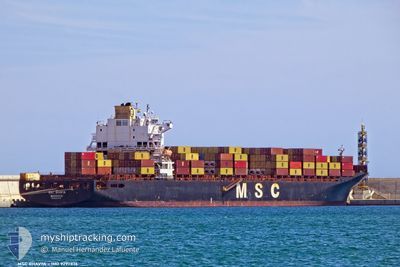
MSC BHAVYA V
Container Ship

Current Trip
| Time Travelled | 5 days |
|---|---|
| Remaining Time | 3 days |
| Distance Travelled | 1876.56 nm |
| Remaining Distance | 1460.86 nm |
| AVG Speed | 13.6 Noeuds |
| MAX Speed | 21.7 Noeuds |
| AVG Wind | 10.5 knots |
| MAX Wind | 26.5 knots |
| MIN Temp | -17.5°C / 0.5°F |
| MAX Temp | 6.5°C / 43.7°F |
| Tirant d eau | 10.4 m |
| Position reçue | 5 d depuis |
Current Position
| Longitude | --- |
|---|---|
| Latitude | --- |
| Etat | Under way using engine |
| Vitesse | 17.8 Noeuds |
| Parcours | 37.1° |
| Zone | Gulf of St-Lawrence |
| Station | T-AIS |
| Position reçue | 5 d depuis |
Information
The current position of MSC BHAVYA V is in Gulf of St-Lawrence with coordinates 47.48926° / -70.20285° as reported on 2025-03-13 05:29 by AIS to our vessel tracker app. The vessel's current speed is 17.8 Noeuds and is heading at the port of ANTWERP. The estimated time of arrival as calculated by MyShipTracking vessel tracking app is 2025-03-22 02:35 LT
The vessel MSC BHAVYA V (IMO: 9297876, MMSI: 636016423) is a Container Ship that was built in 2005 ( 20 Age ). It's sailing under the flag of [LR] Liberia.
In this page you can find informations about the vessels current position, last detected port calls, and current voyage information. If the vessels is not in coverage by AIS you will find the latest position.
The current position of MSC BHAVYA V is detected by our AIS receivers and we are not responsible for the reliability of the data. The last position was recorded while the vessel was in Coverage by the Ais receivers of our vessel tracking app.
The current draught of MSC BHAVYA V as reported by AIS is 10.4 meters
Weather
| Temperature | 6.7°C / 44.06°F |
|---|---|
| Wind Speed | 28 knots |
| Direction | 344° NNW |
| Pressure | 1005.9 hPa |
| Humidity | 78.3 % |
| Cloud Coverage | 100 % |


Featured Company
Last Port Calls
| Port | Arrival | Departure | Time In Port |
|---|---|---|---|
| 2025-03-09 14:44 | 2025-03-12 12:24 | 2 d | |
| 2025-02-24 08:42 | 2025-02-24 20:46 | 12 h | |
| 2025-02-20 20:24 | 2025-02-22 13:07 | 1 d | |
| 2025-02-19 01:29 | 2025-02-19 12:06 | 10 h | |
| 2025-02-15 23:24 | 2025-02-17 07:16 | 1 d | |
| 2025-01-31 05:07 | 2025-02-03 07:46 | 3 d | |
| 2025-01-21 03:49 | 2025-01-22 02:42 | 22 h | |
| 2025-01-18 11:38 | 2025-01-19 03:08 | 15 h | |
| 2025-01-16 12:02 | 2025-01-17 13:40 | 1 d | |
| 2025-01-05 11:12 |
Last Trips
| Origin | Departure | Destination | Arrival | Distance | |
|---|---|---|---|---|---|
| 2025-02-24 20:46 | 2025-03-09 14:44 | 3508.03 nm | |||
| 2025-02-22 13:07 | 2025-02-24 08:42 | 546.05 nm | |||
| 2025-02-19 12:06 | 2025-02-20 20:24 | 521.83 nm | |||
| 2025-02-17 07:16 | 2025-02-19 01:29 | 408.12 nm | |||
| 2025-02-03 07:46 | 2025-02-15 23:24 | 3398.48 nm | |||
| 2025-01-22 02:42 | 2025-01-31 05:07 | 2954.15 nm | |||
| 2025-01-19 03:08 | 2025-01-21 03:49 | 534.62 nm | |||
| 2025-01-17 13:40 | 2025-01-18 11:38 | 278.76 nm | |||
| 2025-01-05 11:12 | 2025-01-16 12:02 | 3461.84 nm |
Events
| Heure | Evenement | Détails | Position/ Destination | Info |
|---|---|---|---|---|
| 2025-03-13 05:31 | Etat Changé | Default Under way using engine |
47.49732 / -70.19349
CAMTR >> BEANR
|
Vitesse: 17.8 kn Parcours: 37.1° |
| 2025-03-13 05:29 | Hors de la zone couverte |
47.48926 / -70.20285
Gulf of St-Lawrence
CAMTR >> BEANR
|
Vitesse: 17.8 kn Parcours: 37.1° |
|
| 2025-03-13 05:27 | Etat Changé | Under way using engine Default |
47.48043 / -70.21304
CAMTR >> BEANR
|
Vitesse: 17.7 kn Parcours: 59° |
| 2025-03-13 05:21 | Etat Changé | Default Under way using engine |
47.46226 / -70.24719
CAMTR >> BEANR
|
Vitesse: 18.3 kn Parcours: 72.8° |
| 2025-03-13 05:12 | Etat Changé | Under way using engine Default |
47.44785 / -70.31426
CAMTR >> BEANR
|
Vitesse: 18.6 kn Parcours: 73° |
| 2025-03-13 04:55 | Etat Changé | Default Under way using engine |
47.42049 / -70.43112
CAMTR >> BEANR
|
Vitesse: 18.6 kn Parcours: 22.8° |
| 2025-03-13 01:56 | Changement d'ETA | 2025/03/21 14:00 2025/03/24 14:00 |
46.75798 / -71.25518
CAMTR >> BEANR
|
Vitesse: 15.5 kn Parcours: 49.1° |
| 2025-03-13 01:49 | Etat Changé | Under way using engine Default |
46.74444 / -71.29343
CAMTR >> BEANR
|
Vitesse: 19.4 kn Parcours: 75° |
| 2025-03-13 01:36 | Dans la zone couverte |
46.74444 / -71.29343
Gulf of St-Lawrence
CAMTR >> BEANR
|
Vitesse: 19.6 kn Parcours: 73.3° |
|
| 2025-03-12 21:10 | Hors de la zone couverte |
46.26637 / -72.63629
Gulf of St-Lawrence
CAMTR >> BEANR
|
Vitesse: 11.4 kn Parcours: 60.8° |