
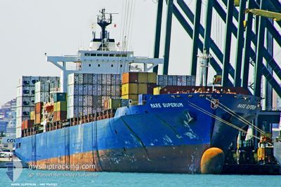
MSC ANNICK
Container Ship
Current Trip
| Time Travelled | 6 days |
|---|---|
| Remaining Time | --- |
| Distance Travelled | 1115.24 nm |
| Remaining Distance | --- |
| AVG Speed | 7.7 Noeuds |
| MAX Speed | 16.7 Noeuds |
| AVG Wind | 19.6 knots |
| MAX Wind | 29.8 knots |
| MIN Temp | 4°C / 39.2°F |
| MAX Temp | 9.6°C / 49.28°F |
| Tirant d eau | 10.4 m |
| Position reçue | 24 m depuis |
Current Position
| Longitude | --- |
|---|---|
| Latitude | --- |
| Etat | Under way using engine |
| Vitesse | 6.2 Noeuds |
| Parcours | 351° |
| Zone | Irish Sea and St. George's Channel |
| Station | T-AIS |
| Position reçue | 24 m depuis |
Info
Information
The current position of MSC ANNICK is in Irish Sea and St. George's Channel with coordinates 53.96529° / -4.14033° as reported on 2026-01-03 12:28 by AIS to our vessel tracker app. The vessel's current speed is 6.2 Noeuds
The vessel MSC ANNICK (IMO: 9169122, MMSI: 636017581) is a Container Ship that was built in 1998 ( 28 Age ). It's sailing under the flag of [LR] Liberia.
In this page you can find informations about the vessels current position, last detected port calls, and current voyage information. If the vessels is not in coverage by AIS you will find the latest position.
The current position of MSC ANNICK is detected by our AIS receivers and we are not responsible for the reliability of the data. The last position was recorded while the vessel was in Coverage by the Ais receivers of our vessel tracking app.
The current draught of MSC ANNICK as reported by AIS is 10.4 meters
Weather
| Temperature | 5°C / 41°F |
|---|---|
| Wind Speed | 23 knots |
| Direction | 345° NNW |
| Pressure | 1013.8 hPa |
| Humidity | 54.7 % |
| Cloud Coverage | 7 % |
Featured Company
Last Port Calls
| Port | Arrival | Departure | Time In Port |
|---|---|---|---|
| 2025-12-27 04:23 | 2025-12-28 06:50 | 1 d | |
| 2025-12-24 10:01 |
Most Visited Ports (Last year)
| Port | Arrivals | |
|---|---|---|
| 10 | ||
| 9 | ||
| 7 | ||
| 6 | ||
| 5 | ||
| 5 |
Last Trips
| Origin | Departure | Destination | Arrival | Distance | |
|---|---|---|---|---|---|
| 2025-12-24 10:01 | 2025-12-27 04:23 | 589.60 nm |
Events
| Heure | Evenement | Détails | Position/ Destination | Info |
|---|---|---|---|---|
| 2026-01-03 12:35 | Etat Changé | Default Under way using engine |
53.97002 / -4.13303
GBLIV
|
Vitesse: 6.2 kn Parcours: 351° |
| 2026-01-03 12:24 | Etat Changé | Under way using engine Default |
53.95963 / -4.13871
GBLIV
|
Vitesse: 6.3 kn Parcours: 348° |
| 2026-01-03 12:23 | Dans la zone couverte |
53.95963 / -4.13871
Irish Sea and St. George's Channel
GBLIV
|
Vitesse: 6.2 kn Parcours: 350.3° |
|
| 2026-01-02 22:19 | Etat Changé | Default Under way using engine |
53.66653 / -4.28540
GBLIV
|
Vitesse: 4.1 kn Parcours: 15° |
| 2026-01-02 22:14 | Hors de la zone couverte |
53.66136 / -4.29132
Irish Sea and St. George's Channel
GBLIV
|
Vitesse: 4.1 kn Parcours: 42.3° |
|
| 2026-01-02 22:11 | Etat Changé | Under way using engine Default |
53.65945 / -4.29389
GBLIV
|
Vitesse: 2.8 kn Parcours: 2° |
| 2026-01-02 22:11 | Dans la zone couverte |
53.65945 / -4.29389
Irish Sea and St. George's Channel
GBLIV
|
Vitesse: 2.9 kn Parcours: 8.3° |
|
| 2026-01-02 18:51 | Etat Changé | Default Under way using engine |
53.98461 / -4.11751
GBLIV
|
Vitesse: 6.3 kn Parcours: 198.2° |
| 2026-01-02 18:43 | Hors de la zone couverte |
53.99734 / -4.11036
Irish Sea and St. George's Channel
GBLIV
|
Vitesse: 6.3 kn Parcours: 198.2° |
|
| 2026-01-02 18:43 | Dans la zone couverte |
53.99734 / -4.11036
Irish Sea and St. George's Channel
GBLIV
|
Vitesse: 6.3 kn Parcours: 198.2° |