
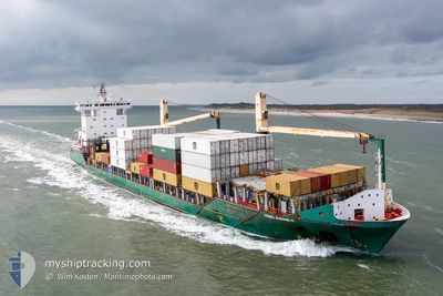
MSC ANNE F
Container Ship
Current Trip
| Time Travelled | 3 days |
|---|---|
| Remaining Time | 1 day |
| Distance Travelled | 594.22 nm |
| Remaining Distance | 316.96 nm |
| AVG Speed | 13.5 Noeuds |
| MAX Speed | 16.5 Noeuds |
| AVG Wind | 22.4 knots |
| MAX Wind | 43 knots |
| MIN Temp | 1.9°C / 35.42°F |
| MAX Temp | 7.7°C / 45.86°F |
| Tirant d eau | 8.5 m |
| Position reçue | 1 m depuis |
Current Position
| Longitude | --- |
|---|---|
| Latitude | --- |
| Etat | Under way using engine |
| Vitesse | 13 Noeuds |
| Parcours | 156.9° |
| Zone | North Sea |
| Station | T-AIS |
| Position reçue | 1 m depuis |
Info
Information
The current position of MSC ANNE F is in North Sea with coordinates 57.97146° / 4.75556° as reported on 2025-02-26 15:47 by AIS to our vessel tracker app. The vessel's current speed is 13 Noeuds and is heading at the port of BREMERHAVEN. The estimated time of arrival as calculated by MyShipTracking vessel tracking app is 2025-02-27 15:50 LT
The vessel MSC ANNE F (IMO: 9347803, MMSI: 255806190) is a Container Ship that was built in 2006 ( 19 Age ). It's sailing under the flag of [PT] Portugal.
In this page you can find informations about the vessels current position, last detected port calls, and current voyage information. If the vessels is not in coverage by AIS you will find the latest position.
The current position of MSC ANNE F is detected by our AIS receivers and we are not responsible for the reliability of the data. The last position was recorded while the vessel was in Coverage by the Ais receivers of our vessel tracking app.
The current draught of MSC ANNE F as reported by AIS is 8.5 meters
Weather
| Temperature | 6.3°C / 43.34°F |
|---|---|
| Wind Speed | 12 knots |
| Direction | 216° SW |
| Pressure | 1009.5 hPa |
| Humidity | 82.2 % |
| Cloud Coverage | 66 % |
Featured Company
Last Port Calls
| Port | Arrival | Departure | Time In Port |
|---|---|---|---|
| 2025-02-23 14:49 | |||
| 2025-02-22 11:32 | 2025-02-23 01:15 | 13 h | |
| 2025-02-21 12:39 | 2025-02-22 00:57 | 12 h | |
| 2025-02-19 12:12 | 2025-02-20 13:12 | 1 d | |
| 2025-02-17 11:02 | 2025-02-18 09:43 | 22 h | |
| 2025-02-14 14:04 | 2025-02-15 01:17 | 11 h | |
| 2025-02-12 23:13 | 2025-02-13 10:09 | 10 h | |
| 2025-02-10 11:50 | 2025-02-11 09:01 | 21 h | |
| 2025-02-06 09:41 | 2025-02-06 23:08 | 13 h | |
| 2025-02-05 19:38 | 2025-02-06 07:19 | 11 h |
Most Visited Ports (Last year)
| Port | Arrivals | |
|---|---|---|
| 37 | ||
| 36 | ||
| 28 | ||
| 25 | ||
| 22 | ||
| 4 |
Last Trips
| Origin | Departure | Destination | Arrival | Distance | |
|---|---|---|---|---|---|
| 2025-02-22 01:57 | 2025-02-22 12:32 | 129.17 nm | |||
| 2025-02-20 14:12 | 2025-02-21 13:39 | 294.10 nm | |||
| 2025-02-18 10:43 | 2025-02-19 13:12 | 357.50 nm | |||
| 2025-02-15 02:17 | 2025-02-17 12:02 | 506.77 nm | |||
| 2025-02-13 11:09 | 2025-02-14 15:04 | 223.25 nm | |||
| 2025-02-11 10:01 | 2025-02-13 00:13 | 312.75 nm | |||
| 2025-02-07 00:08 | 2025-02-10 12:50 | 903.86 nm | |||
| 2025-02-06 08:19 | 2025-02-06 10:41 | 26.71 nm | |||
| 2025-02-05 07:54 | 2025-02-05 20:38 | 128.62 nm | |||
| 2025-02-03 15:45 | 2025-02-04 15:25 | 294.33 nm |
Events
| Heure | Evenement | Détails | Position/ Destination | Info |
|---|---|---|---|---|
| 2025-02-26 13:01 | Etat Changé | Under way using engine Default |
58.53395 / 4.34505
DE BRV
|
Vitesse: 12.1 kn Parcours: 162° |
| 2025-02-26 13:00 | Changement d'ETA | 2025/02/27 13:30 2025/02/27 14:00 |
58.55905 / 4.32955
DE BRV
|
Vitesse: 12.1 kn Parcours: 162° |
| 2025-02-26 12:53 | Dans la zone couverte |
58.53395 / 4.34505
North Sea
DE BRV
|
Vitesse: 11.9 kn Parcours: 161.5° |
|
| 2025-02-26 10:28 | Etat Changé | Default Under way using engine |
59.03539 / 4.00087
DE BRV
|
Vitesse: 13.7 kn Parcours: 186.1° |
| 2025-02-26 10:14 | Hors de la zone couverte |
59.08811 / 4.00111
North Sea
DE BRV
|
Vitesse: 13.7 kn Parcours: 186.1° |
|
| 2025-02-26 10:10 | Etat Changé | Under way using engine Default |
59.10383 / 4.00314
DE BRV
|
Vitesse: 13.6 kn Parcours: 184° |
| 2025-02-26 09:51 | Etat Changé | Default Under way using engine |
59.17590 / 4.01231
DE BRV
|
Vitesse: 13.2 kn Parcours: 191.2° |
| 2025-02-26 00:09 | Changement de zone | Norwegian part of the North Sea Norwegian part of the Norwegian Sea |
60.99763 / 4.78899
North Sea
DE BRV
|
Vitesse: 14.5 kn Parcours: 231.3° |
| 2025-02-25 13:37 | Démarrage | 1.5 nm, North East of ALESUND |
62.48491 / 6.18483
DE BRV
|
Vitesse: 11.3 kn Parcours: 273.2° |
| 2025-02-25 13:24 | Etat Changé | Under way using engine Moored |
62.48205 / 6.19433
DE BRV
|
Vitesse: 0.1 kn Parcours: 205° |