
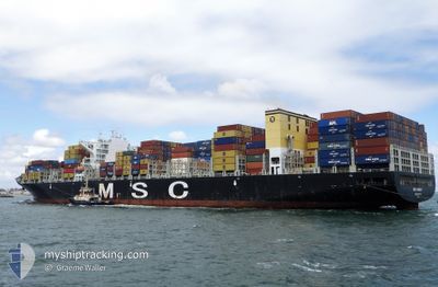
MSC AMALFI
Container Ship
Current Trip
| Time Travelled | 9 h, 20 mins |
|---|---|
| Remaining Time | 1 day |
| Distance Travelled | 92.24 nm |
| Remaining Distance | 449.14 nm |
| AVG Speed | 11.9 Noeuds |
| MAX Speed | 12.9 Noeuds |
| AVG Wind | 5.4 knots |
| MAX Wind | 9.7 knots |
| MIN Temp | 24.8°C / 76.64°F |
| MAX Temp | 26°C / 78.8°F |
| Tirant d eau | 14.5 m |
| Position reçue | 1 h, 2 m depuis |
Current Position
| Longitude | --- |
|---|---|
| Latitude | --- |
| Etat | Under way using engine |
| Vitesse | 11 Noeuds |
| Parcours | 319.3° |
| Zone | Red Sea |
| Station | T-AIS |
| Position reçue | 1 h, 2 m depuis |
Info
Information
The current position of MSC AMALFI is in Red Sea with coordinates 23.08679° / 37.76467° as reported on 2025-01-16 16:04 by AIS to our vessel tracker app. The vessel's current speed is 11 Noeuds and is heading at the port of AQABA. The estimated time of arrival as calculated by MyShipTracking vessel tracking app is 2025-01-18 07:01 LT
The vessel MSC AMALFI (IMO: 9605279, MMSI: 229626000) is a Container Ship that was built in 2014 ( 11 Age ). It's sailing under the flag of [MT] Malta.
In this page you can find informations about the vessels current position, last detected port calls, and current voyage information. If the vessels is not in coverage by AIS you will find the latest position.
The current position of MSC AMALFI is detected by our AIS receivers and we are not responsible for the reliability of the data. The last position was recorded while the vessel was in Coverage by the Ais receivers of our vessel tracking app.
The current draught of MSC AMALFI as reported by AIS is 14.5 meters
Weather
| Temperature | 24.8°C / 76.64°F |
|---|---|
| Wind Speed | 10 knots |
| Direction | 316° NW |
| Pressure | 1016 hPa |
| Humidity | 77.4 % |
| Cloud Coverage | 31 % |
Featured Company
Last Port Calls
| Port | Arrival | Departure | Time In Port |
|---|---|---|---|
| 2025-01-15 06:29 | 2025-01-16 07:46 | 1 d | |
| 2025-01-13 12:05 | 2025-01-15 00:53 | 1 d | |
| 2025-01-11 05:49 | 2025-01-11 15:12 | 9 h | |
| 2025-01-08 13:18 | 2025-01-09 20:05 | 1 d | |
| 2025-01-04 09:23 | 2025-01-04 23:04 | 13 h | |
| 2025-01-01 15:11 | 2025-01-03 00:02 | 1 d | |
| 2024-12-30 04:23 | 2024-12-30 18:57 | 14 h | |
| 2024-12-26 22:57 | 2024-12-29 16:29 | 2 d | |
| 2024-12-24 09:48 | 2024-12-25 07:56 | 22 h | |
| 2024-12-21 08:50 | 2024-12-22 07:33 | 22 h |
Most Visited Ports (Last year)
| Port | Arrivals | |
|---|---|---|
| 6 | ||
| 4 | ||
| 4 | ||
| 3 | ||
| 3 | ||
| 3 |
Last Trips
| Origin | Departure | Destination | Arrival | Distance | |
|---|---|---|---|---|---|
| 2025-01-15 03:53 | 2025-01-15 09:29 | 83.35 nm | |||
| 2025-01-09 22:05 | 2025-01-13 15:05 | 876.62 nm | |||
| 2025-01-09 22:05 | 2025-01-11 07:49 | 154.69 nm | |||
| 2025-01-05 00:04 | 2025-01-08 15:18 | 829.64 nm | |||
| 2025-01-03 01:02 | 2025-01-04 10:23 | 213.15 nm | |||
| 2024-12-30 19:57 | 2025-01-01 16:11 | 679.83 nm | |||
| 2024-12-29 17:29 | 2024-12-30 05:23 | 167.96 nm | |||
| 2024-12-25 08:56 | 2024-12-26 23:57 | 539.49 nm | |||
| 2024-12-22 08:33 | 2024-12-24 10:48 | 419.42 nm | |||
| 2024-12-19 12:38 | 2024-12-21 09:50 | 564.37 nm |
Events
| Heure | Evenement | Détails | Position/ Destination | Info |
|---|---|---|---|---|
| 2025-01-16 16:04 | Etat Changé | Default Under way using engine |
23.08833 / 37.76324
JOAQJ
|
Vitesse: 11 kn Parcours: 319.3° |
| 2025-01-16 16:04 | Hors de la zone couverte |
23.08679 / 37.76467
Red Sea
JOAQJ
|
Vitesse: 11 kn Parcours: 319.3° |
|
| 2025-01-16 16:02 | Etat Changé | Under way using engine Default |
23.08179 / 37.76931
JOAQJ
|
Vitesse: 11 kn Parcours: 319° |
| 2025-01-16 15:14 | Etat Changé | Default Under way using engine |
22.96926 / 37.87250
JOAQJ
|
Vitesse: 11.4 kn Parcours: 320.3° |
| 2025-01-16 14:30 | Etat Changé | Under way using engine Default |
22.86032 / 37.97494
JOAQJ
|
Vitesse: 11.9 kn Parcours: 318° |
| 2025-01-16 14:00 | Etat Changé | Default Under way using engine |
22.78753 / 38.04880
JOAQJ
|
Vitesse: 12.1 kn Parcours: 316.7° |
| 2025-01-16 12:50 | Etat Changé | Under way using engine Default |
22.60872 / 38.21606
JOAQJ
|
Vitesse: 12.5 kn Parcours: 323° |
| 2025-01-16 12:50 | Dans la zone couverte |
22.61421 / 38.21154
Red Sea
JOAQJ
|
Vitesse: 12.3 kn Parcours: 322.4° |
|
| 2025-01-16 11:51 | Etat Changé | Default Under way using engine |
22.44810 / 38.36055
JOAQJ
|
Vitesse: 12.8 kn Parcours: 317.8° |
| 2025-01-16 11:44 | Hors de la zone couverte |
22.42912 / 38.37926
Red Sea
JOAQJ
|
Vitesse: 12.8 kn Parcours: 317.8° |