
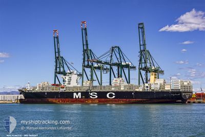
MSC AJACCIO
Container Ship
Current Trip
| Time Travelled | 4 days |
|---|---|
| Remaining Time | --- |
| Distance Travelled | 1841.42 nm |
| Remaining Distance | --- |
| AVG Speed | 16.5 Noeuds |
| MAX Speed | 18.6 Noeuds |
| AVG Wind | 5.3 knots |
| MAX Wind | 13.8 knots |
| MIN Temp | 27.3°C / 81.14°F |
| MAX Temp | 30.5°C / 86.9°F |
| Tirant d eau | 9.3 m |
| Position reçue | 13 h, 23 m depuis |
Current Position
| Longitude | 104.35656° |
|---|---|
| Latitude | 1.30512° |
| Etat | Under way using engine |
| Vitesse | 15.3 Noeuds |
| Parcours | 51.2° |
| Zone | Singapore Strait |
| Station | T-AIS |
| Position reçue | 13 h, 23 m depuis |
Info
Information
The current position of MSC AJACCIO is in Singapore Strait with coordinates 1.30512° / 104.35656° as reported on 2024-04-27 00:28 by AIS to our vessel tracker app. The vessel's current speed is 15.3 Noeuds and is heading at the port of VUNG TAU. The estimated time of arrival as calculated by MyShipTracking vessel tracking app is 2024-04-28 14:00 LT
The vessel MSC AJACCIO (IMO: 9605267, MMSI: 229625000) is a Container Ship that was built in 2014 ( 10 Age ). It's sailing under the flag of [MT] Malta.
In this page you can find informations about the vessels current position, last detected port calls, and current voyage information. If the vessels is not in coverage by AIS you will find the latest position.
The current position of MSC AJACCIO is detected by our AIS receivers and we are not responsible for the reliability of the data. The last position was recorded while the vessel was in Coverage by the Ais receivers of our vessel tracking app.
The current draught of MSC AJACCIO as reported by AIS is 9.3 meters
Weather
| Temperature | 29.9°C / 85.82°F |
|---|---|
| Wind Speed | 5 knots |
| Direction | 117° ESE |
| Pressure | 1007.7 hPa |
| Humidity | 71.8 % |
| Cloud Coverage | 91 % |
Featured Company
Last Port Calls
| Port | Arrival | Departure | Time In Port |
|---|---|---|---|
| 2024-04-21 01:32 | 2024-04-22 19:20 | 1 d | |
| 2024-04-07 13:40 | 2024-04-08 10:17 | 20 h | |
| 2024-04-04 11:27 | 2024-04-06 13:29 | 2 d | |
| 2024-03-29 14:05 | 2024-03-31 13:54 | 1 d | |
| 2024-02-29 12:22 | 2024-03-02 08:15 | 1 d | |
| 2024-02-26 13:11 | 2024-02-28 22:33 | 2 d | |
| 2024-02-24 17:58 | 2024-02-25 23:50 | 1 d | |
| 2024-02-20 04:07 | 2024-02-22 03:09 | 1 d | |
| 2024-02-11 23:43 | 2024-02-12 07:41 | 7 h | |
| 2024-02-03 00:02 | 2024-02-03 00:29 | 27 m |
Last Trips
| Origin | Departure | Destination | Arrival | Distance | |
|---|---|---|---|---|---|
| 2024-04-08 14:17 | 2024-04-21 07:02 | 2868.71 nm | |||
| 2024-04-06 16:29 | 2024-04-07 17:40 | 315.13 nm | |||
| 2024-03-31 17:54 | 2024-04-04 14:27 | 397.15 nm | |||
| 2024-03-02 09:15 | 2024-03-29 18:05 | 10511.87 nm | |||
| 2024-02-28 23:33 | 2024-02-29 13:22 | 163.97 nm | |||
| 2024-02-26 00:50 | 2024-02-26 14:11 | 186.97 nm | |||
| 2024-02-22 03:09 | 2024-02-24 18:58 | 1108.99 nm | |||
| 2024-02-12 04:41 | 2024-02-20 04:07 | 2404.33 nm | |||
| 2024-02-02 21:29 | 2024-02-11 20:43 | 1770.59 nm | |||
| 2024-01-31 04:39 | 2024-02-02 21:02 | 226.36 nm |
Events
| Heure | Evenement | Détails | Position/ Destination | Info |
|---|---|---|---|---|
| 2024-04-27 00:37 | Etat Changé | Default Under way using engine |
1.32725 / 104.38638
VNVUT
|
Vitesse: 15.3 kn Parcours: 51.2° |
| 2024-04-27 00:28 | Hors de la zone couverte |
1.30512 / 104.35656
Singapore Strait
VNVUT
|
Vitesse: 15.3 kn Parcours: 51.2° |
|
| 2024-04-26 23:59 | Changement de zone | Malaysian part of the Singapore Strait Indonesian part of the Singapore Strait |
1.25899 / 104.24341
Singapore Strait
VNVUT
|
Vitesse: 16 kn Parcours: 81° |
| 2024-04-26 20:32 | Changement de zone | Indonesian part of the Singapore Strait Indonesian part of the Malacca Strait |
1.17231 / 103.42219
Singapore Strait
VNVUT
|
Vitesse: 15.6 kn Parcours: 124.3° |
| 2024-04-26 20:30 | Tirant d'eau modifié | 9.3 10.5 |
1.17798 / 103.41391
VNVUT
|
Vitesse: 15.6 kn Parcours: 124.9° |
| 2024-04-26 20:30 | Changement de destination | VNVUT LKCMB |
1.17798 / 103.41391
VNVUT
|
Vitesse: 15.6 kn Parcours: 124.9° |
| 2024-04-26 20:30 | Changement d'ETA | 2024/04/28 14:00 2024/04/13 10:30 |
1.17798 / 103.41391
VNVUT
|
Vitesse: 15.6 kn Parcours: 124.9° |
| 2024-04-26 20:21 | Changement de zone | Indonesian part of the Malacca Strait Indian part of the Laccadive Sea |
1.19914 / 103.38506
Malacca Strait
|
Vitesse: 15.4 kn Parcours: 127.4° |
| 2024-04-26 20:20 | Etat Changé | Under way using engine Default |
1.20374 / 103.37946
LKCMB
|
Vitesse: 15.5 kn Parcours: 131° |
| 2024-04-26 20:20 | Dans la zone couverte |
1.19914 / 103.38506
Malacca Strait
|
Vitesse: 15.4 kn Parcours: 127.4° |