

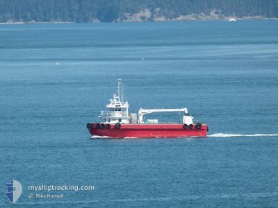
MOTEGA
General Cargo

Current Trip
| Trip Time | 2 h, 47 mins |
|---|---|
| Trip Distance | 13.78 nm |
| AVG Speed | 8 Noeuds |
| MAX Speed | 8.8 Noeuds |
| Tirant d eau | 0 m |
| AVG Wind | 8.5 knots |
| MAX Wind | 11 knots |
| MIN Temp | 4.9°C / 40.82°F |
| MAX Temp | 7°C / 44.6°F |
| Position reçue | 7 d depuis |
Current Position
| Longitude | --- |
|---|---|
| Latitude | --- |
| Etat | Under way using engine |
| Vitesse | |
| Parcours | --- |
| Zone | The Coastal Waters of Southeast Alaska and British Columbia |
| Station | T-AIS |
| Position reçue | 7 d depuis |
Information
The current position of MOTEGA is in The Coastal Waters of Southeast Alaska and British Columbia with coordinates 48.51192° / -122.60605° as reported on 2025-03-20 20:12 by AIS to our vessel tracker app. The vessel's current speed is 0 Noeuds and is currently inside the port of ANACORTES.
The vessel MOTEGA (IMO: 8886802, MMSI: 338701000) is a General Cargo that was built in 1969 ( 56 Age ). It's sailing under the flag of [US] USA.
In this page you can find informations about the vessels current position, last detected port calls, and current voyage information. If the vessels is not in coverage by AIS you will find the latest position.
The current position of MOTEGA is detected by our AIS receivers and we are not responsible for the reliability of the data. The last position was recorded while the vessel was in Coverage by the Ais receivers of our vessel tracking app.
Weather
| Temperature | 9.1°C / 48.38°F |
|---|---|
| Wind Speed | 10 knots |
| Direction | 136° SE |
| Pressure | 1016 hPa |
| Humidity | 74.9 % |
| Cloud Coverage | 93 % |


Featured Company
Last Port Calls
| Port | Arrival | Departure | Time In Port |
|---|---|---|---|
| 2025-03-20 11:00 | |||
| 2025-03-14 11:40 | 2025-03-20 08:13 | 5 d | |
| 2025-03-11 14:51 | 2025-03-14 08:38 | 2 d | |
| 2025-03-11 13:12 | 2025-03-11 13:58 | 45 m | |
| 2025-03-08 09:50 | 2025-03-11 10:41 | 2 d | |
| 2025-03-04 14:55 | 2025-03-08 07:31 | 3 d | |
| 2025-03-01 17:08 | 2025-03-04 10:55 | 2 d | |
| 2025-02-28 14:37 | 2025-03-01 13:19 | 22 h | |
| 2025-02-26 17:06 | 2025-02-28 08:07 | 1 d | |
| 2025-02-24 15:03 | 2025-02-26 13:07 | 1 d |
Most Visited Ports (Last year)
| Port | Arrivals | |
|---|---|---|
| 101 | ||
| 3 | ||
| 2 |
Last Trips
| Origin | Departure | Destination | Arrival | Distance | |
|---|---|---|---|---|---|
| 2025-03-20 08:13 | 2025-03-20 11:00 | 13.78 nm | |||
| 2025-03-14 08:38 | 2025-03-14 11:40 | 11.74 nm | |||
| 2025-03-11 13:58 | 2025-03-11 14:51 | 1.03 nm | |||
| 2025-03-11 10:41 | 2025-03-11 13:12 | 1.67 nm | |||
| 2025-03-08 07:31 | 2025-03-08 09:50 | 11.36 nm | |||
| 2025-03-04 10:55 | 2025-03-04 14:55 | 0.97 nm | |||
| 2025-03-01 13:19 | 2025-03-01 17:08 | 11.18 nm | |||
| 2025-02-28 08:07 | 2025-02-28 14:37 | 13.45 nm | |||
| 2025-02-26 13:07 | 2025-02-26 17:06 | 11.26 nm | |||
| 2025-02-24 09:09 | 2025-02-24 15:03 | 27.51 nm |
Events
| Heure | Evenement | Détails | Position/ Destination | Info |
|---|---|---|---|---|
| 2025-03-20 20:12 | Hors de la zone couverte |
48.51192 / -122.60605
The Coastal Waters of Southeast Alaska and British Columbia
[US] ANACORTES
|
Vitesse: Parcours: 235.2° |
|
| 2025-03-20 20:05 | Arret |
48.51193 / -122.60605
[US] ANACORTES
|
Vitesse: 0.2 kn Parcours: 4° |
|
| 2025-03-20 20:03 | Démarrage |
48.51141 / -122.60643
[US] ANACORTES
|
Vitesse: 4.2 kn Parcours: 93° |
|
| 2025-03-20 18:12 | Arret |
48.51148 / -122.60945
[US] ANACORTES
|
Vitesse: 0.2 kn Parcours: 5° |
|
| 2025-03-20 18:00 | Port d'arrivée |
|
48.51723 / -122.58513
[US] ANACORTES
|
Vitesse: 8.4 kn Parcours: 238.7° |
| 2025-03-20 17:08 | Démarrage | 6.3 nm, North of ANACORTES |
48.62049 / -122.54493
ANACORTES
|
Vitesse: 6.5 kn Parcours: 201.5° |
| 2025-03-20 16:04 | Arret | 6.43 nm, North East of ANACORTES |
48.62231 / -122.54308
ANACORTES
|
Vitesse: 0.1 kn Parcours: 176° |
| 2025-03-20 15:13 | PORT DE DEPART |
|
48.51852 / -122.58335
ANACORTES
|
Vitesse: 8.3 kn Parcours: 49° |
| 2025-03-20 15:06 | Démarrage |
48.51165 / -122.60309
[US] ANACORTES
|
Vitesse: 5.3 kn Parcours: 103° |
|
| 2025-03-20 13:36 | Dans la zone couverte |
48.51192 / -122.60605
The Coastal Waters of Southeast Alaska and British Columbia
[US] ANACORTES
|
Vitesse: Parcours: 196.2° |