

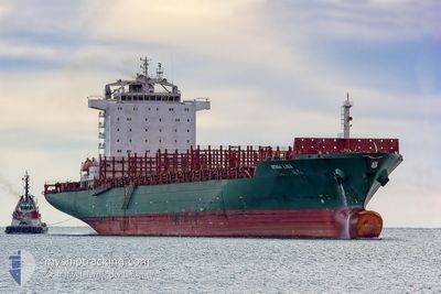
MONA LISA
Container Ship

Current Trip
AOLAD
| Time Travelled | 5 days |
|---|---|
| Remaining Time | --- |
| Distance Travelled | 2591.45 nm |
| Remaining Distance | --- |
| AVG Speed | 18.5 Noeuds |
| MAX Speed | 20.2 Noeuds |
| AVG Wind | 10.6 knots |
| MAX Wind | 15.7 knots |
| MIN Temp | 22.8°C / 73.04°F |
| MAX Temp | 27.7°C / 81.86°F |
| Tirant d eau | 11.6 m |
| Position reçue | 11 d depuis |
Current Position
| Longitude | --- |
|---|---|
| Latitude | --- |
| Etat | Under way using engine |
| Vitesse | 18.9 Noeuds |
| Parcours | 325.5° |
| Zone | South Atlantic Ocean |
| Station | T-AIS |
| Position reçue | 11 d depuis |
Information
The current position of MONA LISA is in South Atlantic Ocean with coordinates -34.93383° / 18.07278° as reported on 2025-03-15 19:57 by AIS to our vessel tracker app. The vessel's current speed is 18.9 Noeuds
The vessel MONA LISA (IMO: 9309277, MMSI: 636016852) is a Container Ship that was built in 2006 ( 19 Age ). It's sailing under the flag of [LR] Liberia.
In this page you can find informations about the vessels current position, last detected port calls, and current voyage information. If the vessels is not in coverage by AIS you will find the latest position.
The current position of MONA LISA is detected by our AIS receivers and we are not responsible for the reliability of the data. The last position was recorded while the vessel was in Coverage by the Ais receivers of our vessel tracking app.
The current draught of MONA LISA as reported by AIS is 11.6 meters
Weather
| Temperature | 26.4°C / 79.52°F |
|---|---|
| Wind Speed | 8 knots |
| Direction | 300° WNW |
| Pressure | 1014.6 hPa |
| Humidity | 74.7 % |
| Cloud Coverage | 100 % |


Featured Company
Last Port Calls
| Port | Arrival | Departure | Time In Port |
|---|---|---|---|
| 2025-03-19 21:46 | 2025-03-21 19:24 | 1 d | |
| 2025-03-12 04:20 | 2025-03-13 23:57 | 1 d | |
| 2025-02-26 02:23 | 2025-02-26 21:55 | 19 h | |
| 2025-02-23 22:52 | 2025-02-24 08:44 | 9 h | |
| 2025-02-21 12:45 | 2025-02-22 11:57 | 23 h | |
| 2025-02-09 00:08 | 2025-02-11 10:32 | 2 d | |
| 2025-02-02 07:58 | 2025-02-03 10:38 | 1 d | |
| 2025-01-22 22:18 | 2025-01-25 01:30 | 2 d | |
| 2025-01-11 12:33 | 2025-01-12 09:24 | 20 h | |
| 2025-01-09 07:30 | 2025-01-10 12:48 | 1 d |
Last Trips
| Origin | Departure | Destination | Arrival | Distance | |
|---|---|---|---|---|---|
| 2025-03-13 23:57 | 2025-03-19 21:46 | 2487.05 nm | |||
| 2025-02-26 21:55 | 2025-03-12 04:20 | 4348.93 nm | |||
| 2025-02-24 08:44 | 2025-02-26 02:23 | 220.12 nm | |||
| 2025-02-22 11:57 | 2025-02-23 22:52 | 107.86 nm | |||
| 2025-02-11 10:32 | 2025-02-21 12:45 | 3690.59 nm | |||
| 2025-02-03 10:38 | 2025-02-09 00:08 | 2099.59 nm | |||
| 2025-01-25 01:30 | 2025-02-02 07:58 | 409.08 nm | |||
| 2025-01-12 09:24 | 2025-01-22 22:18 | 4230.72 nm | |||
| 2025-01-10 12:48 | 2025-01-11 12:33 | 20.32 nm | |||
| 2025-01-07 15:29 | 2025-01-09 07:30 | 224.89 nm |
Events
| Heure | Evenement | Détails | Position/ Destination | Info |
|---|---|---|---|---|
| 2025-03-21 18:24 | PORT DE DEPART |
|
-8.75645 / 13.27867
AOLAD
|
Vitesse: 7.3 kn Parcours: 30° |
| 2025-03-21 18:12 | Démarrage |
-8.77864 / 13.26248
[AO] LUANDA
|
Vitesse: 6.9 kn Parcours: 49° |
|
| 2025-03-21 12:53 | Arret |
-8.77813 / 13.25744
[AO] LUANDA
|
Vitesse: 0.2 kn Parcours: 53° |
|
| 2025-03-21 12:37 | Démarrage |
-8.78405 / 13.26456
[AO] LUANDA
|
Vitesse: 5.4 kn Parcours: 300° |
|
| 2025-03-19 21:21 | Arret |
-8.78682 / 13.27082
[AO] LUANDA
|
Vitesse: 0.3 kn Parcours: 227° |
|
| 2025-03-19 20:46 | Port d'arrivée |
|
-8.76620 / 13.27322
[AO] LUANDA
|
Vitesse: 5.5 kn Parcours: 219° |
| 2025-03-19 19:33 | Démarrage | 5.54 nm, North West of LUANDA |
-8.71767 / 13.18809
AOLAD
|
Vitesse: 3.3 kn Parcours: 359° |
| 2025-03-19 16:09 | Arret | 5.77 nm, North West of LUANDA |
-8.72752 / 13.17291
AOLAD
|
Vitesse: 0.3 kn Parcours: 293° |