
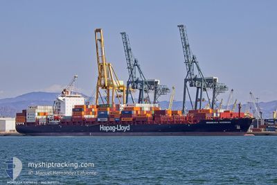
MOMBASA EXPRESS
Container Ship
Current Trip
| Trip Time | 5 days |
|---|---|
| Trip Distance | 1169.87 nm |
| AVG Speed | 10.8 Noeuds |
| MAX Speed | 10.8 Noeuds |
| Tirant d eau | 8.2 m |
| AVG Wind | 20.5 knots |
| MAX Wind | 29 knots |
| MIN Temp | 9.9°C / 49.82°F |
| MAX Temp | 16.1°C / 60.98°F |
| Position reçue | 4 d depuis |
Current Position
| Longitude | --- |
|---|---|
| Latitude | --- |
| Etat | Under way using engine |
| Vitesse | 14.2 Noeuds |
| Parcours | 82° |
| Zone | Alboran Sea |
| Station | T-AIS |
| Position reçue | 4 d depuis |
Info
Information
The current position of MOMBASA EXPRESS is in Alboran Sea with coordinates 36.04548° / -4.84793° as reported on 2025-03-14 02:11 by AIS to our vessel tracker app. The vessel's current speed is 14.2 Noeuds and is currently inside the port of SALERNO.
The vessel MOMBASA EXPRESS (IMO: 9495777, MMSI: 636092500) is a Container Ship that was built in 2013 ( 12 Age ). It's sailing under the flag of [LR] Liberia.
In this page you can find informations about the vessels current position, last detected port calls, and current voyage information. If the vessels is not in coverage by AIS you will find the latest position.
The current position of MOMBASA EXPRESS is detected by our AIS receivers and we are not responsible for the reliability of the data. The last position was recorded while the vessel was in Coverage by the Ais receivers of our vessel tracking app.
The current draught of MOMBASA EXPRESS as reported by AIS is 8.2 meters
Weather
| Temperature | 8°C / 46.4°F |
|---|---|
| Wind Speed | 6 knots |
| Direction | 22° NNE |
| Pressure | 1019.4 hPa |
| Humidity | 76.4 % |
| Cloud Coverage | 23 % |
Featured Company
Last Port Calls
| Port | Arrival | Departure | Time In Port |
|---|---|---|---|
| 2025-03-16 21:24 | |||
| 2025-03-11 15:02 | 2025-03-11 19:54 | 4 h | |
| 2025-02-25 13:51 | 2025-02-28 07:38 | 2 d | |
| 2025-02-20 18:59 | 2025-02-21 19:39 | 1 d | |
| 2025-02-10 13:21 | 2025-02-10 19:59 | 6 h | |
| 2025-02-05 14:56 | 2025-02-05 21:33 | 6 h | |
| 2025-02-02 19:16 | 2025-02-03 03:05 | 7 h | |
| 2025-01-30 22:30 | 2025-01-31 20:14 | 21 h | |
| 2025-01-29 10:57 | 2025-01-30 17:17 | 1 d | |
| 2025-01-26 00:14 | 2025-01-26 20:36 | 20 h |
Most Visited Ports (Last year)
| Port | Arrivals | |
|---|---|---|
| 7 | ||
| 6 | ||
| 6 | ||
| 6 | ||
| 6 | ||
| 6 |
Last Trips
| Origin | Departure | Destination | Arrival | Distance | |
|---|---|---|---|---|---|
| 2025-03-11 19:54 | 2025-03-16 21:24 | 1169.87 nm | |||
| 2025-02-28 07:38 | 2025-03-11 15:02 | 3406.63 nm | |||
| 2025-02-21 19:39 | 2025-02-25 13:51 | 1278.82 nm | |||
| 2025-02-10 19:59 | 2025-02-20 18:59 | 3537.29 nm | |||
| 2025-02-05 21:33 | 2025-02-10 13:21 | 713.69 nm | |||
| 2025-02-03 03:05 | 2025-02-05 14:56 | 486.01 nm | |||
| 2025-01-31 20:14 | 2025-02-02 19:16 | 532.93 nm | |||
| 2025-01-30 17:17 | 2025-01-30 22:30 | 84.11 nm | |||
| 2025-01-26 20:36 | 2025-01-29 10:57 | 647.46 nm | |||
| 2025-01-19 07:30 | 2025-01-26 00:14 | 1182.09 nm |
Events
| Heure | Evenement | Détails | Position/ Destination | Info |
|---|---|---|---|---|
| 2025-03-16 20:38 | Arret |
40.67322 / 14.74485
[IT] SALERNO
|
Vitesse: Parcours: 340° |
|
| 2025-03-16 20:24 | Port d'arrivée |
|
40.66962 / 14.74839
[IT] SALERNO
|
Vitesse: 8.7 kn Parcours: 33° |
| 2025-03-14 02:15 | Etat Changé | Default Under way using engine |
36.04775 / -4.82923
MA PTM>IT SAL
|
Vitesse: 14.2 kn Parcours: 82° |
| 2025-03-14 02:11 | Hors de la zone couverte |
36.04548 / -4.84793
Alboran Sea
MA PTM>IT SAL
|
Vitesse: 14.2 kn Parcours: 82° |
|
| 2025-03-14 01:08 | Changement de zone | Spanish part of the Alboran Sea Spanish part of the Strait of Gibraltar |
36.00886 / -5.17257
Alboran Sea
MA PTM>IT SAL
|
Vitesse: 16.6 kn Parcours: 84.3° |
| 2025-03-14 01:08 | Etat Changé | Under way using engine Default |
36.00886 / -5.17257
MA PTM>IT SAL
|
Vitesse: 16.6 kn Parcours: 85° |
| 2025-03-14 00:39 | Etat Changé | Default Under way using engine |
35.99171 / -5.33647
MA PTM>IT SAL
|
Vitesse: 16 kn Parcours: 72.7° |
| 2025-03-14 00:33 | Changement de zone | Spanish part of the Strait of Gibraltar Moroccan part of the Strait of Gibraltar |
35.98473 / -5.36370
Strait of Gibraltar
MA PTM>IT SAL
|
Vitesse: 16 kn Parcours: 72.6° |
| 2025-03-14 00:30 | Tirant d'eau modifié | 8.2 9 |
35.98007 / -5.38220
MA PTM>IT SAL
|
Vitesse: 16.2 kn Parcours: 72.2° |
| 2025-03-14 00:30 | Changement de destination | MA PTM>IT SAL MA PTM TC1>MA PTMTC3 |
35.98007 / -5.38220
MA PTM>IT SAL
|
Vitesse: 16.2 kn Parcours: 72.2° |