
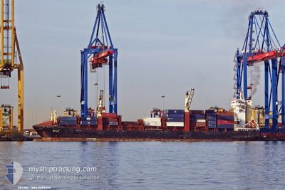
MIZAR
Container Ship
Current Trip
LAST UPDATE TIME
| Time Travelled | 1 day |
|---|---|
| Remaining Time | --- |
| Distance Travelled | 634.57 nm |
| Remaining Distance | --- |
| AVG Speed | 13.7 Noeuds |
| MAX Speed | 16.7 Noeuds |
| AVG Wind | 10.8 knots |
| MAX Wind | 22.1 knots |
| MIN Temp | 25.2°C / 77.36°F |
| MAX Temp | 27.8°C / 82.04°F |
| Tirant d eau | 7.6 m |
| Position reçue | 3 d depuis |
Current Position
| Longitude | -79.51500° |
|---|---|
| Latitude | 8.86500° |
| Etat | At anchor |
| Vitesse | |
| Parcours | 111° |
| Zone | North Pacific Ocean |
| Station | T-AIS |
| Position reçue | 3 d depuis |
Info
Information
The current position of MIZAR is in North Pacific Ocean with coordinates 8.86500° / -79.51500° as reported on 2024-05-13 13:51 by AIS to our vessel tracker app. The vessel's current speed is 0 Noeuds
The vessel MIZAR (IMO: 9295505, MMSI: 636021142) is a Container Ship that was built in 2005 ( 19 Age ). It's sailing under the flag of [LR] Liberia.
In this page you can find informations about the vessels current position, last detected port calls, and current voyage information. If the vessels is not in coverage by AIS you will find the latest position.
The current position of MIZAR is detected by our AIS receivers and we are not responsible for the reliability of the data. The last position was recorded while the vessel was in Coverage by the Ais receivers of our vessel tracking app.
The current draught of MIZAR as reported by AIS is 7.6 meters
Weather
| Temperature | 25.2°C / 77.36°F |
|---|---|
| Wind Speed | 9 knots |
| Direction | 220° SW |
| Pressure | 1008.7 hPa |
| Humidity | 83.5 % |
| Cloud Coverage | 96 % |
Featured Company
Last Port Calls
| Port | Arrival | Departure | Time In Port |
|---|---|---|---|
| 2024-05-14 14:25 | 2024-05-14 22:58 | 8 h | |
| 2024-05-13 16:02 | 2024-05-13 23:54 | 7 h | |
| 2024-05-09 18:53 | 2024-05-10 02:11 | 7 h | |
| 2024-05-08 11:44 | 2024-05-08 18:39 | 6 h | |
| 2024-05-06 09:25 | 2024-05-06 18:53 | 9 h | |
| 2024-05-03 08:50 | 2024-05-03 17:54 | 9 h | |
| 2024-04-29 17:09 | 2024-04-30 19:10 | 1 d | |
| 2024-04-29 05:17 | 2024-04-29 16:53 | 11 h | |
| 2024-04-25 21:15 | 2024-04-27 01:48 | 1 d | |
| 2024-04-22 06:05 | 2024-04-23 07:03 | 1 d |
Last Trips
| Origin | Departure | Destination | Arrival | Distance | |
|---|---|---|---|---|---|
| 2024-05-13 18:54 | 2024-05-14 09:25 | 15.84 nm | |||
| 2024-05-09 21:11 | 2024-05-13 11:02 | 793.87 nm | |||
| 2024-05-08 13:39 | 2024-05-09 13:53 | 228.70 nm | |||
| 2024-05-06 13:53 | 2024-05-08 06:44 | 507.14 nm | |||
| 2024-05-03 12:54 | 2024-05-06 04:25 | 722.77 nm | |||
| 2024-04-30 14:10 | 2024-05-03 03:50 | 791.37 nm | |||
| 2024-04-29 11:53 | 2024-04-29 12:09 | 0.21 nm | |||
| 2024-04-26 19:48 | 2024-04-29 00:17 | 725.22 nm | |||
| 2024-04-23 01:03 | 2024-04-25 15:15 | 303.48 nm | |||
| 2024-04-16 09:19 | 2024-04-22 00:05 | 634.93 nm |
Events
| Heure | Evenement | Détails | Position/ Destination | Info |
|---|---|---|---|---|
| 2024-05-16 18:32 | Démarrage | 1.13 nm, North of MANTA |
-.92030 / -80.71922
LAST UPDATE TIME
|
Vitesse: 4.2 kn Parcours: 309° |
| 2024-05-16 18:15 | Arret | 1.35 nm, North of MANTA |
-.91667 / -80.71833
LAST UPDATE TIME
|
Vitesse: Parcours: -1° |
| 2024-05-14 22:58 | PORT DE DEPART |
|
8.94912 / -79.56965
LAST UPDATE TIME
|
Vitesse: 5.7 kn Parcours: 146° |
| 2024-05-14 22:54 | Démarrage |
8.95563 / -79.57306
[PA] RODMAN
|
Vitesse: 5.7 kn Parcours: 146° |
|
| 2024-05-14 14:50 | Arret |
8.96051 / -79.57636
[PA] RODMAN
|
Vitesse: 0.2 kn Parcours: 154° |
|
| 2024-05-14 14:25 | Port d'arrivée |
|
8.96060 / -79.57633
[PA] RODMAN
|
Vitesse: 7.2 kn Parcours: 321° |
| 2024-05-14 13:39 | Démarrage | 4.82 nm, North of TABOGUILLA |
8.88702 / -79.50182
LAST UPDATE TIME
|
Vitesse: 5.2 kn Parcours: 266° |
| 2024-05-14 00:42 | Arret | 4.58 nm, North of TABOGUILLA |
8.88194 / -79.49889
LAST UPDATE TIME
|
Vitesse: 0.2 kn Parcours: 4° |
| 2024-05-13 23:54 | PORT DE DEPART |
|
8.93861 / -79.56130
LAST UPDATE TIME
|
Vitesse: 5.9 kn Parcours: 179° |
| 2024-05-13 23:47 | Démarrage |
8.95226 / -79.56950
[PA] BALBOA
|
Vitesse: 5.9 kn Parcours: 179° |