

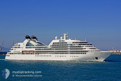
MITSUI OCEAN FUJI
Passengers Ship

Current Trip
BRRIO
| Time Travelled | 1 h, 18 mins |
|---|---|
| Remaining Time | --- |
| Distance Travelled | 11.52 nm |
| Remaining Distance | --- |
| AVG Speed | 12.4 Noeuds |
| MAX Speed | 12.5 Noeuds |
| AVG Wind | 14.6 knots |
| MAX Wind | 17 knots |
| MIN Temp | 26.1°C / 78.98°F |
| MAX Temp | 26.5°C / 79.7°F |
| Tirant d eau | 6.8 m |
| Position reçue | 14 h, 48 m depuis |
Current Position
| Longitude | --- |
|---|---|
| Latitude | --- |
| Etat | Under way using engine |
| Vitesse | 13.2 Noeuds |
| Parcours | 272.5° |
| Zone | Caribbean Sea |
| Station | T-AIS |
| Position reçue | 14 h, 48 m depuis |
Information
The current position of MITSUI OCEAN FUJI is in Caribbean Sea with coordinates 11.91529° / -68.37159° as reported on 2025-03-13 08:25 by AIS to our vessel tracker app. The vessel's current speed is 13.2 Noeuds
The vessel MITSUI OCEAN FUJI (IMO: 9417086, MMSI: 309416000) is a Passengers Ship that was built in 2009 ( 16 Age ). It's sailing under the flag of [BS] Bahamas.
In this page you can find informations about the vessels current position, last detected port calls, and current voyage information. If the vessels is not in coverage by AIS you will find the latest position.
The current position of MITSUI OCEAN FUJI is detected by our AIS receivers and we are not responsible for the reliability of the data. The last position was recorded while the vessel was in Coverage by the Ais receivers of our vessel tracking app.
The current draught of MITSUI OCEAN FUJI as reported by AIS is 6.8 meters
Weather
| Temperature | 26.5°C / 79.7°F |
|---|---|
| Wind Speed | 17 knots |
| Direction | 70° ENE |
| Pressure | 1012.1 hPa |
| Humidity | 76.2 % |
| Cloud Coverage | 80 % |


Featured Company
Last Port Calls
| Port | Arrival | Departure | Time In Port |
|---|---|---|---|
| 2025-03-13 07:40 | 2025-03-13 17:55 | 10 h | |
| 2025-03-11 09:45 | 2025-03-11 19:07 | 9 h | |
| 2025-03-06 07:49 | 2025-03-06 16:19 | 8 h | |
| 2025-03-02 06:50 | 2025-03-03 16:30 | 1 d | |
| 2025-02-25 12:17 | 2025-02-26 19:15 | 1 d | |
| 2025-02-19 07:32 | 2025-02-19 20:01 | 12 h | |
| 2025-02-17 09:33 | 2025-02-17 18:54 | 9 h | |
| 2025-02-12 07:20 | 2025-02-13 18:06 | 1 d | |
| 2025-02-07 07:26 | 2025-02-08 19:02 | 1 d | |
| 2025-01-08 07:50 | 2025-01-09 17:47 | 1 d |
Last Trips
| Origin | Departure | Destination | Arrival | Distance | |
|---|---|---|---|---|---|
| 2025-03-11 19:07 | 2025-03-13 07:40 | 575.56 nm | |||
| 2025-03-06 16:19 | 2025-03-11 09:45 | 2028.35 nm | |||
| 2025-03-03 16:30 | 2025-03-06 07:49 | 1109.61 nm | |||
| 2025-02-26 19:15 | 2025-03-02 06:50 | 1153.67 nm | |||
| 2025-02-19 20:01 | 2025-02-25 12:17 | 1630.14 nm | |||
| 2025-02-17 18:54 | 2025-02-19 07:32 | 366.53 nm | |||
| 2025-02-13 18:06 | 2025-02-17 09:33 | 1506.31 nm | |||
| 2025-02-08 19:02 | 2025-02-12 07:20 | 1309.55 nm | |||
| 2025-01-09 17:47 | 2025-02-07 07:26 | 10058.28 nm | |||
| 2025-01-06 17:45 | 2025-01-08 07:50 | 517.21 nm |
Events
| Heure | Evenement | Détails | Position/ Destination | Info |
|---|---|---|---|---|
| 2025-03-13 21:56 | Démarrage | 0.48 nm, West of WILLEMSTAD |
12.10063 / -68.94576
BRRIO
|
Vitesse: 7.8 kn Parcours: 271° |
| 2025-03-13 21:55 | PORT DE DEPART |
|
12.10063 / -68.94576
BRRIO
|
Vitesse: 2.8 kn Parcours: 150° |
| 2025-03-13 11:40 | Arret |
12.10405 / -68.94154
[CW] WILLEMSTAD
|
Vitesse: 0.3 kn Parcours: 111° |
|
| 2025-03-13 11:40 | Port d'arrivée |
|
12.10405 / -68.94154
[CW] WILLEMSTAD
|
Vitesse: 1.2 kn Parcours: 83° |
| 2025-03-13 08:30 | Etat Changé | Default Under way using engine |
11.91618 / -68.39040
BRRIO
|
Vitesse: 13.2 kn Parcours: 272.5° |
| 2025-03-13 08:25 | Hors de la zone couverte |
11.91529 / -68.37159
Caribbean Sea
|
Vitesse: 13.2 kn Parcours: 272.5° |
|
| 2025-03-13 08:17 | Etat Changé | Under way using engine Default |
11.91394 / -68.34070
BRRIO
|
Vitesse: 13.4 kn Parcours: 272° |
| 2025-03-13 08:14 | Etat Changé | Default Under way using engine |
11.91350 / -68.32802
BRRIO
|
Vitesse: 13.6 kn Parcours: 271.9° |
| 2025-03-13 08:08 | Etat Changé | Under way using engine Default |
11.91258 / -68.30574
BRRIO
|
Vitesse: 12.4 kn Parcours: 272° |
| 2025-03-13 07:11 | Changement de zone | Bonaire part of the Caribbean Sea Saint Vincent and the Grenadines part of the Caribbean Sea |
11.95392 / -68.11835
Caribbean Sea
|
Vitesse: 12.6 kn Parcours: 224.5° |