

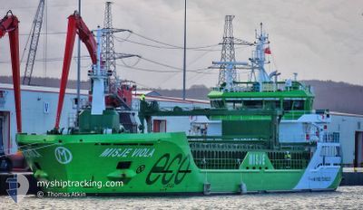
MISJE VIOLA
Cargo

Current Trip
| Trip Time | 1 day |
|---|---|
| Trip Distance | 335.54 nm |
| AVG Speed | 11.3 Noeuds |
| MAX Speed | 12.9 Noeuds |
| Tirant d eau | 6.4 m |
| AVG Wind | 10.1 knots |
| MAX Wind | 21 knots |
| MIN Temp | -5.9°C / 21.38°F |
| MAX Temp | 4.1°C / 39.38°F |
| Position reçue | 6 d depuis |
Current Position
| Longitude | --- |
|---|---|
| Latitude | --- |
| Etat | Under way using engine |
| Vitesse | 9.7 Noeuds |
| Parcours | 357.2° |
| Zone | North Atlantic Ocean |
| Station | T-AIS |
| Position reçue | 6 d depuis |
Information
The current position of MISJE VIOLA is in North Atlantic Ocean with coordinates 59.23278° / -4.14070° as reported on 2025-02-22 11:54 by AIS to our vessel tracker app. The vessel's current speed is 9.7 Noeuds and is currently inside the port of AKRANES.
The vessel MISJE VIOLA (IMO: 9927445, MMSI: 257398000) is a Cargo It's sailing under the flag of [NO] Norway.
In this page you can find informations about the vessels current position, last detected port calls, and current voyage information. If the vessels is not in coverage by AIS you will find the latest position.
The current position of MISJE VIOLA is detected by our AIS receivers and we are not responsible for the reliability of the data. The last position was recorded while the vessel was in Coverage by the Ais receivers of our vessel tracking app.
The current draught of MISJE VIOLA as reported by AIS is 6.4 meters
Weather
| Temperature | 4.2°C / 39.56°F |
|---|---|
| Wind Speed | 38 knots |
| Direction | 187° S |
| Pressure | 980.5 hPa |
| Humidity | 72.7 % |
| Cloud Coverage | 100 % |


Featured Company
Last Port Calls
| Port | Arrival | Departure | Time In Port |
|---|---|---|---|
| 2025-02-27 07:16 | |||
| 2025-02-25 06:04 | 2025-02-25 23:22 | 17 h | |
| 2025-02-16 01:23 | 2025-02-17 19:22 | 1 d | |
| 2025-02-14 17:27 | 2025-02-15 14:39 | 21 h | |
| 2025-02-11 10:05 | 2025-02-12 01:56 | 15 h | |
| 2025-02-10 05:13 | 2025-02-10 21:34 | 16 h | |
| 2025-02-05 07:46 | 2025-02-06 23:52 | 1 d | |
| 2025-02-03 14:51 | 2025-02-04 21:30 | 1 d | |
| 2025-01-30 07:22 | 2025-01-31 19:24 | 1 d | |
| 2025-01-28 04:36 | 2025-01-29 00:49 | 20 h |
Last Trips
| Origin | Departure | Destination | Arrival | Distance | |
|---|---|---|---|---|---|
| 2025-02-25 23:22 | 2025-02-27 07:16 | 335.54 nm | |||
| 2025-02-17 20:22 | 2025-02-25 06:04 | 1262.83 nm | |||
| 2025-02-15 15:39 | 2025-02-16 02:23 | 98.09 nm | |||
| 2025-02-12 02:56 | 2025-02-14 18:27 | 679.23 nm | |||
| 2025-02-10 22:34 | 2025-02-11 11:05 | 127.84 nm | |||
| 2025-02-07 00:52 | 2025-02-10 06:13 | 675.90 nm | |||
| 2025-02-04 22:30 | 2025-02-05 08:46 | 83.51 nm | |||
| 2025-01-31 20:24 | 2025-02-03 15:51 | 570.35 nm | |||
| 2025-01-29 01:49 | 2025-01-30 08:22 | 317.11 nm | |||
| 2025-01-23 13:03 | 2025-01-28 05:36 | 988.10 nm |
Events
| Heure | Evenement | Détails | Position/ Destination | Info |
|---|---|---|---|---|
| 2025-02-27 07:16 | Port d'arrivée |
|
64.31327 / -22.08161
[IS] AKRANES
|
Vitesse: 2.7 kn Parcours: 250° |
| 2025-02-25 23:22 | Démarrage | 0.39 nm, South West of HUSAVIK |
66.04220 / -17.36552
ISHUS
|
Vitesse: 4.5 kn Parcours: 262° |
| 2025-02-25 23:22 | PORT DE DEPART |
|
66.04220 / -17.36552
ISHUS
|
Vitesse: 1.9 kn Parcours: 16° |
| 2025-02-25 06:04 | Port d'arrivée |
|
66.04497 / -17.35891
[IS] HUSAVIK
|
Vitesse: 4.1 kn Parcours: 164° |
| 2025-02-22 11:59 | Etat Changé | Default Under way using engine |
59.24909 / -4.14401
ISHUS
|
Vitesse: 9.7 kn Parcours: 357.2° |
| 2025-02-22 11:54 | Hors de la zone couverte |
59.23278 / -4.14070
North Atlantic Ocean
ISHUS
|
Vitesse: 9.7 kn Parcours: 357.2° |
|
| 2025-02-22 11:04 | Changement d'ETA | 2025/02/25 06:00 2025/02/23 12:00 |
59.11383 / -4.04840
ISHUS
|
Vitesse: 9.7 kn Parcours: 327.5° |
| 2025-02-22 08:27 | Etat Changé | Under way using engine Default |
58.75172 / -3.53243
ISHUS
|
Vitesse: 11 kn Parcours: 328° |
| 2025-02-22 08:03 | Etat Changé | Default Under way using engine |
58.69249 / -3.45559
ISHUS
|
Vitesse: 10.5 kn Parcours: 351.3° |
| 2025-02-22 07:47 | Démarrage | 3.74 nm, North East of SCRABSTER |
58.65451 / -3.45975
ISHUS
|
Vitesse: 5.1 kn Parcours: 38.6° |