
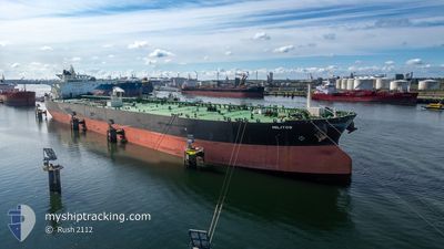
MILITOS
Crude Oil Tanker
Current Trip
| Time Travelled | 3 days |
|---|---|
| Remaining Time | --- |
| Distance Travelled | 715.69 nm |
| Remaining Distance | --- |
| AVG Speed | 9.7 Noeuds |
| MAX Speed | 13.8 Noeuds |
| AVG Wind | 22.4 knots |
| MAX Wind | 41 knots |
| MIN Temp | 9.1°C / 48.38°F |
| MAX Temp | 14.7°C / 58.46°F |
| Tirant d eau | 9.3 m |
| Position reçue | 11 h, 52 m depuis |
Current Position
| Longitude | --- |
|---|---|
| Latitude | --- |
| Etat | Under way using engine |
| Vitesse | 6.5 Noeuds |
| Parcours | 309.6° |
| Zone | Aegean Sea |
| Station | T-AIS |
| Position reçue | 11 h, 52 m depuis |
Info
Information
The current position of MILITOS is in Aegean Sea with coordinates 39.71335° / 25.34227° as reported on 2024-12-26 13:13 by AIS to our vessel tracker app. The vessel's current speed is 6.5 Noeuds and is heading at the port of CANAKKALE. The estimated time of arrival as calculated by MyShipTracking vessel tracking app is 2024-12-26 19:00 LT
The vessel MILITOS (IMO: 9607435, MMSI: 241199000) is a Crude Oil Tanker that was built in 2012 ( 12 Age ). It's sailing under the flag of [GR] Greece.
In this page you can find informations about the vessels current position, last detected port calls, and current voyage information. If the vessels is not in coverage by AIS you will find the latest position.
The current position of MILITOS is detected by our AIS receivers and we are not responsible for the reliability of the data. The last position was recorded while the vessel was in Coverage by the Ais receivers of our vessel tracking app.
The current draught of MILITOS as reported by AIS is 9.3 meters
Weather
| Temperature | 8.7°C / 47.66°F |
|---|---|
| Wind Speed | 40 knots |
| Direction | 40° NE |
| Pressure | 1023.5 hPa |
| Humidity | 83.9 % |
| Cloud Coverage | 100 % |
Featured Company
Most Visited Ports (Last year)
| Port | Arrivals | |
|---|---|---|
| 2 | ||
| 2 | ||
| 1 | ||
| 1 | ||
| 1 | ||
| 1 |
Events
| Heure | Evenement | Détails | Position/ Destination | Info |
|---|---|---|---|---|
| 2024-12-26 13:18 | Etat Changé | Default Under way using engine |
39.71762 / 25.33344
TRCKZ
|
Vitesse: 6.5 kn Parcours: 309.6° |
| 2024-12-26 13:13 | Hors de la zone couverte |
39.71335 / 25.34227
Aegean Sea
TRCKZ
|
Vitesse: 6.5 kn Parcours: 309.6° |
|
| 2024-12-26 07:51 | Etat Changé | Under way using engine Default |
39.04236 / 25.34372
TRCKZ
|
Vitesse: 9.7 kn Parcours: 22° |
| 2024-12-26 07:43 | Etat Changé | Default Under way using engine |
39.02137 / 25.33286
TRCKZ
|
Vitesse: 9.8 kn Parcours: 19.6° |
| 2024-12-26 07:21 | Etat Changé | Under way using engine Default |
38.96788 / 25.30598
TRCKZ
|
Vitesse: 9.6 kn Parcours: 25° |
| 2024-12-26 06:53 | Etat Changé | Default Under way using engine |
38.89650 / 25.26467
TRCKZ
|
Vitesse: 9.8 kn Parcours: 25.8° |
| 2024-12-26 06:24 | Etat Changé | Under way using engine Default |
38.82619 / 25.22089
TRCKZ
|
Vitesse: 10 kn Parcours: 27° |
| 2024-12-26 06:07 | Etat Changé | Default Under way using engine |
38.78439 / 25.19455
TRCKZ
|
Vitesse: 10.2 kn Parcours: 26.8° |
| 2024-12-26 05:54 | Etat Changé | Under way using engine Default |
38.75009 / 25.17323
TRCKZ
|
Vitesse: 10.2 kn Parcours: 24° |
| 2024-12-26 05:46 | Etat Changé | Default Under way using engine |
38.73090 / 25.16179
TRCKZ
|
Vitesse: 10.1 kn Parcours: 22.6° |