
MIDJUR
Cargo
Current Trip
| Time Travelled | 8 days |
|---|---|
| Remaining Time | --- |
| Distance Travelled | 1849.78 nm |
| Remaining Distance | --- |
| AVG Speed | 10.2 Noeuds |
| MAX Speed | 14.1 Noeuds |
| AVG Wind | 10.4 knots |
| MAX Wind | 18 knots |
| MIN Temp | 18.1°C / 64.58°F |
| MAX Temp | 33.1°C / 91.58°F |
| Tirant d eau | 10.1 m |
| Position reçue | 2 d depuis |
Current Position
| Longitude | --- |
|---|---|
| Latitude | --- |
| Etat | Under way using engine |
| Vitesse | 9.9 Noeuds |
| Parcours | 39.2° |
| Zone | South Atlantic Ocean |
| Station | T-AIS |
| Position reçue | 2 d depuis |
Info
Information
The current position of MIDJUR is in South Atlantic Ocean with coordinates -25.03251° / -43.72296° as reported on 2025-03-04 11:53 by AIS to our vessel tracker app. The vessel's current speed is 9.9 Noeuds and is heading at the port of BEJAIA. The estimated time of arrival as calculated by MyShipTracking vessel tracking app is 2025-03-22 12:00 LT
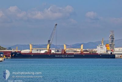
The vessel MIDJUR (IMO: 9835771, MMSI: 215378000) is a Cargo It's sailing under the flag of [MT] Malta.
In this page you can find informations about the vessels current position, last detected port calls, and current voyage information. If the vessels is not in coverage by AIS you will find the latest position.
The current position of MIDJUR is detected by our AIS receivers and we are not responsible for the reliability of the data. The last position was recorded while the vessel was in Coverage by the Ais receivers of our vessel tracking app.
The current draught of MIDJUR as reported by AIS is 10.1 meters
Weather
| Temperature | 27.3°C / 81.14°F |
|---|---|
| Wind Speed | 14 knots |
| Direction | 103° ESE |
| Pressure | 1016.8 hPa |
| Humidity | 69.7 % |
| Cloud Coverage | --- |
Featured Company
Last Port Calls
| Port | Arrival | Departure | Time In Port |
|---|---|---|---|
| 2025-02-24 18:34 | 2025-02-27 00:58 | 2 d | |
| 2025-02-17 16:56 | 2025-02-20 17:07 | 3 d | |
| 2025-02-07 17:20 | 2025-02-13 09:32 | 5 d | |
| 2025-02-01 15:10 | 2025-02-02 20:14 | 1 d |
Most Visited Ports (Last year)
| Port | Arrivals | |
|---|---|---|
| 3 | ||
| 2 | ||
| 1 | ||
| 1 | ||
| 1 | ||
| 1 |
Last Trips
| Origin | Departure | Destination | Arrival | Distance | |
|---|---|---|---|---|---|
| 2025-02-20 14:07 | 2025-02-24 15:34 | 1109.24 nm | |||
| 2025-02-13 06:32 | 2025-02-17 13:56 | 16.74 nm | |||
| 2025-02-02 17:14 | 2025-02-07 14:20 | 18.80 nm | |||
| 2024-12-20 03:58 | 2025-02-01 12:10 | 4544.97 nm |
Events
| Heure | Evenement | Détails | Position/ Destination | Info |
|---|---|---|---|---|
| 2025-03-04 11:57 | Etat Changé | Default Under way using engine |
-25.02294 / -43.71424
DZBJA
|
Vitesse: 9.9 kn Parcours: 39.2° |
| 2025-03-04 11:53 | Hors de la zone couverte |
-25.03251 / -43.72296
South Atlantic Ocean
DZBJA
|
Vitesse: 9.9 kn Parcours: 39.2° |
|
| 2025-03-04 06:27 | Dans la zone couverte |
-25.69044 / -44.36579
South Atlantic Ocean
DZBJA
|
Vitesse: 9.5 kn Parcours: 41.9° |
|
| 2025-03-03 08:36 | Etat Changé | Default Under way using engine |
-28.44723 / -47.07811
DZBJA
|
Vitesse: 9 kn Parcours: 42.1° |
| 2025-03-03 08:32 | Etat Changé | Under way using engine Default |
-28.45317 / -47.08400
DZBJA
|
Vitesse: 8.9 kn Parcours: 42° |
| 2025-03-03 08:32 | Dans la zone couverte |
-28.45317 / -47.08400
South Atlantic Ocean
DZBJA
|
Vitesse: 9 kn Parcours: 42.1° |
|
| 2025-03-03 08:32 | Hors de la zone couverte |
-28.45317 / -47.08400
South Atlantic Ocean
DZBJA
|
Vitesse: 9 kn Parcours: 42.1° |
|
| 2025-03-03 07:46 | Etat Changé | Default Under way using engine |
-28.53993 / -47.17128
DZBJA
|
Vitesse: 8.8 kn Parcours: 43.3° |
| 2025-03-03 07:21 | Hors de la zone couverte |
-28.58263 / -47.21579
South Atlantic Ocean
DZBJA
|
Vitesse: 8.8 kn Parcours: 43.3° |
|
| 2025-03-03 06:50 | Etat Changé | Under way using engine Default |
-28.63959 / -47.27863
DZBJA
|
Vitesse: 9.4 kn Parcours: 43° |