

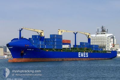
MICHEL A
Container Ship

Current Trip
| Trip Time | 1 day |
|---|---|
| Trip Distance | 366.05 nm |
| AVG Speed | 12.7 Noeuds |
| MAX Speed | 15.7 Noeuds |
| Tirant d eau | 8.9 m |
| AVG Wind | 14.8 knots |
| MAX Wind | 25.9 knots |
| MIN Temp | 10°C / 50°F |
| MAX Temp | 14.9°C / 58.82°F |
| Position reçue | 2 h, 3 m depuis |
Current Position
| Longitude | --- |
|---|---|
| Latitude | --- |
| Etat | Under way using engine |
| Vitesse | 2 Noeuds |
| Parcours | 33° |
| Zone | Tyrrhenian Sea |
| Station | T-AIS |
| Position reçue | 2 h, 3 m depuis |
Information
The current position of MICHEL A is in Tyrrhenian Sea with coordinates 40.59459° / 14.69557° as reported on 2025-03-03 10:05 by AIS to our vessel tracker app. The vessel's current speed is 2 Noeuds and is currently inside the port of SALERNO.
The vessel MICHEL A (IMO: 9379349, MMSI: 215417000) is a Container Ship that was built in 2007 ( 18 Age ). It's sailing under the flag of [MT] Malta.
In this page you can find informations about the vessels current position, last detected port calls, and current voyage information. If the vessels is not in coverage by AIS you will find the latest position.
The current position of MICHEL A is detected by our AIS receivers and we are not responsible for the reliability of the data. The last position was recorded while the vessel was in Coverage by the Ais receivers of our vessel tracking app.
The current draught of MICHEL A as reported by AIS is 8.9 meters
Weather
| Temperature | 12.1°C / 53.78°F |
|---|---|
| Wind Speed | 6 knots |
| Direction | 27° NNE |
| Pressure | 1024.4 hPa |
| Humidity | 40.8 % |
| Cloud Coverage | 5 % |


Featured Company
Last Port Calls
| Port | Arrival | Departure | Time In Port |
|---|---|---|---|
| 2025-03-03 11:59 | |||
| 2025-02-28 23:59 | 2025-03-02 04:51 | 1 d | |
| 2025-02-27 17:38 | 2025-02-28 19:54 | 1 d | |
| 2025-02-25 16:02 | 2025-02-26 04:44 | 12 h | |
| 2025-02-21 22:07 | 2025-02-22 20:57 | 22 h | |
| 2025-02-20 08:03 | 2025-02-21 05:40 | 21 h | |
| 2025-02-15 23:55 | 2025-02-17 15:38 | 1 d | |
| 2025-02-11 23:25 | 2025-02-12 19:50 | 20 h | |
| 2025-02-10 16:09 | 2025-02-11 11:25 | 19 h | |
| 2025-02-08 09:56 | 2025-02-08 19:53 | 9 h |
Last Trips
| Origin | Departure | Destination | Arrival | Distance | |
|---|---|---|---|---|---|
| 2025-03-02 04:51 | 2025-03-03 11:59 | 366.05 nm | |||
| 2025-02-28 19:54 | 2025-02-28 23:59 | 56.78 nm | |||
| 2025-02-26 04:44 | 2025-02-27 17:38 | 227.32 nm | |||
| 2025-02-22 20:57 | 2025-02-25 16:02 | 1027.38 nm | |||
| 2025-02-21 05:40 | 2025-02-21 22:07 | 231.48 nm | |||
| 2025-02-17 15:38 | 2025-02-20 08:03 | 511.42 nm | |||
| 2025-02-12 19:50 | 2025-02-15 23:55 | 1058.42 nm | |||
| 2025-02-11 11:25 | 2025-02-11 23:25 | 65.14 nm | |||
| 2025-02-08 19:53 | 2025-02-10 16:09 | 366.20 nm | |||
| 2025-02-05 14:09 | 2025-02-08 09:56 | 990.48 nm |
Events
| Heure | Evenement | Détails | Position/ Destination | Info |
|---|---|---|---|---|
| 2025-03-03 11:22 | Arret |
40.67289 / 14.74487
[IT] SALERNO
|
Vitesse: Parcours: 160° |
|
| 2025-03-03 10:59 | Port d'arrivée |
|
40.66763 / 14.74762
[IT] SALERNO
|
Vitesse: 6.7 kn Parcours: 71° |
| 2025-03-03 10:14 | Démarrage | 4.64 nm, South West of SALERNO |
40.60154 / 14.69994
ITSAL
|
Vitesse: 4.1 kn Parcours: 26° |
| 2025-03-03 10:08 | Etat Changé | Default Under way using engine |
40.59662 / 14.69689
ITSAL
|
Vitesse: 2 kn Parcours: 33° |
| 2025-03-03 10:05 | Hors de la zone couverte |
40.59459 / 14.69557
Tyrrhenian Sea
[IT] SALERNO
|
Vitesse: 2 kn Parcours: 28.5° |
|
| 2025-03-03 10:03 | Etat Changé | Under way using engine Default |
40.59379 / 14.69505
ITSAL
|
Vitesse: 0.9 kn Parcours: 39° |
| 2025-03-03 09:56 | Etat Changé | Default Under way using engine |
40.59198 / 14.69400
ITSAL
|
Vitesse: 0.9 kn Parcours: 37° |
| 2025-03-03 09:50 | Etat Changé | Under way using engine Default |
40.59113 / 14.69320
ITSAL
|
Vitesse: 0.9 kn Parcours: 40° |
| 2025-03-03 09:13 | Etat Changé | Default Under way using engine |
40.58424 / 14.68430
ITSAL
|
Vitesse: 1.2 kn Parcours: 38° |
| 2025-03-03 09:08 | Etat Changé | Under way using engine Default |
40.58304 / 14.68267
ITSAL
|
Vitesse: 1.4 kn Parcours: 37° |