

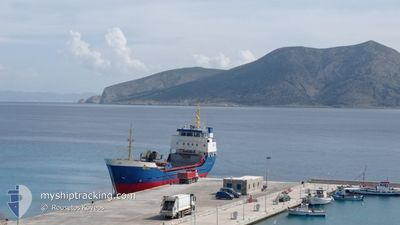
MICHAIL
General Cargo

Current Trip
| Time Travelled | 4 days |
|---|---|
| Remaining Time | --- |
| Distance Travelled | 28.02 nm |
| Remaining Distance | --- |
| AVG Speed | 8.8 Noeuds |
| MAX Speed | 10.4 Noeuds |
| AVG Wind | 13.6 knots |
| MAX Wind | 16 knots |
| MIN Temp | 15.9°C / 60.62°F |
| MAX Temp | 16.9°C / 62.42°F |
| Tirant d eau | 4.5 m |
| Position reçue | 8 h, 28 m depuis |
Current Position
| Longitude | --- |
|---|---|
| Latitude | --- |
| Etat | Under way using engine |
| Vitesse | 9.5 Noeuds |
| Parcours | 208.6° |
| Zone | Aegean Sea |
| Station | T-AIS |
| Position reçue | 8 h, 28 m depuis |
Information
The current position of MICHAIL is in Aegean Sea with coordinates 37.11141° / 26.82923° as reported on 2025-03-28 04:56 by AIS to our vessel tracker app. The vessel's current speed is 9.5 Noeuds
The vessel MICHAIL (IMO: 7716488, MMSI: 240193200) is a General Cargo that was built in 1978 ( 47 Age ). It's sailing under the flag of [GR] Greece.
In this page you can find informations about the vessels current position, last detected port calls, and current voyage information. If the vessels is not in coverage by AIS you will find the latest position.
The current position of MICHAIL is detected by our AIS receivers and we are not responsible for the reliability of the data. The last position was recorded while the vessel was in Coverage by the Ais receivers of our vessel tracking app.
The current draught of MICHAIL as reported by AIS is 4.5 meters
Weather
| Temperature | 15.9°C / 60.62°F |
|---|---|
| Wind Speed | 16 knots |
| Direction | 248° WSW |
| Pressure | 1006 hPa |
| Humidity | 81 % |
| Cloud Coverage | 79 % |


Featured Company
Last Port Calls
| Port | Arrival | Departure | Time In Port |
|---|---|---|---|
| 2025-03-24 14:35 | |||
| 2025-03-23 17:58 | 2025-03-24 11:32 | 17 h | |
| 2025-03-18 11:10 | 2025-03-23 09:32 | 4 d | |
| 2025-03-17 14:36 | 2025-03-18 08:09 | 17 h | |
| 2025-03-15 19:39 | 2025-03-17 07:18 | 1 d | |
| 2025-03-15 06:15 | 2025-03-15 13:35 | 7 h | |
| 2025-03-11 21:23 | 2025-03-14 15:20 | 2 d | |
| 2025-03-11 14:20 | 2025-03-11 18:41 | 4 h | |
| 2025-03-10 13:50 | 2025-03-11 06:21 | 16 h | |
| 2025-03-09 16:24 | 2025-03-10 11:09 | 18 h |
Last Trips
| Origin | Departure | Destination | Arrival | Distance | |
|---|---|---|---|---|---|
| 2025-03-24 11:32 | 2025-03-24 14:35 | 26.53 nm | |||
| 2025-03-23 09:32 | 2025-03-23 17:58 | 28.31 nm | |||
| 2025-03-18 08:09 | 2025-03-18 11:10 | 23.70 nm | |||
| 2025-03-17 07:18 | 2025-03-17 14:36 | 24.02 nm | |||
| 2025-03-15 13:35 | 2025-03-15 19:39 | 61.43 nm | |||
| 2025-03-14 15:20 | 2025-03-15 06:15 | 65.41 nm | |||
| 2025-03-11 18:41 | 2025-03-11 21:23 | 24.95 nm | |||
| 2025-03-11 06:21 | 2025-03-11 14:20 | 29.15 nm | |||
| 2025-03-10 11:09 | 2025-03-10 13:50 | 24.93 nm | |||
| 2025-03-08 18:04 | 2025-03-09 16:24 | 137.44 nm |
Events
| Heure | Evenement | Détails | Position/ Destination | Info |
|---|---|---|---|---|
| 2025-03-28 11:25 | Arret | 1.01 nm, South East of AGIA MARINA |
37.14623 / 26.86643
KOS
|
Vitesse: 0.3 kn Parcours: -1° |
| 2025-03-28 10:51 | Démarrage | 1.24 nm, North East of LEROS |
37.13842 / 26.87798
KOS
|
Vitesse: 5.1 kn Parcours: 315° |
| 2025-03-28 04:56 | Hors de la zone couverte |
37.11141 / 26.82923
Aegean Sea
|
Vitesse: 9.5 kn Parcours: 208.6° |
|
| 2025-03-28 04:56 | Dans la zone couverte |
37.11141 / 26.82923
Aegean Sea
|
Vitesse: 9.5 kn Parcours: 208.6° |
|
| 2025-03-24 12:35 | Port d'arrivée |
|
37.13003 / 26.84974
[GR] LEROS
|
Vitesse: 9 kn Parcours: 328° |
| 2025-03-24 12:22 | Etat Changé | Default Under way using engine |
37.10058 / 26.83402
KOS
|
Vitesse: 9 kn Parcours: 314.5° |
| 2025-03-24 12:18 | Hors de la zone couverte |
37.09316 / 26.84218
Aegean Sea
|
Vitesse: 9 kn Parcours: 314.5° |
|
| 2025-03-24 11:44 | Etat Changé | Under way using engine Default |
37.09452 / 26.94034
KOS
|
Vitesse: 9.5 kn Parcours: 295° |
| 2025-03-24 11:18 | Etat Changé | Default Under way using engine |
37.07567 / 27.00661
KOS
|
Vitesse: 9.7 kn Parcours: 293.9° |
| 2025-03-24 10:14 | Changement de zone | Greek part of the Aegean Sea Turkish part of the Aegean Sea |
36.98153 / 27.19232
Aegean Sea
|
Vitesse: 10.1 kn Parcours: 304.1° |