
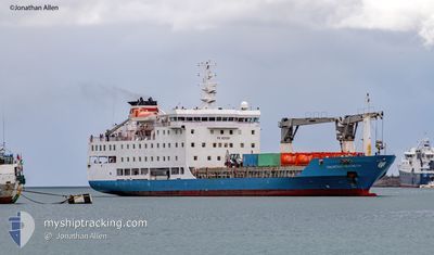
MAURITIUS TROCHETIA
Passenger/Cargo Ship
Current Trip
MU AGALEGA
| Time Travelled | 4 days |
|---|---|
| Remaining Time | --- |
| Distance Travelled | 593.78 nm |
| Remaining Distance | --- |
| AVG Speed | 11.8 Noeuds |
| MAX Speed | 14.4 Noeuds |
| AVG Wind | 10.2 knots |
| MAX Wind | 15 knots |
| MIN Temp | 26.2°C / 79.16°F |
| MAX Temp | 28.8°C / 83.84°F |
| Tirant d eau | 5.9 m |
| Position reçue | 4 d depuis |
Current Position
| Longitude | --- |
|---|---|
| Latitude | --- |
| Etat | Moored |
| Vitesse | 5.7 Noeuds |
| Parcours | 308° |
| Zone | Indian Ocean |
| Station | T-AIS |
| Position reçue | 4 d depuis |
Info
Information
The current position of MAURITIUS TROCHETIA is in Indian Ocean with coordinates -20.14870° / 57.48628° as reported on 2025-12-06 11:21 by AIS to our vessel tracker app. The vessel's current speed is 5.7 Noeuds
The vessel MAURITIUS TROCHETIA (IMO: 9225287, MMSI: 645161000) is a Passenger/Cargo Ship that was built in 2001 ( 24 Age ). It's sailing under the flag of [MU] Mauritius.
In this page you can find informations about the vessels current position, last detected port calls, and current voyage information. If the vessels is not in coverage by AIS you will find the latest position.
The current position of MAURITIUS TROCHETIA is detected by our AIS receivers and we are not responsible for the reliability of the data. The last position was recorded while the vessel was in Coverage by the Ais receivers of our vessel tracking app.
The current draught of MAURITIUS TROCHETIA as reported by AIS is 5.9 meters
Weather
| Temperature | 27.1°C / 80.78°F |
|---|---|
| Wind Speed | 11 knots |
| Direction | 134° SE |
| Pressure | 1012.1 hPa |
| Humidity | 70.7 % |
| Cloud Coverage | 28 % |
Featured Company
Last Port Calls
| Port | Arrival | Departure | Time In Port |
|---|---|---|---|
| 2025-12-01 19:33 | 2025-12-06 15:36 | 4 d | |
| 2025-11-24 12:21 | 2025-11-27 20:00 | 3 d | |
| 2025-11-15 13:41 | 2025-11-19 23:35 | 4 d | |
| 2025-10-30 12:00 | 2025-11-11 00:12 | 11 d | |
| 2025-10-24 17:49 |
Most Visited Ports (Last year)
| Port | Arrivals | |
|---|---|---|
| 24 | ||
| 1 |
Last Trips
| Origin | Departure | Destination | Arrival | Distance | |
|---|---|---|---|---|---|
| 2025-11-27 20:00 | 2025-12-01 19:33 | 725.07 nm | |||
| 2025-11-19 23:35 | 2025-11-24 12:21 | 720.20 nm | |||
| 2025-11-11 00:12 | 2025-11-15 13:41 | 722.15 nm | |||
| 2025-10-24 17:49 | 2025-10-30 12:00 | 724.77 nm |
Events
| Heure | Evenement | Détails | Position/ Destination | Info |
|---|---|---|---|---|
| 2025-12-08 12:29 | Arret |
-10.34333 / 56.58333
MU AGALEGA
|
Vitesse: Parcours: -1° |
|
| 2025-12-06 11:36 | PORT DE DEPART |
|
-20.13282 / 57.46562
MU AGALEGA
|
Vitesse: 6.2 kn Parcours: 305° |
| 2025-12-06 11:28 | Etat Changé | Default Moored |
-20.14135 / 57.47639
[MU] PORT LOUIS
|
Vitesse: 5.7 kn Parcours: 308° |
| 2025-12-06 11:21 | Hors de la zone couverte |
-20.14870 / 57.48628
Indian Ocean
MU AGALEGA
|
Vitesse: 5.7 kn Parcours: 308.7° |
|
| 2025-12-06 11:16 | Changement de destination | MU AGALEGA MU PLU |
-20.15209 / 57.49145
[MU] PORT LOUIS
|
Vitesse: 3.4 kn Parcours: 297° |
| 2025-12-06 11:16 | Changement d'ETA | 2025/12/08 12:30 2025/12/01 14:30 |
-20.15209 / 57.49145
[MU] PORT LOUIS
|
Vitesse: 3.4 kn Parcours: 297° |
| 2025-12-06 11:14 | Etat Changé | Moored Default |
-20.15272 / 57.49303
[MU] PORT LOUIS
|
Vitesse: Parcours: 307° |
| 2025-12-06 11:14 | Démarrage |
-20.15272 / 57.49303
[MU] PORT LOUIS
|
Vitesse: 3.3 kn Parcours: 293° |
|
| 2025-12-06 11:03 | Etat Changé | Default Moored |
-20.15312 / 57.49505
[MU] PORT LOUIS
|
Vitesse: Parcours: 307° |
| 2025-12-06 10:54 | Etat Changé | Moored Default |
-20.15311 / 57.49504
[MU] PORT LOUIS
|
Vitesse: Parcours: 307° |