
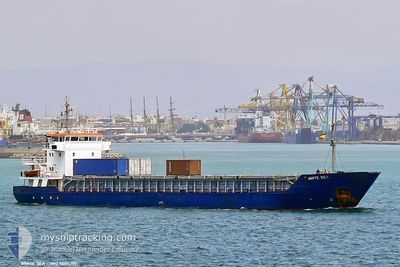
MARION ANITA
General Cargo
Current Trip
| Time Travelled | 1 day |
|---|---|
| Remaining Time | --- |
| Distance Travelled | 244.14 nm |
| Remaining Distance | 9.02 nm |
| AVG Speed | 8.3 Noeuds |
| MAX Speed | 12.3 Noeuds |
| AVG Wind | 10.6 knots |
| MAX Wind | 23 knots |
| MIN Temp | 10.5°C / 50.9°F |
| MAX Temp | 18.4°C / 65.12°F |
| Tirant d eau | 3.4 m |
| Position reçue | 3 m depuis |
Current Position
| Longitude | 5.69140° |
|---|---|
| Latitude | 59.03190° |
| Etat | At anchor |
| Vitesse | 0.2 Noeuds |
| Parcours | 329° |
| Zone | North Sea |
| Station | T-AIS |
| Position reçue | 3 m depuis |
Info
Information
The current position of MARION ANITA is in North Sea with coordinates 59.03190° / 5.69140° as reported on 2024-06-01 07:39 by AIS to our vessel tracker app. The vessel's current speed is 0.2 Noeuds and is heading at the port of BREIVIKEN. The estimated time of arrival as calculated by MyShipTracking vessel tracking app is 2024-06-01 06:00 LT
The vessel MARION ANITA (IMO: 9006291, MMSI: 257088370) is a General Cargo that was built in 1992 ( 32 Age ). It's sailing under the flag of [NO] Norway.
In this page you can find informations about the vessels current position, last detected port calls, and current voyage information. If the vessels is not in coverage by AIS you will find the latest position.
The current position of MARION ANITA is detected by our AIS receivers and we are not responsible for the reliability of the data. The last position was recorded while the vessel was in Coverage by the Ais receivers of our vessel tracking app.
The current draught of MARION ANITA as reported by AIS is 3.4 meters
Weather
| Temperature | 11.3°C / 52.34°F |
|---|---|
| Wind Speed | 8 knots |
| Direction | 347° NNW |
| Pressure | 1020 hPa |
| Humidity | 91.5 % |
| Cloud Coverage | 28 % |
Featured Company
Last Port Calls
| Port | Arrival | Departure | Time In Port |
|---|---|---|---|
| 2024-05-30 00:02 | 2024-05-30 15:58 | 15 h | |
| 2024-05-24 18:10 | 2024-05-25 22:55 | 1 d | |
| 2024-05-22 23:57 | 2024-05-23 09:46 | 9 h | |
| 2024-05-20 19:26 | 2024-05-21 15:39 | 20 h | |
| 2024-05-18 16:18 | 2024-05-19 16:51 | 1 d | |
| 2024-05-17 16:53 | 2024-05-17 18:29 | 1 h | |
| 2024-05-16 23:02 | 2024-05-17 12:55 | 13 h | |
| 2024-05-12 19:07 | 2024-05-13 10:18 | 15 h | |
| 2024-05-11 00:39 | 2024-05-11 19:03 | 18 h | |
| 2024-05-10 00:12 | 2024-05-10 08:19 | 8 h |
Last Trips
| Origin | Departure | Destination | Arrival | Distance | |
|---|---|---|---|---|---|
| 2024-05-25 22:55 | 2024-05-30 00:02 | 514.44 nm | |||
| 2024-05-23 09:46 | 2024-05-24 18:10 | 292.63 nm | |||
| 2024-05-21 15:39 | 2024-05-22 23:57 | 226.36 nm | |||
| 2024-05-19 16:51 | 2024-05-20 19:26 | 282.58 nm | |||
| 2024-05-17 18:29 | 2024-05-18 16:18 | 229.94 nm | |||
| 2024-05-17 12:55 | 2024-05-17 16:53 | 40.80 nm | |||
| 2024-05-13 10:18 | 2024-05-16 23:02 | 403.31 nm | |||
| 2024-05-11 19:03 | 2024-05-12 19:07 | 247.16 nm | |||
| 2024-05-10 08:19 | 2024-05-11 00:39 | 164.76 nm | |||
| 2024-05-09 18:03 | 2024-05-10 00:12 | 61.86 nm |
Events
| Heure | Evenement | Détails | Position/ Destination | Info |
|---|---|---|---|---|
| 2024-06-01 07:00 | Etat Changé | At anchor Under way using engine |
59.03227 / 5.69039
NOBVR
|
Vitesse: 0.7 kn Parcours: 24° |
| 2024-06-01 06:55 | Arret | 0.8 nm, East of BRU |
59.03269 / 5.68917
NOBVR
|
Vitesse: 0.1 kn Parcours: 18° |
| 2024-05-31 17:16 | Detecté en mer | Norwegian part of the North Sea |
57.87506 / 7.19280
North Sea
NOBVR
|
Vitesse: 8.9 kn Parcours: 234.1° |
| 2024-05-31 16:09 | Etat Changé | Under way using engine Moored |
58.00356 / 7.49512
NOBVR
|
Vitesse: 9.5 kn Parcours: 186.3° |
| 2024-05-31 16:07 | Changement de destination | NOBVR NOFRS |
58.01384 / 7.49832
NOBVR
|
Vitesse: 7.2 kn Parcours: 204.7° |
| 2024-05-31 16:07 | Changement d'ETA | 2024/06/01 04:00 2024/05/30 00:00 |
58.01384 / 7.49832
NOBVR
|
Vitesse: 7.2 kn Parcours: 204.7° |
| 2024-05-31 16:05 | Démarrage | 1.55 nm, South East of MANDAL |
58.01384 / 7.49832
NOFRS
|
Vitesse: 7.2 kn Parcours: 204.7° |
| 2024-05-31 08:38 | Etat Changé | Moored Default |
58.01805 / 7.50218
NOFRS
|
Vitesse: Parcours: 191° |
| 2024-05-31 08:20 | Etat Changé | Default Moored |
58.01805 / 7.50217
NOFRS
|
Vitesse: Parcours: 191° |
| 2024-05-31 04:53 | Etat Changé | Moored Under way using engine |
58.01799 / 7.50214
NOFRS
|
Vitesse: Parcours: 191° |