
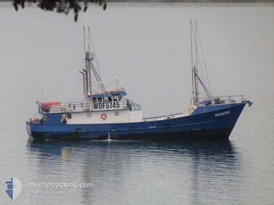
MARINA
Fishing
Current Position
| Longitude | -122.64580° |
|---|---|
| Latitude | 48.51258° |
| Etat | Moored |
| Vitesse | |
| Parcours | --- |
| Zone | The Coastal Waters of Southeast Alaska and British Columbia |
| Station | T-AIS |
| Position reçue | 4 m depuis |
Info
Information
The current position of MARINA is in The Coastal Waters of Southeast Alaska and British Columbia with coordinates 48.51258° / -122.64580° as reported on 2024-04-28 09:40 by AIS to our vessel tracker app. The vessel's current speed is 0 Noeuds and is currently inside the port of ANACORTES.
The vessel MARINA (IMO: 893989300, MMSI: 367466760) is a Fishing It's sailing under the flag of [US] USA.
In this page you can find informations about the vessels current position, last detected port calls, and current voyage information. If the vessels is not in coverage by AIS you will find the latest position.
The current position of MARINA is detected by our AIS receivers and we are not responsible for the reliability of the data. The last position was recorded while the vessel was in Coverage by the Ais receivers of our vessel tracking app.
The current draught of MARINA as reported by AIS is 2.7 meters
Weather
| Temperature | 9.5°C / 49.1°F |
|---|---|
| Wind Speed | 5 knots |
| Direction | 180° S |
| Pressure | 1015.7 hPa |
| Humidity | 85.8 % |
| Cloud Coverage | 100 % |
Featured Company
Most Visited Ports (Last year)
| Port | Arrivals | |
|---|---|---|
| 4 | ||
| 1 | ||
| 1 | ||
| 1 |
Last Trips
| Origin | Departure | Destination | Arrival | Distance |
|---|
Events
| Heure | Evenement | Détails | Position/ Destination | Info |
|---|---|---|---|---|
| 2024-04-28 02:50 | Dans la zone couverte |
48.51261 / -122.64573
The Coastal Waters of Southeast Alaska and British Columbia
[US] ANACORTES
|
Vitesse: Parcours: 296° |
|
| 2024-04-28 01:30 | Hors de la zone couverte |
48.51258 / -122.64577
The Coastal Waters of Southeast Alaska and British Columbia
[US] ANACORTES
|
Vitesse: Parcours: 249° |
|
| 2024-04-25 16:30 | Etat Changé | Moored Under way using engine |
48.51257 / -122.64572
[US] ANACORTES
|
Vitesse: Parcours: 511° |
| 2024-04-25 15:36 | Arret |
48.51255 / -122.64580
[US] ANACORTES
|
Vitesse: 0.3 kn Parcours: 511° |
|
| 2024-04-25 15:20 | Port d'arrivée |
|
48.51288 / -122.67557
[US] ANACORTES
|
Vitesse: 7.2 kn Parcours: 93° |
| 2024-04-25 08:01 | Changement de destination | ANACORTES WA PAPEETE |
48.20812 / -123.90420
ANACORTES WA
|
Vitesse: 7.2 kn Parcours: 92° |
| 2024-04-25 08:01 | Changement d'ETA | 2024/04/25 12:00 2024/09/13 14:00 |
48.20812 / -123.90420
ANACORTES WA
|
Vitesse: 7.2 kn Parcours: 92° |
| 2024-04-25 02:47 | Changement de zone | United States part of the The Coastal Waters of Southeast Alaska and British Columbia United States part of the North Pacific Ocean |
48.44645 / -124.70937
The Coastal Waters of Southeast Alaska and British Columbia
|
Vitesse: 5.9 kn Parcours: 93° |
| 2024-04-25 01:02 | Changement de zone | United States part of the North Pacific Ocean French Polynesian part of the South Pacific Ocean |
48.34303 / -124.91640
North Pacific Ocean
|
Vitesse: 5.8 kn Parcours: 31° |
| 2024-04-25 01:02 | Dans la zone couverte |
48.34303 / -124.91640
North Pacific Ocean
|
Vitesse: 5.8 kn Parcours: 31° |