
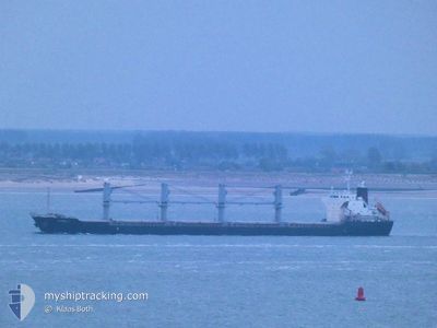
MARINA L
Bulk Carrier
Current Trip
| Time Travelled | 20 days |
|---|---|
| Remaining Time | --- |
| Distance Travelled | 5180.17 nm |
| Remaining Distance | --- |
| AVG Speed | 11.3 Noeuds |
| MAX Speed | 19.1 Noeuds |
| AVG Wind | 12.5 knots |
| MAX Wind | 37 knots |
| MIN Temp | 1.5°C / 34.7°F |
| MAX Temp | 17.4°C / 63.32°F |
| Tirant d eau | 8.4 m |
| Position reçue | 1 m depuis |
Current Position
| Longitude | --- |
|---|---|
| Latitude | --- |
| Etat | Under way using engine |
| Vitesse | 1 Noeuds |
| Parcours | 216° |
| Zone | Mediterranean Sea - Eastern Basin |
| Station | T-AIS |
| Position reçue | 1 m depuis |
Info
Information
The current position of MARINA L is in Mediterranean Sea - Eastern Basin with coordinates 32.93441° / 34.54877° as reported on 2025-02-18 03:55 by AIS to our vessel tracker app. The vessel's current speed is 1 Noeuds
The vessel MARINA L (IMO: 9675705, MMSI: 636016827) is a Bulk Carrier that was built in 2014 ( 11 Age ). It's sailing under the flag of [LR] Liberia.
In this page you can find informations about the vessels current position, last detected port calls, and current voyage information. If the vessels is not in coverage by AIS you will find the latest position.
The current position of MARINA L is detected by our AIS receivers and we are not responsible for the reliability of the data. The last position was recorded while the vessel was in Coverage by the Ais receivers of our vessel tracking app.
The current draught of MARINA L as reported by AIS is 8.4 meters
Weather
| Temperature | 16.4°C / 61.52°F |
|---|---|
| Wind Speed | 9 knots |
| Direction | 127° SE |
| Pressure | 1018.4 hPa |
| Humidity | 67.6 % |
| Cloud Coverage | --- |
Featured Company
Last Port Calls
| Port | Arrival | Departure | Time In Port |
|---|---|---|---|
| 2025-01-23 15:41 | 2025-01-28 10:10 | 4 d | |
| 2025-01-03 23:46 | 2025-01-10 21:56 | 6 d | |
| 2024-12-19 20:06 | 2024-12-19 21:28 | 1 h |
Most Visited Ports (Last year)
| Port | Arrivals | |
|---|---|---|
| 6 | ||
| 4 | ||
| 2 | ||
| 2 | ||
| 1 | ||
| 1 |
Last Trips
| Origin | Departure | Destination | Arrival | Distance | |
|---|---|---|---|---|---|
| 2025-01-10 22:56 | 2025-01-23 18:41 | 3010.38 nm | |||
| 2024-12-20 00:28 | 2025-01-04 00:46 | 2025.48 nm | |||
| 2024-11-28 04:32 | 2024-12-19 23:06 | 1657.40 nm |
Events
| Heure | Evenement | Détails | Position/ Destination | Info |
|---|---|---|---|---|
| 2025-02-18 02:03 | Etat Changé | Under way using engine Default |
32.92086 / 34.58060
IL HFA
|
Vitesse: 1 kn Parcours: 169° |
| 2025-02-18 01:51 | Etat Changé | Default Under way using engine |
32.91955 / 34.58441
IL HFA
|
Vitesse: 0.8 kn Parcours: 164° |
| 2025-02-18 01:22 | Etat Changé | Under way using engine Default |
32.91718 / 34.59157
IL HFA
|
Vitesse: 0.8 kn Parcours: 165° |
| 2025-02-18 01:05 | Etat Changé | Default Under way using engine |
32.91595 / 34.59577
IL HFA
|
Vitesse: 0.8 kn Parcours: 162° |
| 2025-02-17 22:26 | Etat Changé | Under way using engine Default |
32.90846 / 34.63431
IL HFA
|
Vitesse: 0.7 kn Parcours: 151° |
| 2025-02-17 22:16 | Etat Changé | Default Under way using engine |
32.90834 / 34.63660
IL HFA
|
Vitesse: 0.7 kn Parcours: 149° |
| 2025-02-17 21:52 | Etat Changé | Under way using engine Default |
32.90817 / 34.64203
IL HFA
|
Vitesse: 0.7 kn Parcours: 142° |
| 2025-02-17 21:43 | Etat Changé | Default Under way using engine |
32.90828 / 34.64428
IL HFA
|
Vitesse: 0.6 kn Parcours: 144° |
| 2025-02-17 21:30 | Etat Changé | Under way using engine Default |
32.90833 / 34.64714
IL HFA
|
Vitesse: 0.6 kn Parcours: 147° |
| 2025-02-17 21:25 | Etat Changé | Default Under way using engine |
32.90831 / 34.64827
IL HFA
|
Vitesse: 0.6 kn Parcours: 147° |