
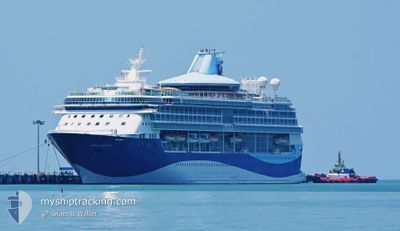
MARELLA DISCOVERY 2
Passengers Ship
Current Trip
| Time Travelled | 7 h, 21 mins |
|---|---|
| Remaining Time | --- |
| Distance Travelled | 110.90 nm |
| Remaining Distance | 13.98 nm |
| AVG Speed | 15.1 Noeuds |
| MAX Speed | 24 Noeuds |
| AVG Wind | 15.8 knots |
| MAX Wind | 19 knots |
| MIN Temp | 13.8°C / 56.84°F |
| MAX Temp | 19.2°C / 66.56°F |
| Tirant d eau | 8 m |
| Position reçue | 1 m depuis |
Current Position
| Longitude | --- |
|---|---|
| Latitude | --- |
| Etat | Under way using engine |
| Vitesse | 15.6 Noeuds |
| Parcours | 276.7° |
| Zone | North Atlantic Ocean |
| Station | T-AIS |
| Position reçue | 1 m depuis |
Info
Information
The current position of MARELLA DISCOVERY 2 is in North Atlantic Ocean with coordinates 28.41241° / -16.03362° as reported on 2025-03-18 05:25 by AIS to our vessel tracker app. The vessel's current speed is 15.6 Noeuds and is heading at the port of TENERIFE. The estimated time of arrival as calculated by MyShipTracking vessel tracking app is 2025-03-18 06:00 LT
The vessel MARELLA DISCOVERY 2 (IMO: 9070620, MMSI: 311378000) is a Passengers Ship that was built in 1995 ( 30 Age ). It's sailing under the flag of [BS] Bahamas.
In this page you can find informations about the vessels current position, last detected port calls, and current voyage information. If the vessels is not in coverage by AIS you will find the latest position.
The current position of MARELLA DISCOVERY 2 is detected by our AIS receivers and we are not responsible for the reliability of the data. The last position was recorded while the vessel was in Coverage by the Ais receivers of our vessel tracking app.
The current draught of MARELLA DISCOVERY 2 as reported by AIS is 8 meters
Weather
| Temperature | 18.6°C / 65.48°F |
|---|---|
| Wind Speed | 14 knots |
| Direction | 342° NNW |
| Pressure | 1020 hPa |
| Humidity | 64 % |
| Cloud Coverage | 36 % |
Featured Company
Last Port Calls
| Port | Arrival | Departure | Time In Port |
|---|---|---|---|
| 2025-03-17 07:11 | 2025-03-17 22:05 | 14 h | |
| 2025-03-16 12:07 | 2025-03-16 19:08 | 7 h | |
| 2025-03-15 07:17 | 2025-03-15 18:12 | 10 h | |
| 2025-03-13 07:18 | 2025-03-13 17:54 | 10 h | |
| 2025-03-12 10:07 | 2025-03-12 21:23 | 11 h | |
| 2025-03-11 06:09 | 2025-03-11 22:50 | 16 h | |
| 2025-03-10 07:14 | 2025-03-10 23:18 | 16 h | |
| 2025-03-09 07:14 | 2025-03-09 18:35 | 11 h | |
| 2025-03-08 07:09 | 2025-03-08 18:37 | 11 h | |
| 2025-03-06 05:57 | 2025-03-06 19:07 | 13 h |
Most Visited Ports (Last year)
| Port | Arrivals | |
|---|---|---|
| 24 | ||
| 16 | ||
| 16 | ||
| 14 | ||
| 14 | ||
| 12 |
Last Trips
| Origin | Departure | Destination | Arrival | Distance | |
|---|---|---|---|---|---|
| 2025-03-16 19:08 | 2025-03-17 07:11 | 134.33 nm | |||
| 2025-03-15 18:12 | 2025-03-16 12:07 | 270.25 nm | |||
| 2025-03-13 17:54 | 2025-03-15 07:17 | 386.99 nm | |||
| 2025-03-12 21:23 | 2025-03-13 07:18 | 57.62 nm | |||
| 2025-03-11 22:50 | 2025-03-12 10:07 | 164.64 nm | |||
| 2025-03-10 23:18 | 2025-03-11 06:09 | 93.96 nm | |||
| 2025-03-09 18:35 | 2025-03-10 07:14 | 141.59 nm | |||
| 2025-03-08 18:37 | 2025-03-09 07:14 | 77.01 nm | |||
| 2025-03-06 19:07 | 2025-03-08 07:09 | 376.01 nm | |||
| 2025-03-05 15:23 | 2025-03-06 05:57 | 242.60 nm |
Events
| Heure | Evenement | Détails | Position/ Destination | Info |
|---|---|---|---|---|
| 2025-03-18 04:09 | Etat Changé | Under way using engine Default |
28.17194 / -15.91246
ES SCT
|
Vitesse: 15 kn Parcours: 13° |
| 2025-03-18 03:52 | Etat Changé | Default Under way using engine |
28.10281 / -15.92865
ES SCT
|
Vitesse: 15 kn Parcours: 16.1° |
| 2025-03-18 03:38 | Etat Changé | Under way using engine Default |
28.04427 / -15.94093
ES SCT
|
Vitesse: 15.3 kn Parcours: 9° |
| 2025-03-18 02:42 | Etat Changé | Default Under way using engine |
27.80527 / -15.95636
ES SCT
|
Vitesse: 15.4 kn Parcours: 329.2° |
| 2025-03-18 02:37 | Etat Changé | Under way using engine Default |
27.78772 / -15.94404
ES SCT
|
Vitesse: 15.8 kn Parcours: 325° |
| 2025-03-18 02:31 | Etat Changé | Default Under way using engine |
27.76768 / -15.92595
ES SCT
|
Vitesse: 15.5 kn Parcours: 325.1° |
| 2025-03-18 02:26 | Etat Changé | Under way using engine Default |
27.75060 / -15.91069
ES SCT
|
Vitesse: 15.6 kn Parcours: 322° |
| 2025-03-18 02:24 | Dans la zone couverte |
27.75060 / -15.91069
North Atlantic Ocean
ES SCT
|
Vitesse: 15.5 kn Parcours: 325.1° |
|
| 2025-03-18 00:36 | Etat Changé | Default Under way using engine |
27.66129 / -15.45580
ES SCT
|
Vitesse: 16.1 kn Parcours: 234.7° |
| 2025-03-18 00:28 | Hors de la zone couverte |
27.68240 / -15.42293
North Atlantic Ocean
ES SCT
|
Vitesse: 16.1 kn Parcours: 234.7° |