
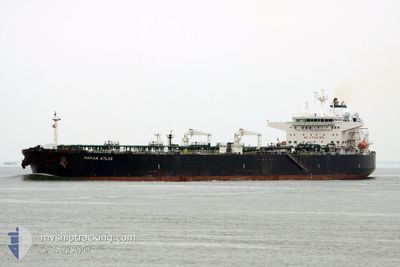
MARAN ATLAS
Crude Oil Tanker
Current Trip
| Time Travelled | 4 days |
|---|---|
| Remaining Time | --- |
| Distance Travelled | 1095.86 nm |
| Remaining Distance | --- |
| AVG Speed | 13.8 Noeuds |
| MAX Speed | 15 Noeuds |
| AVG Wind | 13.1 knots |
| MAX Wind | 22 knots |
| MIN Temp | 9.4°C / 48.92°F |
| MAX Temp | 15.9°C / 60.62°F |
| Tirant d eau | 8.5 m |
| Position reçue | 2 d depuis |
Current Position
| Longitude | --- |
|---|---|
| Latitude | --- |
| Etat | Under way using engine |
| Vitesse | 14.4 Noeuds |
| Parcours | 226° |
| Zone | Adriatic Sea |
| Station | T-AIS |
| Position reçue | 2 d depuis |
Info
Information
The current position of MARAN ATLAS is in Adriatic Sea with coordinates 39.96185° / 18.74087° as reported on 2025-03-04 00:01 by AIS to our vessel tracker app. The vessel's current speed is 14.4 Noeuds and is heading at the port of VALLETTA. The estimated time of arrival as calculated by MyShipTracking vessel tracking app is 2025-03-04 22:00 LT
The vessel MARAN ATLAS (IMO: 9414022, MMSI: 240891000) is a Crude Oil Tanker that was built in 2009 ( 16 Age ). It's sailing under the flag of [GR] Greece.
In this page you can find informations about the vessels current position, last detected port calls, and current voyage information. If the vessels is not in coverage by AIS you will find the latest position.
The current position of MARAN ATLAS is detected by our AIS receivers and we are not responsible for the reliability of the data. The last position was recorded while the vessel was in Coverage by the Ais receivers of our vessel tracking app.
The current draught of MARAN ATLAS as reported by AIS is 8.5 meters
Weather
| Temperature | 15.9°C / 60.62°F |
|---|---|
| Wind Speed | 8 knots |
| Direction | 80° E |
| Pressure | 1022.6 hPa |
| Humidity | 51.8 % |
| Cloud Coverage | 100 % |
Featured Company
Last Trips
| Origin | Departure | Destination | Arrival | Distance | |
|---|---|---|---|---|---|
| 2025-02-11 10:09 | 2025-03-01 09:29 | 340.10 nm | |||
| 2025-01-25 18:33 | 2025-02-10 15:25 | 1449.58 nm | |||
| 2025-01-15 18:45 | 2025-01-25 00:09 | 1530.04 nm | |||
| 2025-01-05 10:48 | 2025-01-14 09:12 | 1969.02 nm | |||
| 2024-12-24 17:00 | 2025-01-04 06:47 | 2063.88 nm |
Events
| Heure | Evenement | Détails | Position/ Destination | Info |
|---|---|---|---|---|
| 2025-03-05 23:14 | Arret | 1.73 nm, North of RAS LANUF |
30.52927 / 18.59715
MALTA
|
Vitesse: 0.2 kn Parcours: 53° |
| 2025-03-04 00:09 | Etat Changé | Default Under way using engine |
39.93880 / 18.71017
MALTA
|
Vitesse: 14.4 kn Parcours: 226° |
| 2025-03-04 00:01 | Hors de la zone couverte |
39.96185 / 18.74087
Adriatic Sea
MALTA
|
Vitesse: 14.4 kn Parcours: 226° |
|
| 2025-03-03 23:52 | Etat Changé | Under way using engine Default |
39.98632 / 18.77508
MALTA
|
Vitesse: 14.2 kn Parcours: 227° |
| 2025-03-03 23:49 | Etat Changé | Default Under way using engine |
39.99328 / 18.78507
MALTA
|
Vitesse: 14.2 kn Parcours: 232° |
| 2025-03-03 23:28 | Etat Changé | Under way using engine Default |
40.04005 / 18.87348
MALTA
|
Vitesse: 13.5 kn Parcours: 157° |
| 2025-03-03 23:01 | Etat Changé | Default Under way using engine |
40.13603 / 18.82925
MALTA
|
Vitesse: 13.9 kn Parcours: 153° |
| 2025-03-03 19:48 | Dans la zone couverte |
40.79215 / 18.31717
Adriatic Sea
MALTA
|
Vitesse: 14.6 kn Parcours: 141° |
|
| 2025-03-03 14:16 | Etat Changé | Default Under way using engine |
41.68362 / 17.00258
MALTA
|
Vitesse: 14.3 kn Parcours: 129° |
| 2025-03-03 13:34 | Hors de la zone couverte |
41.78715 / 16.82945
Adriatic Sea
MALTA
|
Vitesse: 14.3 kn Parcours: 129° |