
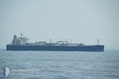
MAPLE GAS
Tanker
Current Trip
| Time Travelled | 3 days |
|---|---|
| Remaining Time | --- |
| Distance Travelled | 797.94 nm |
| Remaining Distance | --- |
| AVG Speed | 14.5 Noeuds |
| MAX Speed | 16.8 Noeuds |
| AVG Wind | 8.9 knots |
| MAX Wind | 17 knots |
| MIN Temp | 10.2°C / 50.36°F |
| MAX Temp | 20.2°C / 68.36°F |
| Tirant d eau | 8.4 m |
| Position reçue | 50 m depuis |
Current Position
| Longitude | 135.54547° |
|---|---|
| Latitude | 37.56165° |
| Etat | Under way using engine |
| Vitesse | 16.2 Noeuds |
| Parcours | 243° |
| Zone | Japan Sea |
| Station | T-AIS |
| Position reçue | 50 m depuis |
Info
Information
The current position of MAPLE GAS is in Japan Sea with coordinates 37.56165° / 135.54547° as reported on 2024-05-22 11:02 by AIS to our vessel tracker app. The vessel's current speed is 16.2 Noeuds and is heading at the port of YEOSU. The estimated time of arrival as calculated by MyShipTracking vessel tracking app is 2024-05-23 19:00 LT
The vessel MAPLE GAS (IMO: 9800491, MMSI: 431648000) is a Tanker It's sailing under the flag of [JP] Japan.
In this page you can find informations about the vessels current position, last detected port calls, and current voyage information. If the vessels is not in coverage by AIS you will find the latest position.
The current position of MAPLE GAS is detected by our AIS receivers and we are not responsible for the reliability of the data. The last position was recorded while the vessel was in Coverage by the Ais receivers of our vessel tracking app.
The current draught of MAPLE GAS as reported by AIS is 8.4 meters
Weather
| Temperature | 16.1°C / 60.98°F |
|---|---|
| Wind Speed | 5 knots |
| Direction | 181° S |
| Pressure | 1015.1 hPa |
| Humidity | 78.4 % |
| Cloud Coverage | 46 % |
Featured Company
Most Visited Ports (Last year)
| Port | Arrivals | |
|---|---|---|
| 4 | ||
| 3 | ||
| 2 | ||
| 2 | ||
| 2 | ||
| 1 |
Last Trips
| Origin | Departure | Destination | Arrival | Distance | |
|---|---|---|---|---|---|
| 2024-04-16 07:43 | 2024-05-18 10:02 | 8041.16 nm | |||
| 2024-01-28 09:26 | 2024-03-03 11:13 | 6659.63 nm |
Events
| Heure | Evenement | Détails | Position/ Destination | Info |
|---|---|---|---|---|
| 2024-05-22 11:06 | Etat Changé | Default Under way using engine |
37.55226 / 135.52254
KR YOS
|
Vitesse: 16.2 kn Parcours: 243° |
| 2024-05-22 10:07 | Etat Changé | Under way using engine Default |
37.67889 / 135.82199
KR YOS
|
Vitesse: 16 kn Parcours: 242° |
| 2024-05-22 09:59 | Etat Changé | Default Under way using engine |
37.69440 / 135.85928
KR YOS
|
Vitesse: 16 kn Parcours: 241.5° |
| 2024-05-22 09:35 | Etat Changé | Under way using engine Default |
37.74579 / 135.97866
KR YOS
|
Vitesse: 15.8 kn Parcours: 242° |
| 2024-05-22 09:33 | Dans la zone couverte |
37.73907 / 135.96296
Japan Sea
KR YOS
|
Vitesse: 15.9 kn Parcours: 241.3° |
|
| 2024-05-22 07:40 | Etat Changé | Default Under way using engine |
37.91927 / 136.59492
KR YOS
|
Vitesse: 16.3 kn Parcours: 253.4° |
| 2024-05-22 07:36 | Hors de la zone couverte |
37.92444 / 136.61687
Japan Sea
KR YOS
|
Vitesse: 16.3 kn Parcours: 253.4° |
|
| 2024-05-22 04:43 | Etat Changé | Under way using engine Default |
37.97781 / 137.58493
KR YOS
|
Vitesse: 16.7 kn Parcours: 4° |
| 2024-05-22 04:13 | Etat Changé | Default Under way using engine |
37.83858 / 137.57194
KR YOS
|
Vitesse: 16.2 kn Parcours: 4.5° |
| 2024-05-22 03:45 | Etat Changé | Under way using engine Default |
37.71505 / 137.55957
KR YOS
|
Vitesse: 16.6 kn Parcours: 5° |