
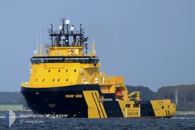
MAGNE VIKING
Anchor Handling Vessel
Current Trip
| Time Travelled | 5 days |
|---|---|
| Remaining Time | 1 day |
| Distance Travelled | 304.91 nm |
| Remaining Distance | 157.54 nm |
| AVG Speed | 6.3 Noeuds |
| MAX Speed | 10.1 Noeuds |
| AVG Wind | 7.9 knots |
| MAX Wind | 12 knots |
| MIN Temp | 7.7°C / 45.86°F |
| MAX Temp | 17.7°C / 63.86°F |
| Tirant d eau | 6.6 m |
| Position reçue | Maintenant |
Current Position
| Longitude | 3.85859° |
|---|---|
| Latitude | 58.00965° |
| Etat | Restricted manoeuverability |
| Vitesse | 5.3 Noeuds |
| Parcours | 9.1° |
| Zone | North Sea |
| Station | T-AIS |
| Position reçue | Maintenant |
Info
Information
The current position of MAGNE VIKING is in North Sea with coordinates 58.00965° / 3.85859° as reported on 2024-05-12 06:48 by AIS to our vessel tracker app. The vessel's current speed is 5.3 Noeuds and is heading at the port of HANOYTANGEN. The estimated time of arrival as calculated by MyShipTracking vessel tracking app is 2024-05-13 13:03 LT
The vessel MAGNE VIKING (IMO: 9423839, MMSI: 257061000) is a Anchor Handling Vessel that was built in 2011 ( 13 Age ). It's sailing under the flag of [NO] Norway.
In this page you can find informations about the vessels current position, last detected port calls, and current voyage information. If the vessels is not in coverage by AIS you will find the latest position.
The current position of MAGNE VIKING is detected by our AIS receivers and we are not responsible for the reliability of the data. The last position was recorded while the vessel was in Coverage by the Ais receivers of our vessel tracking app.
The current draught of MAGNE VIKING as reported by AIS is 6.6 meters
Weather
| Temperature | 9.5°C / 49.1°F |
|---|---|
| Wind Speed | 11 knots |
| Direction | 150° SSE |
| Pressure | 1023 hPa |
| Humidity | 89.9 % |
| Cloud Coverage | 37 % |
Featured Company
Last Trips
Events
| Heure | Evenement | Détails | Position/ Destination | Info |
|---|---|---|---|---|
| 2024-05-11 15:04 | Changement d'ETA | 2024/05/14 04:00 2024/05/13 18:00 |
56.69911 / 3.39429
HANOYTANGEN
|
Vitesse: 4.7 kn Parcours: 8° |
| 2024-05-11 13:49 | Etat Changé | Restricted manoeuverability Default |
56.60258 / 3.36081
HANOYTANGEN
|
Vitesse: 4.9 kn Parcours: 6° |
| 2024-05-11 13:48 | Etat Changé | Default Restricted manoeuverability |
56.60107 / 3.36031
HANOYTANGEN
|
Vitesse: 4.8 kn Parcours: 5° |
| 2024-05-11 11:09 | Démarrage |
56.41956 / 3.29780
HANOYTANGEN
|
Vitesse: 3.1 kn Parcours: 351° |
|
| 2024-05-11 07:31 | Etat Changé | Restricted manoeuverability Default |
56.37152 / 3.26570
HANOYTANGEN
|
Vitesse: Parcours: 115° |
| 2024-05-11 07:22 | Etat Changé | Default Restricted manoeuverability |
56.37152 / 3.26569
HANOYTANGEN
|
Vitesse: Parcours: 115° |
| 2024-05-11 05:12 | Changement d'ETA | 2024/05/13 18:00 2024/05/10 18:00 |
56.37152 / 3.26569
HANOYTANGEN
|
Vitesse: Parcours: 115° |
| 2024-05-11 05:06 | Changement de destination | HANOYTANGEN ELDFISK |
56.37153 / 3.26567
HANOYTANGEN
|
Vitesse: Parcours: 115° |
| 2024-05-11 05:05 | Etat Changé | Restricted manoeuverability Under way using engine |
56.37153 / 3.26567
ELDFISK
|
Vitesse: Parcours: 114° |
| 2024-05-11 04:37 | Arret |
56.37194 / 3.26411
ELDFISK
|
Vitesse: 0.3 kn Parcours: 107° |