
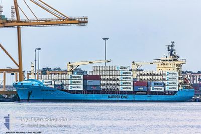
MAERSK ROUBAIX
General Cargo
Current Trip
| Time Travelled | 17 days |
|---|---|
| Remaining Time | --- |
| Distance Travelled | 1954.77 nm |
| Remaining Distance | --- |
| AVG Speed | 11.5 Noeuds |
| MAX Speed | 16.4 Noeuds |
| AVG Wind | 12.3 knots |
| MAX Wind | 29 knots |
| MIN Temp | 7.7°C / 45.86°F |
| MAX Temp | 29.2°C / 84.56°F |
| Tirant d eau | 8.5 m |
| Position reçue | 9 d depuis |
Current Position
| Longitude | --- |
|---|---|
| Latitude | --- |
| Etat | Under way using engine |
| Vitesse | 14.4 Noeuds |
| Parcours | 220.8° |
| Zone | North Atlantic Ocean |
| Station | T-AIS |
| Position reçue | 9 d depuis |
Info
Information
The current position of MAERSK ROUBAIX is in North Atlantic Ocean with coordinates 26.78008° / -14.70158° as reported on 2025-02-07 20:14 by AIS to our vessel tracker app. The vessel's current speed is 14.4 Noeuds
The vessel MAERSK ROUBAIX (IMO: 9332688, MMSI: 477143100) is a General Cargo that was built in 2006 ( 19 Age ). It's sailing under the flag of [HK] Hong Kong.
In this page you can find informations about the vessels current position, last detected port calls, and current voyage information. If the vessels is not in coverage by AIS you will find the latest position.
The current position of MAERSK ROUBAIX is detected by our AIS receivers and we are not responsible for the reliability of the data. The last position was recorded while the vessel was in Coverage by the Ais receivers of our vessel tracking app.
The current draught of MAERSK ROUBAIX as reported by AIS is 8.5 meters
Weather
| Temperature | 21.5°C / 70.7°F |
|---|---|
| Wind Speed | 14 knots |
| Direction | 297° WNW |
| Pressure | 1008.4 hPa |
| Humidity | 65.9 % |
| Cloud Coverage | 15 % |
Featured Company
Last Port Calls
| Port | Arrival | Departure | Time In Port |
|---|---|---|---|
| 2025-01-24 11:51 | 2025-01-31 18:04 | 7 d | |
| 2025-01-16 06:15 | 2025-01-17 01:52 | 19 h | |
| 2025-01-02 20:33 | 2025-01-06 18:47 | 3 d | |
| 2024-12-02 10:18 | 2024-12-08 07:29 | 5 d |
Events
| Heure | Evenement | Détails | Position/ Destination | Info |
|---|---|---|---|---|
| 2025-02-10 10:00 | Arret | 4.18 nm, North of BANJUL |
13.51613 / -16.57596
GMBJL
|
Vitesse: 0.3 kn Parcours: 323° |
| 2025-02-07 20:18 | Etat Changé | Default Under way using engine |
26.76606 / -14.71574
GMBJL
|
Vitesse: 14.4 kn Parcours: 220.8° |
| 2025-02-07 20:14 | Hors de la zone couverte |
26.78008 / -14.70158
North Atlantic Ocean
GMBJL
|
Vitesse: 14.4 kn Parcours: 220.8° |