
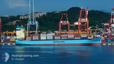
MAERSK PORT KLANG
Cargo
Current Trip
| Time Travelled | 5 days |
|---|---|
| Remaining Time | --- |
| Distance Travelled | 18.25 nm |
| Remaining Distance | --- |
| AVG Speed | 8.7 Noeuds |
| MAX Speed | 15.4 Noeuds |
| AVG Wind | 8.6 knots |
| MAX Wind | 11 knots |
| MIN Temp | 25.7°C / 78.26°F |
| MAX Temp | 28.3°C / 82.94°F |
| Tirant d eau | 10.2 m |
| Position reçue | 5 d depuis |
Current Position
| Longitude | --- |
|---|---|
| Latitude | --- |
| Etat | Under way using engine |
| Vitesse | 15.4 Noeuds |
| Parcours | 80.2° |
| Zone | Singapore Strait |
| Station | T-AIS |
| Position reçue | 5 d depuis |
Info
Information
The current position of MAERSK PORT KLANG is in Singapore Strait with coordinates 1.24476° / 104.01979° as reported on 2024-12-30 06:43 by AIS to our vessel tracker app. The vessel's current speed is 15.4 Noeuds
The vessel MAERSK PORT KLANG (IMO: 9966130, MMSI: 352003952) is a Cargo It's sailing under the flag of [PA] Panama.
In this page you can find informations about the vessels current position, last detected port calls, and current voyage information. If the vessels is not in coverage by AIS you will find the latest position.
The current position of MAERSK PORT KLANG is detected by our AIS receivers and we are not responsible for the reliability of the data. The last position was recorded while the vessel was in Coverage by the Ais receivers of our vessel tracking app.
The current draught of MAERSK PORT KLANG as reported by AIS is 10.2 meters
Weather
| Temperature | 28.1°C / 82.58°F |
|---|---|
| Wind Speed | 8 knots |
| Direction | 19° NNE |
| Pressure | 1010.7 hPa |
| Humidity | 75.5 % |
| Cloud Coverage | 37 % |
Featured Company
Last Port Calls
| Port | Arrival | Departure | Time In Port |
|---|---|---|---|
| 2024-12-29 03:05 | 2024-12-29 20:10 | 17 h | |
| 2024-12-28 05:29 | 2024-12-28 23:36 | 18 h | |
| 2024-12-15 07:23 | 2024-12-15 22:50 | 15 h | |
| 2024-11-30 18:54 | 2024-12-01 06:11 | 11 h | |
| 2024-11-24 16:04 | 2024-11-25 18:45 | 1 d | |
| 2024-11-14 05:01 | 2024-11-15 23:35 | 1 d | |
| 2024-11-02 17:36 | 2024-11-03 14:06 | 20 h | |
| 2024-11-01 10:29 | 2024-11-02 13:26 | 1 d |
Last Trips
| Origin | Departure | Destination | Arrival | Distance | |
|---|---|---|---|---|---|
| 2024-12-29 07:36 | 2024-12-29 11:05 | 18.39 nm | |||
| 2024-12-16 06:50 | 2024-12-28 13:29 | 1068.31 nm | |||
| 2024-12-01 14:11 | 2024-12-15 15:23 | 2253.49 nm | |||
| 2024-11-26 02:45 | 2024-12-01 02:54 | 1636.69 nm | |||
| 2024-11-16 07:35 | 2024-11-25 00:04 | 2191.15 nm | |||
| 2024-11-03 22:06 | 2024-11-14 13:01 | 1310.21 nm | |||
| 2024-11-02 21:26 | 2024-11-03 01:36 | 23.98 nm | |||
| 2024-10-27 22:52 | 2024-11-01 18:29 | 678.56 nm |
Events
| Heure | Evenement | Détails | Position/ Destination | Info |
|---|---|---|---|---|
| 2024-12-30 06:43 | Hors de la zone couverte |
1.24476 / 104.01979
Singapore Strait
KEELUNG
|
Vitesse: 15.4 kn Parcours: 80.2° |
|
| 2024-12-30 06:21 | Changement de zone | Indonesian part of the Singapore Strait Singaporean part of the Singapore Strait |
1.22509 / 103.92893
Singapore Strait
KEELUNG
|
Vitesse: 14.1 kn Parcours: 75.5° |
| 2024-12-30 05:54 | Démarrage | 1.96 nm, East of SINGAPORE |
1.25069 / 103.88650
KEELUNG
|
Vitesse: 3.3 kn Parcours: 197° |
| 2024-12-30 05:43 | Etat Changé | Under way using engine At anchor |
1.25130 / 103.88859
KEELUNG
|
Vitesse: 0.4 kn Parcours: 229° |
| 2024-12-29 21:42 | Arret | 1.96 nm, East of SINGAPORE |
1.24875 / 103.88601
KEELUNG
|
Vitesse: 0.3 kn Parcours: 67° |
| 2024-12-29 21:33 | Etat Changé | At anchor Under way using engine |
1.24887 / 103.88678
KEELUNG
|
Vitesse: 0.9 kn Parcours: 32° |
| 2024-12-29 20:10 | PORT DE DEPART |
|
1.25929 / 103.77376
KEELUNG
|
Vitesse: 7.1 kn Parcours: 165° |
| 2024-12-29 19:59 | Démarrage |
1.27337 / 103.77720
[SG] SINGAPORE
|
Vitesse: 3.1 kn Parcours: 201° |
|
| 2024-12-29 19:43 | Etat Changé | Under way using engine Moored |
1.27680 / 103.77608
[SG] SINGAPORE
|
Vitesse: Parcours: 32° |
| 2024-12-29 19:14 | Tirant d'eau modifié | 10.2 9 |
1.27679 / 103.77609
[SG] SINGAPORE
|
Vitesse: Parcours: 31° |