
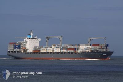
MAERSK NORTHWOOD
Container Ship
Current Trip
| Time Travelled | 14 days |
|---|---|
| Remaining Time | --- |
| Distance Travelled | 5456.18 nm |
| Remaining Distance | 4.18 nm |
| AVG Speed | 16.6 Noeuds |
| MAX Speed | 21.5 Noeuds |
| AVG Wind | 14.2 knots |
| MAX Wind | 34.1 knots |
| MIN Temp | 3.6°C / 38.48°F |
| MAX Temp | 28.1°C / 82.58°F |
| Tirant d eau | 10.2 m |
| Position reçue | 3 d depuis |
Current Position
| Longitude | -79.50272° |
|---|---|
| Latitude | 25.69477° |
| Etat | Under way using engine |
| Vitesse | 16.6 Noeuds |
| Parcours | 188.8° |
| Zone | North Atlantic Ocean |
| Station | T-AIS |
| Position reçue | 3 d depuis |
Info
Information
The current position of MAERSK NORTHWOOD is in North Atlantic Ocean with coordinates 25.69477° / -79.50272° as reported on 2024-04-26 18:30 by AIS to our vessel tracker app. The vessel's current speed is 16.6 Noeuds and is heading at the port of VERACRUZ. The estimated time of arrival as calculated by MyShipTracking vessel tracking app is 2024-04-29 08:00 LT
The vessel MAERSK NORTHWOOD (IMO: 9222118, MMSI: 563433000) is a Container Ship that was built in 2001 ( 23 Age ). It's sailing under the flag of [SG] Singapore.
In this page you can find informations about the vessels current position, last detected port calls, and current voyage information. If the vessels is not in coverage by AIS you will find the latest position.
The current position of MAERSK NORTHWOOD is detected by our AIS receivers and we are not responsible for the reliability of the data. The last position was recorded while the vessel was in Coverage by the Ais receivers of our vessel tracking app.
The current draught of MAERSK NORTHWOOD as reported by AIS is 10.2 meters
Weather
| Temperature | 25.2°C / 77.36°F |
|---|---|
| Wind Speed | 5 knots |
| Direction | 320° NW |
| Pressure | 1009.6 hPa |
| Humidity | 83.5 % |
| Cloud Coverage | 55 % |
Featured Company
Last Port Calls
| Port | Arrival | Departure | Time In Port |
|---|---|---|---|
| 2024-04-08 00:03 | 2024-04-16 04:41 | 8 d | |
| 2024-04-07 02:11 | 2024-04-07 15:45 | 13 h | |
| 2024-04-04 07:01 | 2024-04-05 17:12 | 1 d | |
| 2024-04-02 00:05 | 2024-04-03 10:29 | 1 d | |
| 2024-03-17 03:03 | 2024-03-17 22:03 | 18 h | |
| 2024-03-12 12:50 | 2024-03-15 16:28 | 3 d | |
| 2024-03-09 11:40 | 2024-03-10 07:41 | 20 h | |
| 2024-03-03 21:55 | |||
| 2024-02-13 15:53 | 2024-02-15 05:32 | 1 d | |
| 2024-02-12 08:05 | 2024-02-13 07:03 | 22 h |
Most Visited Ports (Last year)
| Port | Arrivals | |
|---|---|---|
| 5 | ||
| 5 | ||
| 5 | ||
| 5 | ||
| 5 | ||
| 5 |
Last Trips
| Origin | Departure | Destination | Arrival | Distance | |
|---|---|---|---|---|---|
| 2024-04-07 17:45 | 2024-04-08 02:03 | 114.64 nm | |||
| 2024-04-05 19:12 | 2024-04-07 04:11 | 399.06 nm | |||
| 2024-04-03 11:29 | 2024-04-04 09:01 | 264.75 nm | |||
| 2024-03-17 17:03 | 2024-04-02 01:05 | 5213.97 nm | |||
| 2024-03-15 11:28 | 2024-03-16 22:03 | 271.61 nm | |||
| 2024-03-10 02:41 | 2024-03-12 07:50 | 290.50 nm | |||
| 2024-02-15 06:32 | 2024-03-03 15:55 | 6102.30 nm | |||
| 2024-02-13 08:03 | 2024-02-13 16:53 | 119.39 nm | |||
| 2024-02-10 19:50 | 2024-02-12 09:05 | 420.74 nm | |||
| 2024-02-08 21:00 | 2024-02-09 15:09 | 266.53 nm |
Events
| Heure | Evenement | Détails | Position/ Destination | Info |
|---|---|---|---|---|
| 2024-04-30 07:59 | Arret | 3.22 nm, North West of VERACRUZ |
19.23716 / -96.16945
DEBRV - MXVER
|
Vitesse: 0.1 kn Parcours: 351° |
| 2024-04-30 05:48 | Démarrage | 12.44 nm, North of VERACRUZ |
19.40440 / -96.07089
DEBRV - MXVER
|
Vitesse: 6.4 kn Parcours: 214° |
| 2024-04-30 00:55 | Arret | 15.81 nm, North East of VERACRUZ |
19.44057 / -96.00321
DEBRV - MXVER
|
Vitesse: 0.2 kn Parcours: 69° |
| 2024-04-29 22:29 | Démarrage |
19.27574 / -95.70528
DEBRV - MXVER
|
Vitesse: 8.6 kn Parcours: 292° |
|
| 2024-04-29 08:42 | Arret |
19.43936 / -95.59281
DEBRV - MXVER
|
Vitesse: 0.3 kn Parcours: 155° |
|
| 2024-04-26 18:51 | Etat Changé | Default Under way using engine |
25.59465 / -79.52029
DEBRV - MXVER
|
Vitesse: 16.6 kn Parcours: 188.8° |
| 2024-04-26 18:30 | Hors de la zone couverte |
25.69477 / -79.50272
North Atlantic Ocean
DEBRV - MXVER
|
Vitesse: 16.6 kn Parcours: 188.8° |
|
| 2024-04-26 18:26 | Detecté en mer | Bahamas part of the North Atlantic Ocean |
25.70851 / -79.50042
North Atlantic Ocean
DEBRV - MXVER
|
Vitesse: 16.6 kn Parcours: 188.5° |
| 2024-04-26 18:26 | Etat Changé | Under way using engine Default |
25.70851 / -79.50042
DEBRV - MXVER
|
Vitesse: 16.5 kn Parcours: 189° |
| 2024-04-26 18:09 | Dans la zone couverte |
25.70851 / -79.50042
North Atlantic Ocean
DEBRV - MXVER
|
Vitesse: 16.6 kn Parcours: 188.5° |