
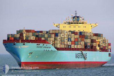
MAERSK KENSINGTON
Container Ship
Current Trip
| Time Travelled | 1 day |
|---|---|
| Remaining Time | 6 days |
| Distance Travelled | 412.95 nm |
| Remaining Distance | 2796.55 nm |
| AVG Speed | 14.9 Noeuds |
| MAX Speed | 19 Noeuds |
| AVG Wind | 12.5 knots |
| MAX Wind | 20 knots |
| MIN Temp | 15.6°C / 60.08°F |
| MAX Temp | 18.9°C / 66.02°F |
| Tirant d eau | 13.9 m |
| Position reçue | 8 h, 8 m depuis |
Current Position
| Longitude | -10.67143° |
|---|---|
| Latitude | 36.42177° |
| Etat | Under way using engine |
| Vitesse | 17.6 Noeuds |
| Parcours | 291.4° |
| Zone | North Atlantic Ocean |
| Station | T-AIS |
| Position reçue | 8 h, 8 m depuis |
Info
Information
The current position of MAERSK KENSINGTON is in North Atlantic Ocean with coordinates 36.42177° / -10.67143° as reported on 2024-05-07 00:54 by AIS to our vessel tracker app. The vessel's current speed is 17.6 Noeuds and is heading at the port of NEW YORK. The estimated time of arrival as calculated by MyShipTracking vessel tracking app is 2024-05-13 16:59 LT
The vessel MAERSK KENSINGTON (IMO: 9333010, MMSI: 303657000) is a Container Ship that was built in 2007 ( 17 Age ). It's sailing under the flag of [US] USA.
In this page you can find informations about the vessels current position, last detected port calls, and current voyage information. If the vessels is not in coverage by AIS you will find the latest position.
The current position of MAERSK KENSINGTON is detected by our AIS receivers and we are not responsible for the reliability of the data. The last position was recorded while the vessel was in Coverage by the Ais receivers of our vessel tracking app.
The current draught of MAERSK KENSINGTON as reported by AIS is 13.9 meters
Weather
| Temperature | 15.7°C / 60.26°F |
|---|---|
| Wind Speed | 13 knots |
| Direction | 71° ENE |
| Pressure | 1021.5 hPa |
| Humidity | 73.9 % |
| Cloud Coverage | 100 % |
Featured Company
Last Port Calls
| Port | Arrival | Departure | Time In Port |
|---|---|---|---|
| 2024-05-05 11:41 | 2024-05-06 08:36 | 20 h | |
| 2024-04-10 04:52 | 2024-04-11 03:47 | 22 h | |
| 2024-04-06 04:05 | 2024-04-06 19:23 | 15 h | |
| 2024-04-04 23:23 | 2024-04-05 07:44 | 8 h | |
| 2024-04-02 03:35 | 2024-04-03 09:16 | 1 d | |
| 2024-03-30 09:40 | 2024-03-31 08:25 | 22 h | |
| 2024-03-26 09:17 | 2024-03-26 20:10 | 10 h | |
| 2024-03-03 00:29 | 2024-03-03 16:49 | 16 h |
Most Visited Ports (Last year)
| Port | Arrivals | |
|---|---|---|
| 9 | ||
| 9 | ||
| 8 | ||
| 7 | ||
| 5 | ||
| 5 |
Last Trips
| Origin | Departure | Destination | Arrival | Distance | |
|---|---|---|---|---|---|
| 2024-04-11 07:47 | 2024-05-05 13:41 | 9936.18 nm | |||
| 2024-04-07 00:53 | 2024-04-10 08:52 | 1094.24 nm | |||
| 2024-04-05 13:14 | 2024-04-06 09:35 | 256.96 nm | |||
| 2024-04-03 14:16 | 2024-04-05 04:53 | 476.57 nm | |||
| 2024-03-31 12:25 | 2024-04-02 08:35 | 832.25 nm | |||
| 2024-03-27 00:10 | 2024-03-30 13:40 | 1085.36 nm | |||
| 2024-03-03 17:49 | 2024-03-26 13:17 | 9861.75 nm | |||
| 2024-02-22 02:39 | 2024-03-03 01:29 | 3233.41 nm |
Events
| Heure | Evenement | Détails | Position/ Destination | Info |
|---|---|---|---|---|
| 2024-05-07 00:58 | Etat Changé | Default Under way using engine |
36.43038 / -10.69861
ESALR > USNWK
|
Vitesse: 17.6 kn Parcours: 291.4° |
| 2024-05-07 00:54 | Hors de la zone couverte |
36.42177 / -10.67143
North Atlantic Ocean
ESALR > USNWK
|
Vitesse: 17.6 kn Parcours: 291.4° |
|
| 2024-05-07 00:40 | Etat Changé | Under way using engine Default |
36.39761 / -10.59565
ESALR > USNWK
|
Vitesse: 18 kn Parcours: 291° |
| 2024-05-07 00:37 | Etat Changé | Default Under way using engine |
36.39167 / -10.57833
ESALR > USNWK
|
Vitesse: 17.7 kn Parcours: 291.7° |
| 2024-05-06 23:39 | Etat Changé | Under way using engine Default |
36.28267 / -10.25115
ESALR > USNWK
|
Vitesse: 17.9 kn Parcours: 293° |
| 2024-05-06 23:32 | Etat Changé | Default Under way using engine |
36.26919 / -10.21129
ESALR > USNWK
|
Vitesse: 17.8 kn Parcours: 292.5° |
| 2024-05-06 22:57 | Etat Changé | Under way using engine Default |
36.20294 / -10.01334
ESALR > USNWK
|
Vitesse: 17.9 kn Parcours: 293° |
| 2024-05-06 22:12 | Etat Changé | Default Under way using engine |
36.11464 / -9.75859
ESALR > USNWK
|
Vitesse: 17.9 kn Parcours: 291.4° |
| 2024-05-06 22:07 | Etat Changé | Under way using engine Default |
36.10499 / -9.72887
ESALR > USNWK
|
Vitesse: 18 kn Parcours: 288° |
| 2024-05-06 21:18 | Etat Changé | Default Under way using engine |
36.08719 / -9.42660
ESALR > USNWK
|
Vitesse: 18 kn Parcours: 272.8° |