
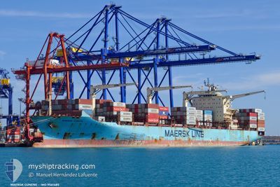
MAERSK CUNENE
Container Ship
Current Trip
| Time Travelled | 2 days |
|---|---|
| Remaining Time | 2 days |
| Distance Travelled | 817.39 nm |
| Remaining Distance | 1118.96 nm |
| AVG Speed | 16.8 Noeuds |
| MAX Speed | 20.3 Noeuds |
| AVG Wind | 10.7 knots |
| MAX Wind | 17.7 knots |
| MIN Temp | 17.6°C / 63.68°F |
| MAX Temp | 20.2°C / 68.36°F |
| Tirant d eau | 10.1 m |
| Position reçue | 53 m depuis |
Current Position
| Longitude | 11.21386° |
|---|---|
| Latitude | 37.35797° |
| Etat | Under way using engine |
| Vitesse | 18 Noeuds |
| Parcours | 119.8° |
| Zone | Mediterranean Sea - Western Basin |
| Station | T-AIS |
| Position reçue | 53 m depuis |
Info
Information
The current position of MAERSK CUNENE is in Mediterranean Sea - Western Basin with coordinates 37.35797° / 11.21386° as reported on 2024-05-13 15:53 by AIS to our vessel tracker app. The vessel's current speed is 18 Noeuds and is heading at the port of PORT SAID. The estimated time of arrival as calculated by MyShipTracking vessel tracking app is 2024-05-16 07:35 LT
The vessel MAERSK CUNENE (IMO: 9561485, MMSI: 566158000) is a Container Ship that was built in 2011 ( 13 Age ). It's sailing under the flag of [SG] Singapore.
In this page you can find informations about the vessels current position, last detected port calls, and current voyage information. If the vessels is not in coverage by AIS you will find the latest position.
The current position of MAERSK CUNENE is detected by our AIS receivers and we are not responsible for the reliability of the data. The last position was recorded while the vessel was in Coverage by the Ais receivers of our vessel tracking app.
The current draught of MAERSK CUNENE as reported by AIS is 10.1 meters
Weather
| Temperature | 18.7°C / 65.66°F |
|---|---|
| Wind Speed | 15 knots |
| Direction | 91° E |
| Pressure | 1010.7 hPa |
| Humidity | 91.6 % |
| Cloud Coverage | 22 % |
Featured Company
Last Port Calls
| Port | Arrival | Departure | Time In Port |
|---|---|---|---|
| 2024-05-11 06:45 | 2024-05-11 16:21 | 9 h | |
| 2024-05-09 23:09 | 2024-05-10 18:10 | 19 h | |
| 2024-04-27 15:12 | 2024-05-01 01:36 | 3 d | |
| 2024-04-10 07:25 | 2024-04-11 05:42 | 22 h | |
| 2024-04-08 11:44 | 2024-04-09 05:25 | 17 h | |
| 2024-04-01 16:15 | 2024-04-02 14:07 | 21 h | |
| 2024-03-21 08:46 | 2024-03-24 18:13 | 3 d | |
| 2024-03-03 12:56 | 2024-03-04 06:57 | 18 h | |
| 2024-03-01 21:06 | 2024-03-02 16:34 | 19 h | |
| 2024-03-01 18:11 |
Last Trips
| Origin | Departure | Destination | Arrival | Distance | |
|---|---|---|---|---|---|
| 2024-05-10 19:10 | 2024-05-11 08:45 | 59.40 nm | |||
| 2024-05-01 02:36 | 2024-05-10 00:09 | 3162.95 nm | |||
| 2024-04-11 07:42 | 2024-04-27 16:12 | 3281.50 nm | |||
| 2024-04-09 05:25 | 2024-04-10 09:25 | 86.36 nm | |||
| 2024-04-02 15:07 | 2024-04-08 11:44 | 927.06 nm | |||
| 2024-03-24 19:13 | 2024-04-01 17:15 | 2535.08 nm | |||
| 2024-03-04 07:57 | 2024-03-21 09:46 | 3258.81 nm | |||
| 2024-03-02 17:34 | 2024-03-03 13:56 | 32.97 nm | |||
| 2024-03-01 19:11 | 2024-03-01 22:06 | 20.66 nm |
Events
| Heure | Evenement | Détails | Position/ Destination | Info |
|---|---|---|---|---|
| 2024-05-13 15:55 | Etat Changé | Default Under way using engine |
37.35415 / 11.22216
ES ALR>EG PSD
|
Vitesse: 18 kn Parcours: 119.8° |
| 2024-05-13 15:45 | Etat Changé | Under way using engine Default |
37.37655 / 11.17138
ES ALR>EG PSD
|
Vitesse: 18 kn Parcours: 118° |
| 2024-05-13 15:45 | Dans la zone couverte |
37.37445 / 11.17640
Mediterranean Sea - Western Basin
ES ALR>EG PSD
|
Vitesse: 18 kn Parcours: 117.6° |
|
| 2024-05-13 10:47 | Etat Changé | Default Under way using engine |
37.51147 / 9.38654
ES ALR>EG PSD
|
Vitesse: 16.9 kn Parcours: 70.1° |
| 2024-05-13 10:36 | Hors de la zone couverte |
37.49393 / 9.32565
Mediterranean Sea - Western Basin
ES ALR>EG PSD
|
Vitesse: 16.9 kn Parcours: 70.1° |
|
| 2024-05-13 10:36 | Etat Changé | Under way using engine Default |
37.49316 / 9.32296
ES ALR>EG PSD
|
Vitesse: 16.9 kn Parcours: 70° |
| 2024-05-13 10:18 | Dans la zone couverte |
37.49393 / 9.32565
Mediterranean Sea - Western Basin
ES ALR>EG PSD
|
Vitesse: 16.9 kn Parcours: 70.1° |
|
| 2024-05-13 08:50 | Etat Changé | Default Under way using engine |
37.31890 / 8.73142
ES ALR>EG PSD
|
Vitesse: 17.3 kn Parcours: 72.5° |
| 2024-05-13 08:46 | Changement de zone | Tunisian part of the Mediterranean Sea - Western Basin Algerian part of the Mediterranean Sea - Western Basin |
37.31369 / 8.71056
Mediterranean Sea - Western Basin
ES ALR>EG PSD
|
Vitesse: 17.3 kn Parcours: 72.5° |
| 2024-05-13 08:46 | Hors de la zone couverte |
37.31369 / 8.71056
Mediterranean Sea - Western Basin
ES ALR>EG PSD
|
Vitesse: 17.3 kn Parcours: 72.5° |