

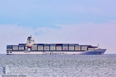
MAERSK BENGUELA
Container Ship

Current Trip
| Time Travelled | 3 days |
|---|---|
| Remaining Time | 3 days |
| Distance Travelled | 614.70 nm |
| Remaining Distance | 1145.24 nm |
| AVG Speed | 12 Noeuds |
| MAX Speed | 18 Noeuds |
| AVG Wind | 11.6 knots |
| MAX Wind | 22 knots |
| MIN Temp | -0.7°C / 30.74°F |
| MAX Temp | 8.6°C / 47.48°F |
| Tirant d eau | 12 m |
| Position reçue | Maintenant |
Current Position
| Longitude | --- |
|---|---|
| Latitude | --- |
| Etat | Under way using engine |
| Vitesse | 13.9 Noeuds |
| Parcours | 254.4° |
| Zone | English Channel |
| Station | T-AIS |
| Position reçue | Maintenant |
Information
The current position of MAERSK BENGUELA is in English Channel with coordinates 50.14737° / -1.97933° as reported on 2025-02-18 19:16 by AIS to our vessel tracker app. The vessel's current speed is 13.9 Noeuds and is heading at the port of TANGER MED. The estimated time of arrival as calculated by MyShipTracking vessel tracking app is 2025-02-22 01:44 LT
The vessel MAERSK BENGUELA (IMO: 9355367, MMSI: 477552400) is a Container Ship that was built in 2009 ( 16 Age ). It's sailing under the flag of [HK] Hong Kong.
In this page you can find informations about the vessels current position, last detected port calls, and current voyage information. If the vessels is not in coverage by AIS you will find the latest position.
The current position of MAERSK BENGUELA is detected by our AIS receivers and we are not responsible for the reliability of the data. The last position was recorded while the vessel was in Coverage by the Ais receivers of our vessel tracking app.
The current draught of MAERSK BENGUELA as reported by AIS is 12 meters
Weather
| Temperature | 8.6°C / 47.48°F |
|---|---|
| Wind Speed | 22 knots |
| Direction | 113° ESE |
| Pressure | 1014.6 hPa |
| Humidity | 73.3 % |
| Cloud Coverage | 100 % |


Featured Company
Last Port Calls
| Port | Arrival | Departure | Time In Port |
|---|---|---|---|
| 2025-02-14 13:49 | 2025-02-15 14:00 | 1 d | |
| 2025-02-09 23:31 | 2025-02-13 13:30 | 3 d | |
| 2025-02-08 14:38 | 2025-02-09 11:09 | 20 h | |
| 2025-01-27 12:22 | 2025-01-28 02:14 | 13 h | |
| 2025-01-25 19:08 | 2025-01-26 04:45 | 9 h | |
| 2025-01-24 05:35 | 2025-01-25 06:26 | 1 d | |
| 2025-01-21 03:58 | 2025-01-21 19:02 | 15 h | |
| 2025-01-15 06:01 | 2025-01-17 00:19 | 1 d | |
| 2025-01-10 15:54 | 2025-01-11 19:50 | 1 d | |
| 2025-01-10 05:46 | 2025-01-10 07:02 | 1 h |
Most Visited Ports (Last year)
| Port | Arrivals | |
|---|---|---|
| 13 | ||
| 12 | ||
| 10 | ||
| 9 | ||
| 7 | ||
| 7 |
Last Trips
| Origin | Departure | Destination | Arrival | Distance | |
|---|---|---|---|---|---|
| 2025-02-13 13:30 | 2025-02-14 13:49 | 324.27 nm | |||
| 2025-02-09 11:09 | 2025-02-09 23:31 | 131.75 nm | |||
| 2025-01-28 02:14 | 2025-02-08 14:38 | 4552.03 nm | |||
| 2025-01-26 04:45 | 2025-01-27 12:22 | 363.14 nm | |||
| 2025-01-25 06:26 | 2025-01-25 19:08 | 49.33 nm | |||
| 2025-01-21 19:02 | 2025-01-24 05:35 | 797.31 nm | |||
| 2025-01-17 00:19 | 2025-01-21 03:58 | 1931.04 nm | |||
| 2025-01-11 19:50 | 2025-01-15 06:01 | 1303.22 nm | |||
| 2025-01-10 07:02 | 2025-01-10 15:54 | 39.74 nm | |||
| 2025-01-07 00:19 | 2025-01-10 05:46 | 1357.47 nm |
Events
| Heure | Evenement | Détails | Position/ Destination | Info |
|---|---|---|---|---|
| 2025-02-18 19:16 | Etat Changé | Under way using engine Default |
50.14737 / -1.97933
DEHAM>>MAPTM
|
Vitesse: 13.8 kn Parcours: 254° |
| 2025-02-18 19:15 | Etat Changé | Default Under way using engine |
50.14791 / -1.97641
DEHAM>>MAPTM
|
Vitesse: 14 kn Parcours: 254.6° |
| 2025-02-18 19:10 | Changement de zone | French part of the English Channel United Kingdom part of the English Channel |
50.15355 / -1.94542
English Channel
DEHAM>>MAPTM
|
Vitesse: 14 kn Parcours: 253.2° |
| 2025-02-18 18:28 | Etat Changé | Under way using engine Default |
50.19876 / -1.69353
DEHAM>>MAPTM
|
Vitesse: 14.7 kn Parcours: 255° |
| 2025-02-18 18:28 | Dans la zone couverte |
50.19854 / -1.69476
English Channel
DEHAM>>MAPTM
|
Vitesse: 14.8 kn Parcours: 255.1° |
|
| 2025-02-18 17:27 | Etat Changé | Default Under way using engine |
50.26540 / -1.30939
DEHAM>>MAPTM
|
Vitesse: 15.2 kn Parcours: 255.6° |
| 2025-02-18 17:22 | Hors de la zone couverte |
50.27136 / -1.27445
English Channel
DEHAM>>MAPTM
|
Vitesse: 15.2 kn Parcours: 255.6° |
|
| 2025-02-18 17:20 | Etat Changé | Under way using engine Default |
50.27322 / -1.26343
DEHAM>>MAPTM
|
Vitesse: 15.5 kn Parcours: 255° |
| 2025-02-18 17:19 | Etat Changé | Default Under way using engine |
50.27412 / -1.25825
DEHAM>>MAPTM
|
Vitesse: 15.4 kn Parcours: 255.9° |
| 2025-02-18 17:09 | Etat Changé | Under way using engine Default |
50.28574 / -1.19177
DEHAM>>MAPTM
|
Vitesse: 15.4 kn Parcours: 253° |