
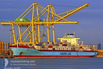
LOUIS MAERSK
Not available
Current Trip
LAST UPDATE TIME
| Time Travelled | 10 days |
|---|---|
| Remaining Time | --- |
| Distance Travelled | 3360.38 nm |
| Remaining Distance | --- |
| AVG Speed | 13.3 Noeuds |
| MAX Speed | 17.3 Noeuds |
| AVG Wind | 10.5 knots |
| MAX Wind | 17 knots |
| MIN Temp | 21.3°C / 70.34°F |
| MAX Temp | 28.8°C / 83.84°F |
| Tirant d eau | 13 m |
| Position reçue | 8 d depuis |
Current Position
| Longitude | --- |
|---|---|
| Latitude | --- |
| Etat | Under way using engine |
| Vitesse | 17 Noeuds |
| Parcours | 254° |
| Zone | North Atlantic Ocean |
| Station | T-AIS |
| Position reçue | 8 d depuis |
Info
Information
The current position of LOUIS MAERSK is in North Atlantic Ocean with coordinates 33.49670° / -17.11000° as reported on 2024-09-28 08:41 by AIS to our vessel tracker app. The vessel's current speed is 17 Noeuds
The vessel LOUIS MAERSK (MMSI: 477664600) is a Not available It's sailing under the flag of [HK] Hong Kong.
In this page you can find informations about the vessels current position, last detected port calls, and current voyage information. If the vessels is not in coverage by AIS you will find the latest position.
The current position of LOUIS MAERSK is detected by our AIS receivers and we are not responsible for the reliability of the data. The last position was recorded while the vessel was in Coverage by the Ais receivers of our vessel tracking app.
The current draught of LOUIS MAERSK as reported by AIS is 13 meters
Weather
| Temperature | 28.6°C / 83.48°F |
|---|---|
| Wind Speed | 3 knots |
| Direction | 100° E |
| Pressure | 1011.9 hPa |
| Humidity | 68.8 % |
| Cloud Coverage | 14 % |
Featured Company
Last Port Calls
| Port | Arrival | Departure | Time In Port |
|---|---|---|---|
| 2024-09-25 12:06 | 2024-09-26 08:48 | 20 h | |
| 2024-09-24 18:14 | 2024-09-25 11:57 | 17 h | |
| 2024-09-21 20:26 | 2024-09-22 03:45 | 7 h | |
| 2024-09-16 21:02 | 2024-09-17 13:03 | 16 h | |
| 2024-09-14 23:23 | 2024-09-16 15:32 | 1 d | |
| 2024-09-12 12:34 | 2024-09-13 00:27 | 11 h | |
| 2024-09-10 11:47 | 2024-09-11 09:07 | 21 h | |
| 2024-09-08 21:47 | 2024-09-09 14:44 | 16 h | |
| 2024-09-04 14:25 | 2024-09-05 09:54 | 19 h | |
| 2024-09-03 17:53 | 2024-09-04 12:11 | 18 h |
Most Visited Ports (Last year)
| Port | Arrivals | |
|---|---|---|
| 13 | ||
| 11 | ||
| 10 | ||
| 9 | ||
| 6 | ||
| 6 |
Last Trips
| Origin | Departure | Destination | Arrival | Distance | |
|---|---|---|---|---|---|
| 2024-09-25 13:57 | 2024-09-25 14:06 | 2.07 nm | |||
| 2024-09-22 05:45 | 2024-09-24 20:14 | 155.07 nm | |||
| 2024-09-17 16:03 | 2024-09-21 22:26 | 1820.64 nm | |||
| 2024-09-16 18:32 | 2024-09-17 00:02 | 60.78 nm | |||
| 2024-09-13 03:27 | 2024-09-15 02:23 | 76.61 nm | |||
| 2024-09-11 12:07 | 2024-09-12 15:34 | 371.93 nm | |||
| 2024-09-09 17:44 | 2024-09-10 14:47 | 283.41 nm | |||
| 2024-09-05 11:54 | 2024-09-09 00:47 | 1530.91 nm | |||
| 2024-09-04 13:11 | 2024-09-04 16:25 | 19.53 nm | |||
| 2024-08-24 12:22 | 2024-09-03 18:53 | 4349.96 nm |
Events
| Heure | Evenement | Détails | Position/ Destination | Info |
|---|---|---|---|---|
| 2024-09-28 08:47 | Etat Changé | Default Under way using engine |
33.48820 / -17.16429
LAST UPDATE TIME
|
Vitesse: 17 kn Parcours: 254° |
| 2024-09-28 08:41 | Hors de la zone couverte |
33.49670 / -17.11000
North Atlantic Ocean
|
Vitesse: 17 kn Parcours: 254° |
|
| 2024-09-28 08:31 | Etat Changé | Under way using engine Default |
33.50670 / -17.06170
LAST UPDATE TIME
|
Vitesse: 16.4 kn Parcours: 256° |
| 2024-09-28 08:23 | Etat Changé | Default Under way using engine |
33.51281 / -17.03710
LAST UPDATE TIME
|
Vitesse: 13.9 kn Parcours: 254° |
| 2024-09-28 07:54 | Changement de zone | Portuguese (Madeira) part of the North Atlantic Ocean Spanish part of the North Atlantic Ocean |
33.54670 / -16.89000
North Atlantic Ocean
|
Vitesse: 13 kn Parcours: 255° |
| 2024-09-28 07:54 | Etat Changé | Under way using engine Default |
33.54670 / -16.89000
LAST UPDATE TIME
|
Vitesse: 13 kn Parcours: 255° |
| 2024-09-28 07:54 | Dans la zone couverte |
33.54670 / -16.89000
North Atlantic Ocean
|
Vitesse: 13 kn Parcours: 255° |
|
| 2024-09-28 07:48 | Changement de destination | LAST UPDATE TIME ESALRLB > PA MIT |
33.55031 / -16.87058
LAST UPDATE TIME
|
Vitesse: 13 kn Parcours: 253° |