
LNG IMO
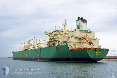
Lng Tanker
Current Trip
| Time Travelled | 35 days |
|---|---|
| Remaining Time | 8 days |
| Distance Travelled | 7123.81 nm |
| Remaining Distance | 1748.39 nm |
| AVG Speed | 9.4 Noeuds |
| MAX Speed | 21.2 Noeuds |
| AVG Wind | 14 knots |
| MAX Wind | 31.9 knots |
| MIN Temp | 13.3°C / 55.94°F |
| MAX Temp | 30.2°C / 86.36°F |
| Tirant d eau | 9.5 m |
| Position reçue | 8 d depuis |
Current Position
| Longitude | --- |
|---|---|
| Latitude | --- |
| Etat | Under way using engine |
| Vitesse | 1.9 Noeuds |
| Parcours | 324° |
| Zone | Indian Ocean |
| Station | T-AIS |
| Position reçue | 8 d depuis |
Info
Information
The current position of LNG IMO is in Indian Ocean with coordinates -20.16725° / 57.38867° as reported on 2025-02-18 08:04 by AIS to our vessel tracker app. The vessel's current speed is 1.9 Noeuds and is heading at the port of PORT LOUIS. The estimated time of arrival as calculated by MyShipTracking vessel tracking app is 2025-03-07 08:29 LT
The vessel LNG IMO (IMO: 9311581, MMSI: 310565000) is a Lng Tanker that was built in 2007 ( 18 Age ). It's sailing under the flag of [BM] Bermuda.
In this page you can find informations about the vessels current position, last detected port calls, and current voyage information. If the vessels is not in coverage by AIS you will find the latest position.
The current position of LNG IMO is detected by our AIS receivers and we are not responsible for the reliability of the data. The last position was recorded while the vessel was in Coverage by the Ais receivers of our vessel tracking app.
The current draught of LNG IMO as reported by AIS is 9.5 meters
Weather
| Temperature | 22.4°C / 72.32°F |
|---|---|
| Wind Speed | 15 knots |
| Direction | 113° ESE |
| Pressure | 1018 hPa |
| Humidity | 69.6 % |
| Cloud Coverage | 100 % |
Featured Company
Events
| Heure | Evenement | Détails | Position/ Destination | Info |
|---|---|---|---|---|
| 2025-02-18 08:08 | Etat Changé | Default Under way using engine |
-20.16870 / 57.38702
PORT LOUIS
|
Vitesse: 1.9 kn Parcours: 324° |
| 2025-02-18 08:04 | Hors de la zone couverte |
-20.16725 / 57.38867
Indian Ocean
PORT LOUIS
|
Vitesse: 1.9 kn Parcours: 226.7° |
|
| 2025-02-18 07:56 | Etat Changé | Under way using engine Default |
-20.16448 / 57.39193
PORT LOUIS
|
Vitesse: 1.5 kn Parcours: 324° |
| 2025-02-18 07:49 | Etat Changé | Default Under way using engine |
-20.16246 / 57.39451
PORT LOUIS
|
Vitesse: 1.4 kn Parcours: 326° |
| 2025-02-18 04:07 | Etat Changé | Under way using engine Default |
-19.95090 / 57.38325
PORT LOUIS
|
Vitesse: 7.2 kn Parcours: 170° |
| 2025-02-18 04:04 | Etat Changé | Default Under way using engine |
-19.94603 / 57.38238
PORT LOUIS
|
Vitesse: 7.1 kn Parcours: 169.4° |
| 2025-02-18 04:04 | Etat Changé | Under way using engine Default |
-19.94570 / 57.38233
PORT LOUIS
|
Vitesse: 7 kn Parcours: 169° |
| 2025-02-18 03:56 | Etat Changé | Default Under way using engine |
-19.93075 / 57.37947
PORT LOUIS
|
Vitesse: 7 kn Parcours: 174.6° |
| 2025-02-18 03:27 | Etat Changé | Under way using engine Default |
-19.87465 / 57.37907
PORT LOUIS
|
Vitesse: 6.9 kn Parcours: 186° |
| 2025-02-18 03:24 | Etat Changé | Default Under way using engine |
-19.86936 / 57.37951
PORT LOUIS
|
Vitesse: 6.8 kn Parcours: 183.9° |