
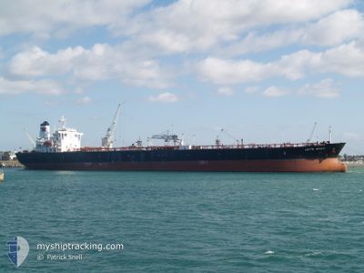
LEYTE SPIRIT
Oil Products Tanker
Current Trip
| Trip Time | 11 days |
|---|---|
| Trip Distance | 2962.29 nm |
| AVG Speed | 11.6 Noeuds |
| MAX Speed | 14.4 Noeuds |
| Tirant d eau | 11.9 m |
| AVG Wind | 10.5 knots |
| MAX Wind | 29.9 knots |
| MIN Temp | 17.7°C / 63.86°F |
| MAX Temp | 30.3°C / 86.54°F |
| Position reçue | 1 h, 38 m depuis |
Current Position
| Longitude | 103.55566° |
|---|---|
| Latitude | 1.30426° |
| Etat | Under way using engine |
| Vitesse | 6 Noeuds |
| Parcours | 17.7° |
| Zone | Singapore Strait |
| Station | T-AIS |
| Position reçue | 1 h, 38 m depuis |
Info
Information
The current position of LEYTE SPIRIT is in Singapore Strait with coordinates 1.30426° / 103.55566° as reported on 2024-06-26 08:35 by AIS to our vessel tracker app. The vessel's current speed is 6 Noeuds and is currently inside the port of TANJUNG PELEPAS.
The vessel LEYTE SPIRIT (IMO: 9484089, MMSI: 311000466) is a Oil Products Tanker that was built in 2011 ( 13 Age ). It's sailing under the flag of [BS] Bahamas.
In this page you can find informations about the vessels current position, last detected port calls, and current voyage information. If the vessels is not in coverage by AIS you will find the latest position.
The current position of LEYTE SPIRIT is detected by our AIS receivers and we are not responsible for the reliability of the data. The last position was recorded while the vessel was in Coverage by the Ais receivers of our vessel tracking app.
The current draught of LEYTE SPIRIT as reported by AIS is 11.9 meters
Weather
| Temperature | 29.1°C / 84.38°F |
|---|---|
| Wind Speed | 8 knots |
| Direction | 155° SSE |
| Pressure | 1006 hPa |
| Humidity | 75.7 % |
| Cloud Coverage | 83 % |
Featured Company
Last Port Calls
| Port | Arrival | Departure | Time In Port |
|---|---|---|---|
| 2024-06-26 09:05 | |||
| 2024-06-11 23:17 | 2024-06-15 08:09 | 3 d | |
| 2024-06-08 15:04 | |||
| 2024-05-30 22:42 | 2024-06-01 22:46 | 2 d | |
| 2024-05-07 07:41 | 2024-05-10 06:13 | 2 d | |
| 2024-04-01 02:12 |
Most Visited Ports (Last year)
| Port | Arrivals | |
|---|---|---|
| 3 | ||
| 2 | ||
| 2 | ||
| 1 | ||
| 1 | ||
| 1 |
Last Trips
| Origin | Departure | Destination | Arrival | Distance | |
|---|---|---|---|---|---|
| 2024-06-15 16:09 | 2024-06-26 17:05 | 2962.29 nm | |||
| 2024-06-09 00:04 | 2024-06-12 07:17 | 874.35 nm | |||
| 2024-05-10 09:13 | 2024-05-31 07:42 | 6346.89 nm | |||
| 2024-04-01 06:12 | 2024-05-07 10:41 | 6006.93 nm |
Events
| Heure | Evenement | Détails | Position/ Destination | Info |
|---|---|---|---|---|
| 2024-06-26 09:45 | Arret |
1.35751 / 103.54095
[MY] TANJUNG PELEPAS
|
Vitesse: 0.2 kn Parcours: 339° |
|
| 2024-06-26 09:05 | Port d'arrivée |
|
1.33325 / 103.55143
[MY] TANJUNG PELEPAS
|
Vitesse: 2.7 kn Parcours: 335° |
| 2024-06-26 08:41 | Etat Changé | Default Under way using engine |
1.31361 / 103.55782
MYTPP
|
Vitesse: 6 kn Parcours: 17.7° |
| 2024-06-26 08:35 | Hors de la zone couverte |
1.30426 / 103.55566
Singapore Strait
[MY] TANJUNG PELEPAS
|
Vitesse: 6 kn Parcours: 17.7° |
|
| 2024-06-26 08:22 | Etat Changé | Under way using engine Default |
1.27579 / 103.54821
MYTPP
|
Vitesse: 8.5 kn Parcours: 18° |
| 2024-06-26 08:05 | Démarrage | 6.12 nm, South of TANJUNG PELEPAS |
1.24601 / 103.54763
MYTPP
|
Vitesse: 3.2 kn Parcours: 311° |
| 2024-06-26 07:58 | Etat Changé | Default Under way using engine |
1.24639 / 103.55137
MYTPP
|
Vitesse: 0.8 kn Parcours: 237° |
| 2024-06-26 07:46 | Etat Changé | Under way using engine Default |
1.24783 / 103.55209
MYTPP
|
Vitesse: 0.5 kn Parcours: 241° |
| 2024-06-26 07:33 | Dans la zone couverte |
1.24784 / 103.55213
Singapore Strait
|
Vitesse: 0.3 kn Parcours: 75.3° |
|
| 2024-06-25 22:09 | Hors de la zone couverte |
1.24747 / 103.54728
Singapore Strait
|
Vitesse: Parcours: 49.8° |