
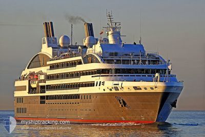
L'AUSTRAL
Passengers Ship
Current Trip
| Time Travelled | 8 h, 13 mins |
|---|---|
| Remaining Time | 1 h, 51 mins |
| Distance Travelled | 57.29 nm |
| Remaining Distance | 30.08 nm |
| AVG Speed | 8.4 Noeuds |
| MAX Speed | 9.1 Noeuds |
| AVG Wind | 12.4 knots |
| MAX Wind | 15.8 knots |
| MIN Temp | 20.6°C / 69.08°F |
| MAX Temp | 23.1°C / 73.58°F |
| Tirant d eau | 4.9 m |
| Position reçue | 1 h, 33 m depuis |
Current Position
| Longitude | 14.89345° |
|---|---|
| Latitude | 36.29151° |
| Etat | Under way using engine |
| Vitesse | 8.8 Noeuds |
| Parcours | 213.7° |
| Zone | Mediterranean Sea - Eastern Basin |
| Station | T-AIS |
| Position reçue | 1 h, 33 m depuis |
Info
Information
The current position of L'AUSTRAL is in Mediterranean Sea - Eastern Basin with coordinates 36.29151° / 14.89345° as reported on 2024-05-29 00:40 by AIS to our vessel tracker app. The vessel's current speed is 8.8 Noeuds and is heading at the port of VALLETTA. The estimated time of arrival as calculated by MyShipTracking vessel tracking app is 2024-05-29 06:04 LT
The vessel L'AUSTRAL (IMO: 9502518, MMSI: 578000700) is a Passengers Ship that was built in 2010 ( 14 Age ). It's sailing under the flag of [WF] Wallis Futuna Is.
In this page you can find informations about the vessels current position, last detected port calls, and current voyage information. If the vessels is not in coverage by AIS you will find the latest position.
The current position of L'AUSTRAL is detected by our AIS receivers and we are not responsible for the reliability of the data. The last position was recorded while the vessel was in Coverage by the Ais receivers of our vessel tracking app.
The current draught of L'AUSTRAL as reported by AIS is 4.9 meters
Weather
| Temperature | 20.8°C / 69.44°F |
|---|---|
| Wind Speed | 7 knots |
| Direction | 268° W |
| Pressure | 1014.5 hPa |
| Humidity | 72.5 % |
| Cloud Coverage | 45 % |
Featured Company
Last Port Calls
| Port | Arrival | Departure | Time In Port |
|---|---|---|---|
| 2024-05-28 12:39 | 2024-05-28 20:00 | 7 h | |
| 2024-05-27 07:37 | 2024-05-27 18:17 | 10 h | |
| 2024-05-26 08:03 | 2024-05-26 19:57 | 11 h | |
| 2024-05-25 11:38 | 2024-05-25 18:24 | 6 h | |
| 2024-05-25 06:56 | 2024-05-25 08:18 | 1 h | |
| 2024-05-24 09:15 | 2024-05-24 23:17 | 14 h | |
| 2024-05-23 07:05 | 2024-05-23 19:22 | 12 h | |
| 2024-05-22 07:04 | 2024-05-22 13:09 | 6 h | |
| 2024-05-20 07:16 | 2024-05-20 18:07 | 10 h | |
| 2024-05-19 06:08 | 2024-05-19 20:12 | 14 h |
Last Trips
| Origin | Departure | Destination | Arrival | Distance | |
|---|---|---|---|---|---|
| 2024-05-27 18:17 | 2024-05-28 12:39 | 224.64 nm | |||
| 2024-05-26 19:57 | 2024-05-27 07:37 | 125.79 nm | |||
| 2024-05-25 18:24 | 2024-05-26 08:03 | 173.71 nm | |||
| 2024-05-24 23:17 | 2024-05-25 11:38 | 75.39 nm | |||
| 2024-05-24 23:17 | 2024-05-25 06:56 | 32.99 nm | |||
| 2024-05-23 19:22 | 2024-05-24 09:15 | 198.06 nm | |||
| 2024-05-22 13:09 | 2024-05-23 07:05 | 232.67 nm | |||
| 2024-05-20 18:07 | 2024-05-22 07:04 | 396.28 nm | |||
| 2024-05-19 20:12 | 2024-05-20 07:16 | 72.62 nm | |||
| 2024-05-18 19:54 | 2024-05-19 06:08 | 72.67 nm |
Events
| Heure | Evenement | Détails | Position/ Destination | Info |
|---|---|---|---|---|
| 2024-05-29 00:49 | Etat Changé | Default Under way using engine |
36.27181 / 14.87678
MT MLA
|
Vitesse: 8.8 kn Parcours: 213.7° |
| 2024-05-29 00:40 | Hors de la zone couverte |
36.29151 / 14.89345
Mediterranean Sea - Eastern Basin
MT MLA
|
Vitesse: 8.8 kn Parcours: 213.7° |
|
| 2024-05-28 23:42 | Etat Changé | Under way using engine Default |
36.40467 / 15.00069
MT MLA
|
Vitesse: 8.9 kn Parcours: 217° |
| 2024-05-28 23:37 | Etat Changé | Default Under way using engine |
36.41278 / 15.00848
MT MLA
|
Vitesse: 8.9 kn Parcours: 217° |
| 2024-05-28 23:22 | Etat Changé | Under way using engine Default |
36.44368 / 15.03768
MT MLA
|
Vitesse: 8.9 kn Parcours: 216° |
| 2024-05-28 23:13 | Etat Changé | Default Under way using engine |
36.46167 / 15.05500
MT MLA
|
Vitesse: 8.9 kn Parcours: 215.8° |
| 2024-05-28 23:10 | Etat Changé | Under way using engine Default |
36.46669 / 15.05878
MT MLA
|
Vitesse: 8.9 kn Parcours: 217° |
| 2024-05-28 23:01 | Dans la zone couverte |
36.46669 / 15.05878
Mediterranean Sea - Eastern Basin
MT MLA
|
Vitesse: 8.9 kn Parcours: 215.8° |
|
| 2024-05-28 21:48 | Etat Changé | Default Under way using engine |
36.62565 / 15.20849
MT MLA
|
Vitesse: 8.7 kn Parcours: 215.1° |
| 2024-05-28 21:46 | Hors de la zone couverte |
36.62898 / 15.21139
Mediterranean Sea - Eastern Basin
MT MLA
|
Vitesse: 8.7 kn Parcours: 215.1° |