
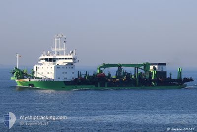
LANGE WAPPER
Trailing Suction Hopper Dredger
Current Trip
BJCOO
| Time Travelled | 14 days |
|---|---|
| Remaining Time | --- |
| Distance Travelled | 3057.91 nm |
| Remaining Distance | --- |
| AVG Speed | 12.1 Noeuds |
| MAX Speed | 14.6 Noeuds |
| AVG Wind | 11.6 knots |
| MAX Wind | 25 knots |
| MIN Temp | 18.7°C / 65.66°F |
| MAX Temp | 33.5°C / 92.3°F |
| Tirant d eau | 6.2 m |
| Position reçue | 2024-01-05 02:21 |
Current Position
| Longitude | -42.82385° |
|---|---|
| Latitude | -23.06840° |
| Etat | Under way using engine |
| Vitesse | 11.3 Noeuds |
| Parcours | 96.7° |
| Zone | South Atlantic Ocean |
| Station | T-AIS |
| Position reçue | 2024-01-05 02:21 |
Info
Information
The current position of LANGE WAPPER is in South Atlantic Ocean with coordinates -23.06840° / -42.82385° as reported on 2024-01-05 02:21 by AIS to our vessel tracker app. The vessel's current speed is 11.3 Noeuds
The vessel LANGE WAPPER (IMO: 9174139, MMSI: 205309000) is a Trailing Suction Hopper Dredger that was built in 1999 ( 25 Age ). It's sailing under the flag of [BE] Belgium.
In this page you can find informations about the vessels current position, last detected port calls, and current voyage information. If the vessels is not in coverage by AIS you will find the latest position.
The current position of LANGE WAPPER is detected by our AIS receivers and we are not responsible for the reliability of the data. The last position was recorded while the vessel was in Coverage by the Ais receivers of our vessel tracking app.
The current draught of LANGE WAPPER as reported by AIS is 6.2 meters
Weather
| Temperature | 19.6°C / 67.28°F |
|---|---|
| Wind Speed | 22 knots |
| Direction | 44° NE |
| Pressure | 1020.7 hPa |
| Humidity | 68.2 % |
| Cloud Coverage | --- |
Featured Company
Last Port Calls
| Port | Arrival | Departure | Time In Port |
|---|---|---|---|
| 2024-04-16 10:51 | 2024-04-16 12:31 | 1 h | |
| 2024-04-16 02:55 | 2024-04-16 03:27 | 32 m | |
| 2024-04-15 11:42 | 2024-04-15 12:54 | 1 h | |
| 2024-04-12 23:54 | 2024-04-13 00:30 | 35 m | |
| 2024-04-12 17:38 | 2024-04-12 19:06 | 1 h | |
| 2024-04-12 11:26 | 2024-04-12 12:10 | 44 m | |
| 2024-04-11 10:02 | 2024-04-11 10:09 | 7 m | |
| 2024-04-11 04:09 | 2024-04-11 04:14 | 4 m | |
| 2024-04-11 03:29 | 2024-04-11 03:38 | 8 m | |
| 2024-04-11 00:50 | 2024-04-11 01:18 | 27 m |
Last Trips
| Origin | Departure | Destination | Arrival | Distance | |
|---|---|---|---|---|---|
| 2024-04-16 04:27 | 2024-04-16 11:51 | 36.66 nm | |||
| 2024-04-15 13:54 | 2024-04-16 03:55 | 69.71 nm | |||
| 2024-04-13 01:30 | 2024-04-15 12:42 | 245.47 nm | |||
| 2024-04-12 20:06 | 2024-04-13 00:54 | 26.04 nm | |||
| 2024-04-12 13:10 | 2024-04-12 18:38 | 32.19 nm | |||
| 2024-04-11 11:09 | 2024-04-12 12:26 | 114.51 nm | |||
| 2024-04-11 05:14 | 2024-04-11 11:02 | 31.52 nm | |||
| 2024-04-11 04:38 | 2024-04-11 05:09 | 1.02 nm | |||
| 2024-04-11 02:18 | 2024-04-11 04:29 | 15.70 nm | |||
| 2024-04-11 01:42 | 2024-04-11 01:50 | 0.12 nm |
Events
| Heure | Evenement | Détails | Position/ Destination | Info |
|---|---|---|---|---|
| 2024-04-29 15:02 | Démarrage |
22.48895 / -18.25972
BJCOO
|
Vitesse: 6.3 kn Parcours: 32° |
|
| 2024-04-29 10:10 | Arret |
22.49507 / -18.23091
BJCOO
|
Vitesse: 0.3 kn Parcours: 42° |
|
| 2024-04-21 15:18 | Démarrage | 8.02 nm, South of LOME |
6.00987 / 1.24522
BJCOO
|
Vitesse: 11.7 kn Parcours: 203° |
| 2024-04-21 15:14 | Arret | 7.58 nm, South of LOME |
6.01675 / 1.24771
BJCOO
|
Vitesse: Parcours: 215° |
| 2024-04-21 14:28 | Démarrage | 4.33 nm, South of LOME |
6.06579 / 1.27604
BJCOO
|
Vitesse: 12 kn Parcours: 217° |
| 2024-04-21 14:03 | Arret | 3.9 nm, South of LOME |
6.07233 / 1.28184
BJCOO
|
Vitesse: 0.2 kn Parcours: 278° |
| 2024-04-21 13:48 | Démarrage | 5.11 nm, South of LOME |
6.05253 / 1.27667
BJCOO
|
Vitesse: 9.1 kn Parcours: 18° |