
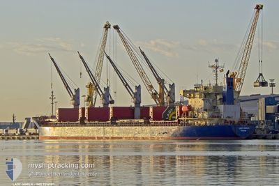
LADY JAMILA
Bulk Carrier
Current Trip
DZ AAE
| Time Travelled | 29 days |
|---|---|
| Remaining Time | --- |
| Distance Travelled | 1792.98 nm |
| Remaining Distance | --- |
| AVG Speed | 10.7 Noeuds |
| MAX Speed | 15.7 Noeuds |
| AVG Wind | 12.6 knots |
| MAX Wind | 36.8 knots |
| MIN Temp | -2.3°C / 27.86°F |
| MAX Temp | 17.8°C / 64.04°F |
| Tirant d eau | 9.7 m |
| Position reçue | 1 m depuis |
Current Position
| Longitude | --- |
|---|---|
| Latitude | --- |
| Etat | At anchor |
| Vitesse | |
| Parcours | 194° |
| Zone | Sea of Marmara |
| Station | T-AIS |
| Position reçue | 1 m depuis |
Info
Information
The current position of LADY JAMILA is in Sea of Marmara with coordinates 40.97349° / 28.93016° as reported on 2026-01-05 23:02 by AIS to our vessel tracker app. The vessel's current speed is 0 Noeuds
The vessel LADY JAMILA (IMO: 9316983, MMSI: 352002374) is a Bulk Carrier that was built in 2007 ( 19 Age ). It's sailing under the flag of [PA] Panama.
In this page you can find informations about the vessels current position, last detected port calls, and current voyage information. If the vessels is not in coverage by AIS you will find the latest position.
The current position of LADY JAMILA is detected by our AIS receivers and we are not responsible for the reliability of the data. The last position was recorded while the vessel was in Coverage by the Ais receivers of our vessel tracking app.
The current draught of LADY JAMILA as reported by AIS is 9.7 meters
Weather
| Temperature | 12.1°C / 53.78°F |
|---|---|
| Wind Speed | 7 knots |
| Direction | 119° ESE |
| Pressure | 1017.4 hPa |
| Humidity | 66.8 % |
| Cloud Coverage | 100 % |
Featured Company
Events
| Heure | Evenement | Détails | Position/ Destination | Info |
|---|---|---|---|---|
| 2026-01-05 19:59 | Arret | 1.8 nm, East of ZEYTINBURNU |
40.97111 / 28.93108
DZ AAE
|
Vitesse: 0.3 kn Parcours: 302° |
| 2026-01-05 19:53 | Etat Changé | At anchor Under way using engine |
40.97106 / 28.93213
DZ AAE
|
Vitesse: 0.6 kn Parcours: 288° |
| 2026-01-05 17:20 | Changement de zone | Turkish part of the Sea of Marmara Turkish part of the Black Sea |
41.22880 / 29.12928
Sea of Marmara
|
Vitesse: 5.6 kn Parcours: 199.8° |
| 2026-01-05 14:57 | Démarrage | 15.43 nm, North West of RUMELI FENERI |
41.45904 / 28.95413
DZ AAE
|
Vitesse: 3.4 kn Parcours: 142° |
| 2026-01-05 08:31 | Arret | 11.4 nm, North West of RUMELI FENERI |
41.39433 / 28.98343
DZ AAE
|
Vitesse: 0.3 kn Parcours: 257° |
| 2026-01-05 07:31 | Etat Changé | Under way using engine At anchor |
41.35705 / 28.96708
DZ AAE
|
Vitesse: 11.9 kn Parcours: 348.8° |
| 2026-01-05 07:13 | Démarrage | 7.36 nm, North West of RUMELI FENERI |
41.31965 / 29.00020
DZ AAE
|
Vitesse: 3.4 kn Parcours: 315° |
| 2026-01-05 07:01 | Etat Changé | At anchor Default |
41.32045 / 29.00617
DZ AAE
|
Vitesse: 0.5 kn Parcours: 241° |
| 2026-01-05 06:58 | Etat Changé | Default At anchor |
41.32075 / 29.00657
DZ AAE
|
Vitesse: 0.4 kn Parcours: 237° |
| 2026-01-05 06:49 | Etat Changé | At anchor Default |
41.32136 / 29.00766
DZ AAE
|
Vitesse: 0.1 kn Parcours: 263° |