
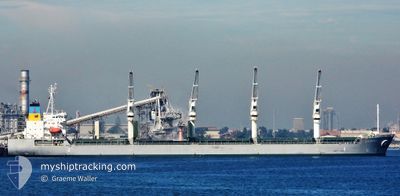
LA BAMBA
Bulk Carrier
Current Trip
| Trip Time | 2 days |
|---|---|
| Trip Distance | 714.87 nm |
| AVG Speed | 12.1 Noeuds |
| MAX Speed | 15 Noeuds |
| Tirant d eau | 6.1 m |
| AVG Wind | 11.9 knots |
| MAX Wind | 30 knots |
| MIN Temp | 16.1°C / 60.98°F |
| MAX Temp | 22.5°C / 72.5°F |
| Position reçue | 1 d depuis |
Current Position
| Longitude | 129.92143° |
|---|---|
| Latitude | 35.81906° |
| Etat | Under way using engine |
| Vitesse | 14.4 Noeuds |
| Parcours | 345.6° |
| Zone | Japan Sea |
| Station | T-AIS |
| Position reçue | 1 d depuis |
Info
Information
The current position of LA BAMBA is in Japan Sea with coordinates 35.81906° / 129.92143° as reported on 2024-05-17 03:00 by AIS to our vessel tracker app. The vessel's current speed is 14.4 Noeuds and is currently inside the port of POHANG.
The vessel LA BAMBA (IMO: 9495363, MMSI: 538004494) is a Bulk Carrier that was built in 2012 ( 12 Age ). It's sailing under the flag of [MH] Marshall Is.
In this page you can find informations about the vessels current position, last detected port calls, and current voyage information. If the vessels is not in coverage by AIS you will find the latest position.
The current position of LA BAMBA is detected by our AIS receivers and we are not responsible for the reliability of the data. The last position was recorded while the vessel was in Coverage by the Ais receivers of our vessel tracking app.
The current draught of LA BAMBA as reported by AIS is 6.1 meters
Weather
| Temperature | 21.5°C / 70.7°F |
|---|---|
| Wind Speed | 7 knots |
| Direction | 238° WSW |
| Pressure | 1015 hPa |
| Humidity | 57.5 % |
| Cloud Coverage | 2 % |
Featured Company
Last Port Calls
| Port | Arrival | Departure | Time In Port |
|---|---|---|---|
| 2024-05-17 15:03 | |||
| 2024-05-11 18:29 | 2024-05-15 05:55 | 3 d | |
| 2024-04-29 10:00 | 2024-05-10 16:12 | 11 d | |
| 2024-04-23 08:16 | 2024-04-24 18:40 | 1 d | |
| 2024-03-26 14:14 | 2024-04-01 07:32 | 5 d | |
| 2024-03-20 14:34 | 2024-03-22 06:29 | 1 d | |
| 2024-03-09 02:03 | 2024-03-16 19:52 | 7 d |
Most Visited Ports (Last year)
| Port | Arrivals | |
|---|---|---|
| 3 | ||
| 2 | ||
| 2 | ||
| 2 | ||
| 1 | ||
| 1 |
Last Trips
| Origin | Departure | Destination | Arrival | Distance | |
|---|---|---|---|---|---|
| 2024-05-15 05:55 | 2024-05-17 15:03 | 714.87 nm | |||
| 2024-05-10 16:12 | 2024-05-11 18:29 | 205.76 nm | |||
| 2024-04-24 18:40 | 2024-04-29 10:00 | 623.80 nm | |||
| 2024-04-01 07:32 | 2024-04-23 08:16 | 5645.55 nm | |||
| 2024-03-22 06:29 | 2024-03-26 14:14 | 1230.84 nm | |||
| 2024-03-16 19:52 | 2024-03-20 14:34 | 1220.33 nm | |||
| 2024-02-08 20:10 | 2024-03-09 02:03 | 6623.37 nm |
Events
| Heure | Evenement | Détails | Position/ Destination | Info |
|---|---|---|---|---|
| 2024-05-17 06:49 | Arret |
36.01391 / 129.40053
[KR] POHANG
|
Vitesse: 0.1 kn Parcours: 277° |
|
| 2024-05-17 06:03 | Port d'arrivée |
|
36.02343 / 129.41483
[KR] POHANG
|
Vitesse: 8.3 kn Parcours: 236° |
| 2024-05-17 03:08 | Etat Changé | Default Under way using engine |
35.85065 / 129.90990
KR KPO
|
Vitesse: 14.4 kn Parcours: 345.6° |
| 2024-05-17 03:00 | Hors de la zone couverte |
35.81906 / 129.92143
Japan Sea
KR KPO
|
Vitesse: 14.4 kn Parcours: 345.6° |
|
| 2024-05-17 00:59 | Etat Changé | Under way using engine Default |
35.44400 / 130.09228
KR KPO
|
Vitesse: 12 kn Parcours: 337° |
| 2024-05-17 00:44 | Etat Changé | Default Under way using engine |
35.40015 / 130.11778
KR KPO
|
Vitesse: 12.2 kn Parcours: 329.6° |
| 2024-05-17 00:38 | Changement de zone | South Korean part of the Japan Sea Japanese part of the North Pacific Ocean |
35.37977 / 130.13128
Japan Sea
KR KPO
|
Vitesse: 12.2 kn Parcours: 329.6° |
| 2024-05-17 00:38 | Etat Changé | Under way using engine Default |
35.37977 / 130.13128
KR KPO
|
Vitesse: 12.1 kn Parcours: 338° |
| 2024-05-17 00:38 | Dans la zone couverte |
35.37977 / 130.13128
Japan Sea
KR KPO
|
Vitesse: 12.2 kn Parcours: 329.6° |
|
| 2024-05-14 23:29 | Hors de la zone couverte |
35.05321 / 139.66792
North Pacific Ocean
KR KPO
|
Vitesse: 14 kn Parcours: 234.7° |