
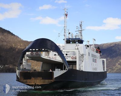
KVINNHERAD
Passenger
Current Trip
NG LOS
| Time Travelled | 3 days |
|---|---|
| Remaining Time | --- |
| Distance Travelled | 109.63 nm |
| Remaining Distance | --- |
| AVG Speed | 6.5 Noeuds |
| MAX Speed | 9.1 Noeuds |
| AVG Wind | 5.8 knots |
| MAX Wind | 13.4 knots |
| MIN Temp | 24°C / 75.2°F |
| MAX Temp | 29.9°C / 85.82°F |
| Tirant d eau | 3.3 m |
| Position reçue | 2023-06-06 13:40 |
Current Position
| Longitude | 8.32386° |
|---|---|
| Latitude | 4.97782° |
| Etat | Under way using engine |
| Vitesse | |
| Parcours | 175° |
| Zone | North Atlantic Ocean |
| Station | T-AIS |
| Position reçue | 2023-06-06 13:40 |
Info
Information
The current position of KVINNHERAD is in North Atlantic Ocean with coordinates 4.97782° / 8.32386° as reported on 2023-06-06 13:40 by AIS to our vessel tracker app. The vessel's current speed is 0 Noeuds
The vessel KVINNHERAD (IMO: 7704681, MMSI: 657228600) is a Passenger It's sailing under the flag of [NG] Nigeria.
In this page you can find informations about the vessels current position, last detected port calls, and current voyage information. If the vessels is not in coverage by AIS you will find the latest position.
The current position of KVINNHERAD is detected by our AIS receivers and we are not responsible for the reliability of the data. The last position was recorded while the vessel was in Coverage by the Ais receivers of our vessel tracking app.
The current draught of KVINNHERAD as reported by AIS is 3.3 meters
Weather
| Temperature | 28°C / 82.4°F |
|---|---|
| Wind Speed | 7 knots |
| Direction | 213° SSW |
| Pressure | 1014.4 hPa |
| Humidity | 77.4 % |
| Cloud Coverage | 77 % |
Featured Company
Most Visited Ports (Last year)
| Port | Arrivals | |
|---|---|---|
| 23 |
Events
| Heure | Evenement | Détails | Position/ Destination | Info |
|---|---|---|---|---|
| 2024-06-05 05:15 | Arret | 16.22 nm, East of LIMBOH |
4.06629 / 9.39404
NG LOS
|
Vitesse: 0.1 kn Parcours: -1° |
| 2024-06-05 05:08 | Démarrage | 16.28 nm, East of LIMBOH |
4.06660 / 9.39493
NG LOS
|
Vitesse: 3.7 kn Parcours: -1° |
| 2024-06-05 01:51 | Arret | 16.37 nm, East of LIMBOH |
4.06267 / 9.39741
NG LOS
|
Vitesse: Parcours: -1° |
| 2024-06-04 08:48 | Démarrage | 0.43 nm, South West of CALABAR |
4.96947 / 8.31532
NG LOS
|
Vitesse: 7.4 kn Parcours: -1° |
| 2024-06-04 08:48 | PORT DE DEPART |
|
4.96947 / 8.31532
NG LOS
|
Vitesse: 0.1 kn Parcours: -1° |