
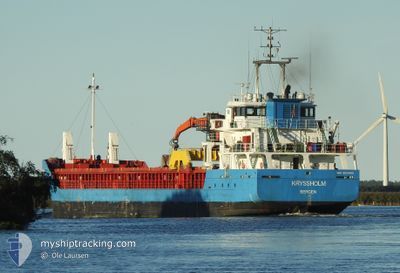
KRYSSHOLM
General Cargo
Current Trip
| Time Travelled | 14 days |
|---|---|
| Remaining Time | 1 day |
| Distance Travelled | 1171.88 nm |
| Remaining Distance | 301.92 nm |
| AVG Speed | 6.8 Noeuds |
| MAX Speed | 11.1 Noeuds |
| AVG Wind | 13.4 knots |
| MAX Wind | 25.8 knots |
| MIN Temp | 1.5°C / 34.7°F |
| MAX Temp | 11.4°C / 52.52°F |
| Tirant d eau | 5.2 m |
| Position reçue | Maintenant |
Current Position
| Longitude | -3.83791° |
|---|---|
| Latitude | 58.70197° |
| Etat | Under way using engine |
| Vitesse | 9.4 Noeuds |
| Parcours | 87° |
| Zone | North Atlantic Ocean |
| Station | T-AIS |
| Position reçue | Maintenant |
Info
Information
The current position of KRYSSHOLM is in North Atlantic Ocean with coordinates 58.70197° / -3.83791° as reported on 2024-04-26 08:15 by AIS to our vessel tracker app. The vessel's current speed is 9.4 Noeuds and is heading at the port of HUSOYA. The estimated time of arrival as calculated by MyShipTracking vessel tracking app is 2024-04-27 23:43 LT
The vessel KRYSSHOLM (IMO: 9579468, MMSI: 257041670) is a General Cargo that was built in 2011 ( 13 Age ). It's sailing under the flag of [NO] Norway.
In this page you can find informations about the vessels current position, last detected port calls, and current voyage information. If the vessels is not in coverage by AIS you will find the latest position.
The current position of KRYSSHOLM is detected by our AIS receivers and we are not responsible for the reliability of the data. The last position was recorded while the vessel was in Coverage by the Ais receivers of our vessel tracking app.
The current draught of KRYSSHOLM as reported by AIS is 5.2 meters
Weather
| Temperature | 6.7°C / 44.06°F |
|---|---|
| Wind Speed | 11 knots |
| Direction | 357° N |
| Pressure | 1007 hPa |
| Humidity | 67.6 % |
| Cloud Coverage | 100 % |
Featured Company
Last Port Calls
| Port | Arrival | Departure | Time In Port |
|---|---|---|---|
| 2024-04-09 15:33 | 2024-04-11 09:23 | 1 d | |
| 2024-04-08 18:44 | 2024-04-08 19:51 | 1 h | |
| 2024-04-06 21:11 | 2024-04-07 10:36 | 13 h | |
| 2024-04-05 08:28 | 2024-04-05 21:08 | 12 h | |
| 2024-03-12 22:16 | 2024-03-13 17:20 | 19 h | |
| 2024-03-12 20:00 | 2024-03-12 22:05 | 2 h | |
| 2024-03-10 07:02 | 2024-03-12 18:02 | 2 d | |
| 2024-03-09 20:10 | 2024-03-09 22:02 | 1 h | |
| 2024-03-08 13:56 | 2024-03-08 16:47 | 2 h | |
| 2024-03-07 21:34 | 2024-03-08 04:22 | 6 h |
Last Trips
| Origin | Departure | Destination | Arrival | Distance | |
|---|---|---|---|---|---|
| 2024-04-08 19:51 | 2024-04-09 15:33 | 190.78 nm | |||
| 2024-04-07 10:36 | 2024-04-08 18:44 | 74.85 nm | |||
| 2024-04-05 21:08 | 2024-04-06 21:11 | 163.77 nm | |||
| 2024-03-13 18:20 | 2024-04-05 08:28 | 1584.61 nm | |||
| 2024-03-12 23:05 | 2024-03-12 23:16 | 0.25 nm | |||
| 2024-03-12 19:02 | 2024-03-12 21:00 | 18.15 nm | |||
| 2024-03-09 23:02 | 2024-03-10 08:02 | 66.01 nm | |||
| 2024-03-08 17:47 | 2024-03-09 21:10 | 247.06 nm | |||
| 2024-03-08 05:22 | 2024-03-08 14:56 | 87.61 nm | |||
| 2024-03-07 13:45 | 2024-03-07 22:34 | 80.62 nm |
Events
| Heure | Evenement | Détails | Position/ Destination | Info |
|---|---|---|---|---|
| 2024-04-26 08:11 | Etat Changé | Under way using engine Default |
58.70121 / -3.85791
NOHSO
|
Vitesse: 9.5 kn Parcours: 86° |
| 2024-04-26 07:26 | Etat Changé | Default Under way using engine |
58.69697 / -4.07995
NOHSO
|
Vitesse: 8.9 kn Parcours: 84.5° |
| 2024-04-26 07:18 | Changement de zone | United Kingdom part of the North Atlantic Ocean United Kingdom part of the Inner Seas off the West Coast of Scotland |
58.69520 / -4.11613
North Atlantic Ocean
NOHSO
|
Vitesse: 8.9 kn Parcours: 84.5° |
| 2024-04-26 07:17 | Dans la zone couverte |
58.69520 / -4.11613
North Atlantic Ocean
NOHSO
|
Vitesse: 8.9 kn Parcours: 84.5° |
|
| 2024-04-25 18:30 | Etat Changé | Default Under way using engine |
57.64693 / -5.91656
NOHSO
|
Vitesse: 8.4 kn Parcours: 359.4° |
| 2024-04-25 18:23 | Etat Changé | Under way using engine Default |
57.63045 / -5.91616
NOHSO
|
Vitesse: 8.4 kn Parcours: 358° |
| 2024-04-25 18:23 | Hors de la zone couverte |
57.63045 / -5.91616
Inner Seas off the West Coast of Scotland
NOHSO
|
Vitesse: 8.4 kn Parcours: 359.4° |
|
| 2024-04-25 17:54 | Etat Changé | Default Under way using engine |
57.56560 / -5.91787
NOHSO
|
Vitesse: 8 kn Parcours: 0.8° |
| 2024-04-25 17:48 | Etat Changé | Under way using engine Default |
57.55236 / -5.91823
NOHSO
|
Vitesse: 7.9 kn Parcours: 1° |
| 2024-04-25 17:46 | Etat Changé | Default Under way using engine |
57.54834 / -5.91829
NOHSO
|
Vitesse: 7.8 kn Parcours: 1.4° |