
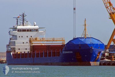
KRISTA
General Cargo
Current Trip
| Time Travelled | 2 h, 10 mins |
|---|---|
| Remaining Time | --- |
| Distance Travelled | 20.33 nm |
| Remaining Distance | --- |
| AVG Speed | 10.4 Noeuds |
| MAX Speed | 11.8 Noeuds |
| AVG Wind | 13.2 knots |
| MAX Wind | 14.8 knots |
| MIN Temp | 16.6°C / 61.88°F |
| MAX Temp | 20.7°C / 69.26°F |
| Tirant d eau | 4.2 m |
| Position reçue | 1 m depuis |
Current Position
| Longitude | -9.14996° |
|---|---|
| Latitude | 42.43869° |
| Etat | Under way using engine |
| Vitesse | 9.1 Noeuds |
| Parcours | 303.4° |
| Zone | North Atlantic Ocean |
| Station | T-AIS |
| Position reçue | 1 m depuis |
Info
Information
The current position of KRISTA is in North Atlantic Ocean with coordinates 42.43869° / -9.14996° as reported on 2024-05-28 19:09 by AIS to our vessel tracker app. The vessel's current speed is 9.1 Noeuds and is heading at the port of AUGHINISH. The estimated time of arrival as calculated by MyShipTracking vessel tracking app is 2024-05-31 12:30 LT
The vessel KRISTA (IMO: 9434759, MMSI: 305284000) is a General Cargo that was built in 2008 ( 16 Age ). It's sailing under the flag of [AG] Antigua Barbuda.
In this page you can find informations about the vessels current position, last detected port calls, and current voyage information. If the vessels is not in coverage by AIS you will find the latest position.
The current position of KRISTA is detected by our AIS receivers and we are not responsible for the reliability of the data. The last position was recorded while the vessel was in Coverage by the Ais receivers of our vessel tracking app.
The current draught of KRISTA as reported by AIS is 4.2 meters
Weather
| Temperature | 15.5°C / 59.9°F |
|---|---|
| Wind Speed | 18 knots |
| Direction | 338° NNW |
| Pressure | 1020.8 hPa |
| Humidity | 85.3 % |
| Cloud Coverage | 37 % |
Featured Company
Last Port Calls
| Port | Arrival | Departure | Time In Port |
|---|---|---|---|
| 2024-05-24 07:22 | 2024-05-28 19:01 | 4 d | |
| 2024-05-14 18:14 | 2024-05-15 22:30 | 1 d | |
| 2024-05-10 10:56 | 2024-05-13 21:12 | 3 d | |
| 2024-04-26 11:00 | 2024-04-26 11:33 | 33 m | |
| 2024-04-19 10:05 | 2024-04-24 17:29 | 5 d | |
| 2024-04-13 23:26 | 2024-04-14 00:29 | 1 h | |
| 2024-04-09 00:44 | 2024-04-10 11:09 | 1 d | |
| 2024-04-01 08:01 | 2024-04-05 20:43 | 4 d | |
| 2024-03-29 06:21 | 2024-03-29 06:26 | 4 m | |
| 2024-03-24 22:01 | 2024-03-29 05:37 | 4 d |
Most Visited Ports (Last year)
| Port | Arrivals | |
|---|---|---|
| 6 | ||
| 4 | ||
| 3 | ||
| 3 | ||
| 3 | ||
| 2 |
Last Trips
| Origin | Departure | Destination | Arrival | Distance | |
|---|---|---|---|---|---|
| 2024-05-15 22:30 | 2024-05-24 07:22 | 1951.56 nm | |||
| 2024-05-13 21:12 | 2024-05-14 18:14 | 214.08 nm | |||
| 2024-04-26 11:33 | 2024-05-10 10:56 | 2233.95 nm | |||
| 2024-04-24 17:29 | 2024-04-26 11:00 | 475.81 nm | |||
| 2024-04-14 00:29 | 2024-04-19 10:05 | 1196.14 nm | |||
| 2024-04-10 11:09 | 2024-04-13 23:26 | 781.73 nm | |||
| 2024-04-05 20:43 | 2024-04-09 00:44 | 717.13 nm | |||
| 2024-03-29 06:26 | 2024-04-01 08:01 | 671.17 nm | |||
| 2024-03-29 05:37 | 2024-03-29 06:21 | 5.97 nm | |||
| 2024-03-04 05:01 | 2024-03-24 22:01 | 2971.38 nm |
Events
| Heure | Evenement | Détails | Position/ Destination | Info |
|---|---|---|---|---|
| 2024-05-28 18:08 | Tirant d'eau modifié | 4.2 5.8 |
42.47087 / -8.97241
IE AUG
|
Vitesse: 11.7 kn Parcours: 198.5° |
| 2024-05-28 18:08 | Changement de destination | IE AUG ES VIL |
42.47087 / -8.97241
IE AUG
|
Vitesse: 11.7 kn Parcours: 198.5° |
| 2024-05-28 18:08 | Changement d'ETA | 2024/05/31 11:30 2024/05/24 06:00 |
42.47087 / -8.97241
IE AUG
|
Vitesse: 11.7 kn Parcours: 198.5° |
| 2024-05-28 17:25 | Etat Changé | Under way using engine Default |
42.58521 / -8.89150
ES VIL
|
Vitesse: 10 kn Parcours: 261° |
| 2024-05-28 17:19 | Etat Changé | Default Under way using engine |
42.58747 / -8.87169
ES VIL
|
Vitesse: 10.2 kn Parcours: 257.1° |
| 2024-05-28 17:09 | Etat Changé | Under way using engine Default |
42.59359 / -8.83158
ES VIL
|
Vitesse: 10.2 kn Parcours: 258° |
| 2024-05-28 17:01 | PORT DE DEPART |
|
42.59667 / -8.80333
ES VIL
|
Vitesse: 3.8 kn Parcours: 298° |
| 2024-05-28 16:55 | Dans la zone couverte |
42.59281 / -8.83654
North Atlantic Ocean
|
Vitesse: 10.3 kn Parcours: 257.8° |
|
| 2024-05-28 16:51 | Démarrage |
42.60001 / -8.77846
[ES] VILLAGARCIA
|
Vitesse: 3.7 kn Parcours: 291° |
|
| 2024-05-24 05:31 | Arret |
42.59500 / -8.77500
[ES] VILLAGARCIA
|
Vitesse: Parcours: -1° |