
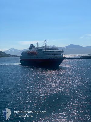
KONG HARALD
Ro-Ro/Passenger Ship
Current Trip
| Time Travelled | 2 mins |
|---|---|
| Remaining Time | 1 day |
| Distance Travelled | --- |
| Remaining Distance | 407.95 nm |
| AVG Speed | --- |
| MAX Speed | --- |
| AVG Wind | --- |
| MAX Wind | --- |
| MIN Temp | --- |
| MAX Temp | --- |
| Tirant d eau | 4.9 m |
| Position reçue | 2 m depuis |
Current Position
| Longitude | --- |
|---|---|
| Latitude | --- |
| Etat | Under way using engine |
| Vitesse | 10.3 Noeuds |
| Parcours | 205° |
| Zone | Norwegian Sea |
| Station | T-AIS |
| Position reçue | 2 m depuis |
Info
Information
The current position of KONG HARALD is in Norwegian Sea with coordinates 65.46270° / 12.18636° as reported on 2025-03-02 15:05 by AIS to our vessel tracker app. The vessel's current speed is 10.3 Noeuds and is heading at the port of BERGEN. The estimated time of arrival as calculated by MyShipTracking vessel tracking app is 2025-03-03 19:10 LT
The vessel KONG HARALD (IMO: 9039119, MMSI: 257200000) is a Ro-Ro/Passenger Ship that was built in 1993 ( 32 Age ). It's sailing under the flag of [NO] Norway.
In this page you can find informations about the vessels current position, last detected port calls, and current voyage information. If the vessels is not in coverage by AIS you will find the latest position.
The current position of KONG HARALD is detected by our AIS receivers and we are not responsible for the reliability of the data. The last position was recorded while the vessel was in Coverage by the Ais receivers of our vessel tracking app.
The current draught of KONG HARALD as reported by AIS is 4.9 meters
Weather
| Temperature | 1.4°C / 34.52°F |
|---|---|
| Wind Speed | 12 knots |
| Direction | 176° S |
| Pressure | 1001.9 hPa |
| Humidity | 99.8 % |
| Cloud Coverage | 100 % |
Featured Company
Last Port Calls
| Port | Arrival | Departure | Time In Port |
|---|---|---|---|
| 2025-03-02 14:03 | 2025-03-02 15:05 | 1 h | |
| 2025-03-02 10:41 | 2025-03-02 11:19 | 38 m | |
| 2025-03-02 09:21 | 2025-03-02 09:36 | 14 m | |
| 2025-03-02 05:24 | 2025-03-02 05:37 | 12 m | |
| 2025-03-02 01:28 | 2025-03-02 02:38 | 1 h | |
| 2025-03-01 21:11 | 2025-03-01 21:34 | 22 m | |
| 2025-03-01 16:53 | 2025-03-01 19:39 | 2 h | |
| 2025-03-01 13:12 | 2025-03-01 14:16 | 1 h | |
| 2025-03-01 11:36 | 2025-03-01 12:03 | 27 m | |
| 2025-03-01 06:55 | 2025-03-01 07:44 | 49 m |
Last Trips
| Origin | Departure | Destination | Arrival | Distance | |
|---|---|---|---|---|---|
| 2025-03-02 12:19 | 2025-03-02 15:03 | 36.65 nm | |||
| 2025-03-02 10:36 | 2025-03-02 11:41 | 14.27 nm | |||
| 2025-03-02 06:37 | 2025-03-02 10:21 | 51.36 nm | |||
| 2025-03-02 03:38 | 2025-03-02 06:24 | 37.79 nm | |||
| 2025-03-01 22:34 | 2025-03-02 02:28 | 52.74 nm | |||
| 2025-03-01 20:39 | 2025-03-01 22:11 | 19.32 nm | |||
| 2025-03-01 15:16 | 2025-03-01 17:53 | 36.26 nm | |||
| 2025-03-01 13:03 | 2025-03-01 14:12 | 15.28 nm | |||
| 2025-03-01 08:44 | 2025-03-01 12:36 | 43.09 nm | |||
| 2025-03-01 04:48 | 2025-03-01 07:55 | 42.75 nm |
Events
| Heure | Evenement | Détails | Position/ Destination | Info |
|---|---|---|---|---|
| 2025-03-02 15:05 | PORT DE DEPART |
|
65.46270 / 12.18636
BERGEN
|
Vitesse: 10.2 kn Parcours: 222° |
| 2025-03-02 15:01 | Démarrage |
65.47238 / 12.20332
[NO] BRONNOYSUND
|
Vitesse: 9.3 kn Parcours: 214° |
|
| 2025-03-02 14:03 | Arret |
65.47572 / 12.21047
[NO] BRONNOYSUND
|
Vitesse: 0.3 kn Parcours: 198° |
|
| 2025-03-02 14:03 | Port d'arrivée |
|
65.47572 / 12.21047
[NO] BRONNOYSUND
|
Vitesse: 4.9 kn Parcours: 205° |
| 2025-03-02 11:19 | PORT DE DEPART |
|
66.02880 / 12.63457
BERGEN
|
Vitesse: 3.2 kn Parcours: 294° |
| 2025-03-02 11:15 | Démarrage |
66.02564 / 12.64122
[NO] SANDNESSJOEN
|
Vitesse: 4.1 kn Parcours: 235° |
|
| 2025-03-02 10:46 | Arret |
66.02401 / 12.63758
[NO] SANDNESSJOEN
|
Vitesse: Parcours: 236° |
|
| 2025-03-02 10:41 | Port d'arrivée |
|
66.02519 / 12.64014
[NO] SANDNESSJOEN
|
Vitesse: 6.4 kn Parcours: 180° |
| 2025-03-02 09:36 | Démarrage | 0.33 nm, South West of NESNA |
66.19651 / 13.00260
BERGEN
|
Vitesse: 9.8 kn Parcours: 200° |
| 2025-03-02 09:36 | PORT DE DEPART |
|
66.19651 / 13.00260
BERGEN
|
Vitesse: 2.3 kn Parcours: 209° |