
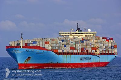
KLEVEN
Container Ship
Current Trip
| Time Travelled | 22 h, 10 mins |
|---|---|
| Remaining Time | --- |
| Distance Travelled | 84.07 nm |
| Remaining Distance | --- |
| AVG Speed | 10.9 Noeuds |
| MAX Speed | 12.6 Noeuds |
| AVG Wind | 5.2 knots |
| MAX Wind | 10.6 knots |
| MIN Temp | 24.4°C / 75.92°F |
| MAX Temp | 25.5°C / 77.9°F |
| Tirant d eau | 12.3 m |
| Position reçue | 18 h, 36 m depuis |
Current Position
| Longitude | -79.37623° |
|---|---|
| Latitude | 26.30073° |
| Etat | Under way using engine |
| Vitesse | 11.9 Noeuds |
| Parcours | 72.1° |
| Zone | North Atlantic Ocean |
| Station | T-AIS |
| Position reçue | 18 h, 36 m depuis |
Info
Information
The current position of KLEVEN is in North Atlantic Ocean with coordinates 26.30073° / -79.37623° as reported on 2024-05-01 16:19 by AIS to our vessel tracker app. The vessel's current speed is 11.9 Noeuds
The vessel KLEVEN (IMO: 9085546, MMSI: 636018912) is a Container Ship that was built in 1996 ( 28 Age ). It's sailing under the flag of [LR] Liberia.
In this page you can find informations about the vessels current position, last detected port calls, and current voyage information. If the vessels is not in coverage by AIS you will find the latest position.
The current position of KLEVEN is detected by our AIS receivers and we are not responsible for the reliability of the data. The last position was recorded while the vessel was in Coverage by the Ais receivers of our vessel tracking app.
The current draught of KLEVEN as reported by AIS is 12.3 meters
Weather
| Temperature | 24.4°C / 75.92°F |
|---|---|
| Wind Speed | 7 knots |
| Direction | 114° ESE |
| Pressure | 1012.8 hPa |
| Humidity | 76.7 % |
| Cloud Coverage | 1 % |
Featured Company
Last Port Calls
| Port | Arrival | Departure | Time In Port |
|---|---|---|---|
| 2024-05-01 12:36 | 2024-05-01 12:45 | 8 m | |
| 2024-04-30 19:12 | 2024-05-01 12:26 | 17 h | |
| 2024-04-30 18:38 | 2024-04-30 18:57 | 18 m | |
| 2024-04-27 01:47 | 2024-04-28 05:54 | 1 d | |
| 2024-04-24 00:53 | 2024-04-25 00:02 | 23 h | |
| 2024-04-20 14:05 | 2024-04-21 11:36 | 21 h | |
| 2024-04-19 02:06 | 2024-04-19 16:17 | 14 h | |
| 2024-04-16 08:26 | 2024-04-17 22:43 | 1 d | |
| 2024-04-13 21:37 | 2024-04-14 16:52 | 19 h | |
| 2024-03-31 14:26 | 2024-04-02 12:03 | 1 d |
Most Visited Ports (Last year)
| Port | Arrivals | |
|---|---|---|
| 7 | ||
| 5 | ||
| 4 | ||
| 3 | ||
| 2 | ||
| 2 |
Last Trips
| Origin | Departure | Destination | Arrival | Distance | |
|---|---|---|---|---|---|
| 2024-05-01 08:26 | 2024-05-01 08:36 | 0.46 nm | |||
| 2024-04-30 14:57 | 2024-04-30 15:12 | 0.70 nm | |||
| 2024-04-28 01:54 | 2024-04-30 14:38 | 469.09 nm | |||
| 2024-04-24 20:02 | 2024-04-26 21:47 | 123.55 nm | |||
| 2024-04-21 07:36 | 2024-04-23 20:53 | 432.21 nm | |||
| 2024-04-19 12:17 | 2024-04-20 10:05 | 249.74 nm | |||
| 2024-04-17 18:43 | 2024-04-18 22:06 | 255.06 nm | |||
| 2024-04-14 12:52 | 2024-04-16 04:26 | 387.59 nm | |||
| 2024-04-02 13:03 | 2024-04-13 17:37 | 3128.44 nm | |||
| 2024-03-26 04:00 | 2024-03-31 15:26 | 1366.60 nm |
Events
| Heure | Evenement | Détails | Position/ Destination | Info |
|---|---|---|---|---|
| 2024-05-01 19:07 | Arret | 7.82 nm, South of FREEPORT (BS) |
26.39992 / -78.82277
BSFPO
|
Vitesse: 0.3 kn Parcours: 207° |
| 2024-05-01 16:23 | Etat Changé | Default Under way using engine |
26.30485 / -79.36190
BSFPO
|
Vitesse: 11.9 kn Parcours: 72.1° |
| 2024-05-01 16:19 | Hors de la zone couverte |
26.30073 / -79.37623
North Atlantic Ocean
BSFPO
|
Vitesse: 11.9 kn Parcours: 72.1° |
|
| 2024-05-01 15:29 | Changement de zone | Bahamas part of the North Atlantic Ocean United States part of the North Atlantic Ocean |
26.24731 / -79.55450
North Atlantic Ocean
BSFPO
|
Vitesse: 12.2 kn Parcours: 71.6° |
| 2024-05-01 12:45 | PORT DE DEPART |
|
26.09346 / -80.10846
BSFPO
|
Vitesse: 5.8 kn Parcours: 88° |
| 2024-05-01 12:40 | Démarrage |
26.09329 / -80.11556
[US] PORT EVERGLADES
|
Vitesse: 3.4 kn Parcours: 86° |
|
| 2024-05-01 12:37 | Arret |
26.09317 / -80.11759
[US] PORT EVERGLADES
|
Vitesse: 0.2 kn Parcours: 90° |
|
| 2024-05-01 12:36 | Port d'arrivée |
|
26.09318 / -80.11758
[US] PORT EVERGLADES
|
Vitesse: 0.9 kn Parcours: 94° |
| 2024-05-01 12:26 | PORT DE DEPART |
|
26.08692 / -80.11389
BSFPO
|
Vitesse: 2.8 kn Parcours: 170° |
| 2024-05-01 12:17 | Démarrage |
26.07842 / -80.11435
[US] FORT LAUDERDALE
|
Vitesse: 3.1 kn Parcours: 180° |