

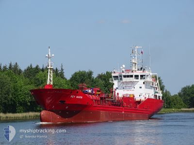
KEY MARIN
Oil/Chemical Tanker

Current Trip
NOSPG
| Time Travelled | 1 day |
|---|---|
| Remaining Time | --- |
| Distance Travelled | 323.60 nm |
| Remaining Distance | --- |
| AVG Speed | 10 Noeuds |
| MAX Speed | 11.7 Noeuds |
| AVG Wind | 11.6 knots |
| MAX Wind | 25.7 knots |
| MIN Temp | 5.4°C / 41.72°F |
| MAX Temp | 7.6°C / 45.68°F |
| Tirant d eau | 5.2 m |
| Position reçue | 7 h, 56 m depuis |
Current Position
| Longitude | --- |
|---|---|
| Latitude | --- |
| Etat | Under way using engine |
| Vitesse | 9.7 Noeuds |
| Parcours | 226.5° |
| Zone | North Sea |
| Station | T-AIS |
| Position reçue | 7 h, 56 m depuis |
Information
The current position of KEY MARIN is in North Sea with coordinates 55.18212° / 4.94825° as reported on 2025-03-27 22:17 by AIS to our vessel tracker app. The vessel's current speed is 9.7 Noeuds
The vessel KEY MARIN (IMO: 9297228, MMSI: 236342000) is a Oil/Chemical Tanker that was built in 2005 ( 20 Age ). It's sailing under the flag of [GI] Gibraltar.
In this page you can find informations about the vessels current position, last detected port calls, and current voyage information. If the vessels is not in coverage by AIS you will find the latest position.
The current position of KEY MARIN is detected by our AIS receivers and we are not responsible for the reliability of the data. The last position was recorded while the vessel was in Coverage by the Ais receivers of our vessel tracking app.
The current draught of KEY MARIN as reported by AIS is 5.2 meters
Weather
| Temperature | 7.2°C / 44.96°F |
|---|---|
| Wind Speed | 20 knots |
| Direction | 222° SW |
| Pressure | 1007.8 hPa |
| Humidity | 94.4 % |
| Cloud Coverage | 100 % |


Featured Company
Last Port Calls
| Port | Arrival | Departure | Time In Port |
|---|---|---|---|
| 2025-03-25 07:42 | 2025-03-26 16:01 | 1 d | |
| 2025-03-22 12:09 | 2025-03-22 17:17 | 5 h | |
| 2025-03-20 10:48 | 2025-03-20 16:49 | 6 h | |
| 2025-03-19 14:59 | 2025-03-20 09:45 | 18 h | |
| 2025-03-16 22:02 | 2025-03-16 22:49 | 46 m | |
| 2025-03-16 05:09 | 2025-03-16 07:21 | 2 h | |
| 2025-03-14 02:14 | 2025-03-15 00:16 | 22 h | |
| 2025-03-10 11:53 | 2025-03-13 16:00 | 3 d | |
| 2025-03-05 10:52 | 2025-03-06 15:43 | 1 d | |
| 2025-03-01 07:50 | 2025-03-01 21:13 | 13 h |
Last Trips
| Origin | Departure | Destination | Arrival | Distance | |
|---|---|---|---|---|---|
| 2025-03-22 17:17 | 2025-03-25 07:42 | 571.15 nm | |||
| 2025-03-20 16:49 | 2025-03-22 12:09 | 385.50 nm | |||
| 2025-03-20 09:45 | 2025-03-20 10:48 | 10.31 nm | |||
| 2025-03-16 22:49 | 2025-03-19 14:59 | 665.18 nm | |||
| 2025-03-16 07:21 | 2025-03-16 22:02 | 2.95 nm | |||
| 2025-03-15 00:16 | 2025-03-16 05:09 | 271.64 nm | |||
| 2025-03-13 16:00 | 2025-03-14 02:14 | 105.68 nm | |||
| 2025-03-06 15:43 | 2025-03-10 11:53 | 725.90 nm | |||
| 2025-03-01 21:13 | 2025-03-05 10:52 | 781.79 nm | |||
| 2025-02-25 02:08 | 2025-03-01 07:50 | 846.44 nm |
Events
| Heure | Evenement | Détails | Position/ Destination | Info |
|---|---|---|---|---|
| 2025-03-27 22:30 | Etat Changé | Default Under way using engine |
55.15835 / 4.90301
NOSPG
|
Vitesse: 9.7 kn Parcours: 226.5° |
| 2025-03-27 22:17 | Detecté en mer | German part of the North Sea |
55.18212 / 4.94825
North Sea
|
Vitesse: 9.7 kn Parcours: 226.5° |
| 2025-03-27 22:17 | Etat Changé | Under way using engine Default |
55.18212 / 4.94825
NOSPG
|
Vitesse: 9.8 kn Parcours: 227° |
| 2025-03-27 22:17 | Hors de la zone couverte |
55.18212 / 4.94825
North Sea
|
Vitesse: 9.7 kn Parcours: 226.5° |
|
| 2025-03-27 21:44 | Etat Changé | Default Under way using engine |
55.24305 / 5.06321
NOSPG
|
Vitesse: 9.6 kn Parcours: 227.9° |
| 2025-03-27 18:39 | Etat Changé | Under way using engine Default |
55.60321 / 5.66612
NOSPG
|
Vitesse: 9.9 kn Parcours: 216° |
| 2025-03-27 18:34 | Etat Changé | Default Under way using engine |
55.61322 / 5.67893
NOSPG
|
Vitesse: 9.9 kn Parcours: 214.2° |
| 2025-03-27 17:39 | Etat Changé | Under way using engine Default |
55.74181 / 5.83862
NOSPG
|
Vitesse: 10.2 kn Parcours: 218° |
| 2025-03-27 17:39 | Dans la zone couverte |
55.73874 / 5.83481
North Sea
|
Vitesse: 10.2 kn Parcours: 214° |
|
| 2025-03-27 15:27 | Hors de la zone couverte |
56.03859 / 6.24110
North Sea
|
Vitesse: 10.3 kn Parcours: 215.6° |