
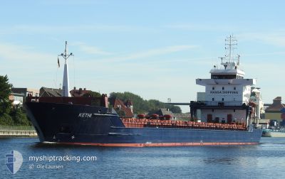
KETHI
General Cargo
Current Trip
| Trip Time | 23 days |
|---|---|
| Trip Distance | 2485.29 nm |
| AVG Speed | 10.2 Noeuds |
| MAX Speed | 10.2 Noeuds |
| Tirant d eau | 7.5 m |
| AVG Wind | 11.4 knots |
| MAX Wind | 40.3 knots |
| MIN Temp | -2.3°C / 27.86°F |
| MAX Temp | 15°C / 59°F |
| Position reçue | 3 d depuis |
Current Position
| Longitude | --- |
|---|---|
| Latitude | --- |
| Etat | Under way using engine |
| Vitesse | 11.6 Noeuds |
| Parcours | 103.3° |
| Zone | Gulf of Finland |
| Station | T-AIS |
| Position reçue | 3 d depuis |
Info
Information
The current position of KETHI is in Gulf of Finland with coordinates 60.05049° / 28.42901° as reported on 2025-03-11 20:46 by AIS to our vessel tracker app. The vessel's current speed is 11.6 Noeuds and is currently inside the port of ST PETERSBURG.
The vessel KETHI (IMO: 9263552, MMSI: 215540000) is a General Cargo that was built in 2002 ( 23 Age ). It's sailing under the flag of [MT] Malta.
In this page you can find informations about the vessels current position, last detected port calls, and current voyage information. If the vessels is not in coverage by AIS you will find the latest position.
The current position of KETHI is detected by our AIS receivers and we are not responsible for the reliability of the data. The last position was recorded while the vessel was in Coverage by the Ais receivers of our vessel tracking app.
The current draught of KETHI as reported by AIS is 7.5 meters
Weather
| Temperature | 1°C / 33.8°F |
|---|---|
| Wind Speed | 12 knots |
| Direction | 229° SW |
| Pressure | 1009.8 hPa |
| Humidity | 60.8 % |
| Cloud Coverage | 78 % |
Featured Company
Last Port Calls
| Port | Arrival | Departure | Time In Port |
|---|---|---|---|
| 2025-03-15 18:54 | |||
| 2025-02-16 21:29 | 2025-02-20 14:03 | 3 d | |
| 2025-02-12 03:25 | 2025-02-12 04:06 | 41 m | |
| 2025-01-28 07:21 | |||
| 2025-01-15 13:52 | 2025-01-16 15:00 | 1 d | |
| 2025-01-06 19:41 | 2025-01-11 16:08 | 4 d | |
| 2025-01-05 12:39 | 2025-01-05 14:00 | 1 h | |
| 2025-01-05 03:42 | 2025-01-05 04:24 | 41 m | |
| 2025-01-01 22:22 |
Last Trips
| Origin | Departure | Destination | Arrival | Distance | |
|---|---|---|---|---|---|
| 2025-02-20 14:03 | 2025-03-15 18:54 | 2485.29 nm | |||
| 2025-02-12 04:06 | 2025-02-16 21:29 | 1064.00 nm | |||
| 2025-01-16 15:00 | 2025-01-28 07:21 | 1796.65 nm | |||
| 2025-01-11 16:08 | 2025-01-15 13:52 | 760.45 nm | |||
| 2025-01-05 14:00 | 2025-01-06 19:41 | 285.25 nm | |||
| 2025-01-05 04:24 | 2025-01-05 12:39 | 50.27 nm | |||
| 2025-01-01 22:22 | 2025-01-05 03:42 | 797.08 nm |
Events
| Heure | Evenement | Détails | Position/ Destination | Info |
|---|---|---|---|---|
| 2025-03-15 16:30 | Arret |
59.89270 / 30.21629
[RU] ST PETERSBURG
|
Vitesse: 0.1 kn Parcours: 215° |
|
| 2025-03-15 15:54 | Port d'arrivée |
|
59.88880 / 30.16211
[RU] ST PETERSBURG
|
Vitesse: 8.2 kn Parcours: 112° |
| 2025-03-11 20:49 | Etat Changé | Default Under way using engine |
60.04788 / 28.45016
RU LED
|
Vitesse: 11.6 kn Parcours: 103.3° |
| 2025-03-11 20:46 | Etat Changé | Under way using engine Default |
60.05049 / 28.42901
RU LED
|
Vitesse: 11.7 kn Parcours: 131° |
| 2025-03-11 20:46 | Hors de la zone couverte |
60.05049 / 28.42901
Gulf of Finland
RU LED
|
Vitesse: 11.6 kn Parcours: 103.3° |
|
| 2025-03-11 20:14 | Etat Changé | Default Under way using engine |
60.11472 / 28.26644
RU LED
|
Vitesse: 11.7 kn Parcours: 105.2° |
| 2025-03-11 15:03 | Changement de zone | Russian part of the Gulf of Finland Estonian part of the Gulf of Finland |
59.95714 / 26.42280
Gulf of Finland
RU LED
|
Vitesse: 11.6 kn Parcours: 73.6° |
| 2025-03-11 14:28 | Etat Changé | Under way using engine Default |
59.92362 / 26.20149
RU LED
|
Vitesse: 11.6 kn Parcours: 72° |
| 2025-03-11 14:21 | Dans la zone couverte |
59.92379 / 26.20251
Gulf of Finland
RU LED
|
Vitesse: 11.7 kn Parcours: 71.1° |
|
| 2025-03-11 11:14 | Hors de la zone couverte |
59.77877 / 24.99397
Gulf of Finland
RU LED
|
Vitesse: 11.4 kn Parcours: 78.1° |