
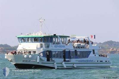
KEPHRENN
Passenger
Current Trip
| Time Travelled | 6 days |
|---|---|
| Remaining Time | 1 h, 21 mins |
| Distance Travelled | 169.96 nm |
| Remaining Distance | 15.50 nm |
| AVG Speed | 8.5 Noeuds |
| MAX Speed | 15.7 Noeuds |
| AVG Wind | 8.1 knots |
| MAX Wind | 13 knots |
| MIN Temp | 11°C / 51.8°F |
| MAX Temp | 16.2°C / 61.16°F |
| Tirant d eau | 1.7 m |
| Position reçue | 1 m depuis |
Current Position
| Longitude | -3.04288° |
|---|---|
| Latitude | 48.84546° |
| Etat | Under way using engine |
| Vitesse | 14.3 Noeuds |
| Parcours | 227° |
| Zone | English Channel |
| Station | T-AIS |
| Position reçue | 1 m depuis |
Info
Information
The current position of KEPHRENN is in English Channel with coordinates 48.84546° / -3.04288° as reported on 2024-05-23 13:19 by AIS to our vessel tracker app. The vessel's current speed is 14.3 Noeuds and is heading at the port of SAINT QUAY PORTRIEUX. The estimated time of arrival as calculated by MyShipTracking vessel tracking app is 2024-05-23 14:41 LT
The vessel KEPHRENN (IMO: 9961635, MMSI: 228142450) is a Passenger It's sailing under the flag of [FR] France.
In this page you can find informations about the vessels current position, last detected port calls, and current voyage information. If the vessels is not in coverage by AIS you will find the latest position.
The current position of KEPHRENN is detected by our AIS receivers and we are not responsible for the reliability of the data. The last position was recorded while the vessel was in Coverage by the Ais receivers of our vessel tracking app.
The current draught of KEPHRENN as reported by AIS is 1.7 meters
Weather
| Temperature | 14°C / 57.2°F |
|---|---|
| Wind Speed | 13 knots |
| Direction | 339° NNW |
| Pressure | 1017.2 hPa |
| Humidity | 81.9 % |
| Cloud Coverage | 53 % |
Featured Company
Last Port Calls
| Port | Arrival | Departure | Time In Port |
|---|---|---|---|
| 2024-05-16 14:30 | 2024-05-16 14:46 | 15 m | |
| 2024-05-16 11:34 | 2024-05-16 12:02 | 28 m | |
| 2024-04-25 16:34 | 2024-04-25 16:45 | 10 m | |
| 2024-04-25 15:58 | 2024-04-25 16:14 | 15 m | |
| 2024-04-25 06:18 | 2024-04-25 06:30 | 12 m | |
| 2024-04-25 05:49 | 2024-04-25 06:02 | 12 m | |
| 2024-04-05 13:59 | 2024-04-05 14:19 | 20 m | |
| 2024-04-05 09:59 | 2024-04-05 11:35 | 1 h | |
| 2024-04-04 13:55 | 2024-04-05 07:47 | 17 h | |
| 2024-04-04 11:19 | 2024-04-04 11:43 | 23 m |
Most Visited Ports (Last year)
| Port | Arrivals | |
|---|---|---|
| 23 | ||
| 3 | ||
| 2 | ||
| 1 |
Last Trips
| Origin | Departure | Destination | Arrival | Distance | |
|---|---|---|---|---|---|
| 2024-05-16 14:02 | 2024-05-16 16:30 | 30.97 nm | |||
| 2024-04-25 18:45 | 2024-05-16 13:34 | 667.48 nm | |||
| 2024-04-25 18:14 | 2024-04-25 18:34 | 2.96 nm | |||
| 2024-04-25 08:30 | 2024-04-25 17:58 | 55.92 nm | |||
| 2024-04-25 08:02 | 2024-04-25 08:18 | 3.11 nm | |||
| 2024-04-05 16:19 | 2024-04-25 07:49 | 382.81 nm | |||
| 2024-04-05 13:35 | 2024-04-05 15:59 | 28.72 nm | |||
| 2024-04-05 09:47 | 2024-04-05 11:59 | 30.05 nm | |||
| 2024-04-04 13:43 | 2024-04-04 15:55 | 30.41 nm | |||
| 2024-04-02 16:15 | 2024-04-04 13:19 | 48.43 nm |
Events
| Heure | Evenement | Détails | Position/ Destination | Info |
|---|---|---|---|---|
| 2024-05-23 12:43 | Démarrage | 8.81 nm, East of TREGUIER |
48.82826 / -3.00844
BREHAT
|
Vitesse: 10.1 kn Parcours: 14.9° |
| 2024-05-23 12:31 | Arret | 8.57 nm, East of TREGUIER |
48.82387 / -3.01282
BREHAT
|
Vitesse: 0.1 kn Parcours: 189° |
| 2024-05-23 12:25 | Démarrage | 8.94 nm, East of TREGUIER |
48.83207 / -3.00686
BREHAT
|
Vitesse: 8.2 kn Parcours: 195.7° |
| 2024-05-23 12:21 | Etat Changé | Under way using engine Default |
48.83605 / -3.00953
BREHAT
|
Vitesse: Parcours: -1° |
| 2024-05-23 12:07 | Etat Changé | Default Under way using engine |
48.83604 / -3.00953
BREHAT
|
Vitesse: 0.8 kn Parcours: 34° |
| 2024-05-23 11:09 | Etat Changé | Under way using engine Default |
48.83437 / -3.00558
BREHAT
|
Vitesse: 0.3 kn Parcours: 330° |
| 2024-05-23 11:07 | Etat Changé | Default Under way using engine |
48.83430 / -3.00568
BREHAT
|
Vitesse: 0.2 kn Parcours: 5° |
| 2024-05-23 10:49 | Arret | 9.01 nm, East of TREGUIER |
48.83427 / -3.00604
BREHAT
|
Vitesse: 0.3 kn Parcours: 34° |
| 2024-05-23 10:43 | Démarrage | 8.99 nm, East of TREGUIER |
48.83430 / -3.00667
BREHAT
|
Vitesse: 5.1 kn Parcours: 143.7° |
| 2024-05-23 10:37 | Arret | 8.92 nm, East of TREGUIER |
48.83600 / -3.00932
BREHAT
|
Vitesse: 0.3 kn Parcours: 358° |