

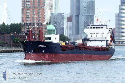
KAMELIA
General Cargo

Current Trip
| Time Travelled | 16 h, 59 mins |
|---|---|
| Remaining Time | 2 days |
| Distance Travelled | 181.46 nm |
| Remaining Distance | 765.31 nm |
| AVG Speed | 10.8 Noeuds |
| MAX Speed | 11.3 Noeuds |
| AVG Wind | 16.3 knots |
| MAX Wind | 21.9 knots |
| MIN Temp | 0.6°C / 33.08°F |
| MAX Temp | 4.8°C / 40.64°F |
| Tirant d eau | 6 m |
| Position reçue | 1 m depuis |
Current Position
| Longitude | --- |
|---|---|
| Latitude | --- |
| Etat | Under way using engine |
| Vitesse | 11.3 Noeuds |
| Parcours | 247.7° |
| Zone | Baltic Sea |
| Station | T-AIS |
| Position reçue | 1 m depuis |
Information
The current position of KAMELIA is in Baltic Sea with coordinates 54.95192° / 15.94077° as reported on 2025-02-23 13:52 by AIS to our vessel tracker app. The vessel's current speed is 11.3 Noeuds and is heading at the port of SCHIEDAM. The estimated time of arrival as calculated by MyShipTracking vessel tracking app is 2025-02-26 10:57 LT
The vessel KAMELIA (IMO: 9188958, MMSI: 229245000) is a General Cargo that was built in 1999 ( 26 Age ). It's sailing under the flag of [MT] Malta.
In this page you can find informations about the vessels current position, last detected port calls, and current voyage information. If the vessels is not in coverage by AIS you will find the latest position.
The current position of KAMELIA is detected by our AIS receivers and we are not responsible for the reliability of the data. The last position was recorded while the vessel was in Coverage by the Ais receivers of our vessel tracking app.
The current draught of KAMELIA as reported by AIS is 6 meters
Weather
| Temperature | 4.7°C / 40.46°F |
|---|---|
| Wind Speed | 6 knots |
| Direction | 288° WNW |
| Pressure | 1024 hPa |
| Humidity | 97.4 % |
| Cloud Coverage | 100 % |


Featured Company
Last Port Calls
| Port | Arrival | Departure | Time In Port |
|---|---|---|---|
| 2025-02-20 21:02 | 2025-02-22 20:54 | 1 d | |
| 2025-02-12 18:53 | 2025-02-18 10:33 | 5 d | |
| 2025-02-06 00:43 | 2025-02-07 16:21 | 1 d | |
| 2025-02-04 20:30 | 2025-02-05 22:21 | 1 d | |
| 2025-01-29 20:57 | 2025-01-31 05:01 | 1 d | |
| 2025-01-27 15:32 | 2025-01-28 20:29 | 1 d | |
| 2025-01-25 21:04 | 2025-01-25 21:06 | 2 m | |
| 2025-01-23 00:06 | 2025-01-24 04:29 | 1 d | |
| 2025-01-18 21:01 | 2025-01-22 10:31 | 3 d | |
| 2025-01-12 19:17 | 2025-01-14 07:13 | 1 d |
Last Trips
| Origin | Departure | Destination | Arrival | Distance | |
|---|---|---|---|---|---|
| 2025-02-18 13:33 | 2025-02-20 23:02 | 486.41 nm | |||
| 2025-02-07 17:21 | 2025-02-12 21:53 | 1136.41 nm | |||
| 2025-02-05 23:21 | 2025-02-06 01:43 | 22.36 nm | |||
| 2025-01-31 07:01 | 2025-02-04 21:30 | 894.33 nm | |||
| 2025-01-28 21:29 | 2025-01-29 22:57 | 281.56 nm | |||
| 2025-01-25 22:06 | 2025-01-27 16:32 | 465.53 nm | |||
| 2025-01-24 05:29 | 2025-01-25 22:04 | 381.54 nm | |||
| 2025-01-22 11:31 | 2025-01-23 01:06 | 120.74 nm | |||
| 2025-01-14 09:13 | 2025-01-18 22:01 | 1064.82 nm | |||
| 2025-01-10 12:48 | 2025-01-12 21:17 | 306.95 nm |
Events
| Heure | Evenement | Détails | Position/ Destination | Info |
|---|---|---|---|---|
| 2025-02-23 12:47 | Dans la zone couverte |
55.02288 / 16.26856
Baltic Sea
NLSCI
|
Vitesse: 11.1 kn Parcours: 245.4° |
|
| 2025-02-23 05:28 | Etat Changé | Default Under way using engine |
55.29965 / 18.55658
NLSCI
|
Vitesse: 10.1 kn Parcours: 252° |
| 2025-02-23 05:21 | Hors de la zone couverte |
55.30650 / 18.59118
Baltic Sea
NLSCI
|
Vitesse: 10.1 kn Parcours: 252° |
|
| 2025-02-23 03:49 | Changement de zone | Polish part of the Baltic Sea Russian part of the Baltic Sea |
55.38821 / 19.04488
Baltic Sea
NLSCI
|
Vitesse: 10.5 kn Parcours: 253.1° |
| 2025-02-23 03:44 | Dans la zone couverte |
55.39009 / 19.05560
Baltic Sea
NLSCI
|
Vitesse: 10.5 kn Parcours: 253.2° |
|
| 2025-02-23 02:07 | Etat Changé | Default Under way using engine |
55.47957 / 19.54406
NLSCI
|
Vitesse: 10.5 kn Parcours: 254.7° |
| 2025-02-23 01:58 | Etat Changé | Under way using engine Default |
55.48722 / 19.58608
NLSCI
|
Vitesse: 10.5 kn Parcours: 250° |
| 2025-02-23 00:44 | Etat Changé | Default Under way using engine |
55.55607 / 19.95223
NLSCI
|
Vitesse: 10.5 kn Parcours: 250.7° |
| 2025-02-23 00:34 | Etat Changé | Under way using engine Default |
55.56467 / 19.99968
NLSCI
|
Vitesse: 10.7 kn Parcours: 254° |
| 2025-02-23 00:34 | Hors de la zone couverte |
55.56467 / 19.99968
Baltic Sea
NLSCI
|
Vitesse: 10.5 kn Parcours: 250.7° |