
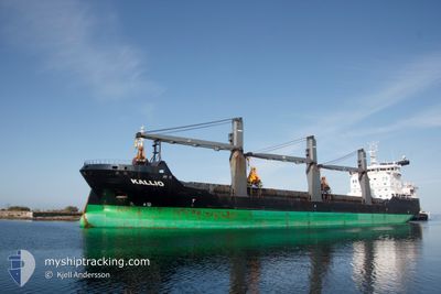
KALLIO
General Cargo
Current Trip
| Time Travelled | 22 h, 35 mins |
|---|---|
| Remaining Time | --- |
| Distance Travelled | 232.04 nm |
| Remaining Distance | --- |
| AVG Speed | 10.9 Noeuds |
| MAX Speed | 19.3 Noeuds |
| AVG Wind | 15.7 knots |
| MAX Wind | 21.3 knots |
| MIN Temp | 2.9°C / 37.22°F |
| MAX Temp | 6.6°C / 43.88°F |
| Tirant d eau | 6.5 m |
| Position reçue | 20 m depuis |
Current Position
| Longitude | --- |
|---|---|
| Latitude | --- |
| Etat | Under way using engine |
| Vitesse | 10.8 Noeuds |
| Parcours | 258.5° |
| Zone | English Channel |
| Station | T-AIS |
| Position reçue | 20 m depuis |
Info
Information
The current position of KALLIO is in English Channel with coordinates 50.28098° / -1.32430° as reported on 2025-03-15 12:29 by AIS to our vessel tracker app. The vessel's current speed is 10.8 Noeuds and is heading at the port of GIJON. The estimated time of arrival as calculated by MyShipTracking vessel tracking app is 2025-03-17 15:00 LT
The vessel KALLIO (IMO: 9319064, MMSI: 230645000) is a General Cargo that was built in 2006 ( 19 Age ). It's sailing under the flag of [FI] Finland.
In this page you can find informations about the vessels current position, last detected port calls, and current voyage information. If the vessels is not in coverage by AIS you will find the latest position.
The current position of KALLIO is detected by our AIS receivers and we are not responsible for the reliability of the data. The last position was recorded while the vessel was in Coverage by the Ais receivers of our vessel tracking app.
The current draught of KALLIO as reported by AIS is 6.5 meters
Weather
| Temperature | 6.3°C / 43.34°F |
|---|---|
| Wind Speed | 19 knots |
| Direction | 48° NE |
| Pressure | 1021.5 hPa |
| Humidity | 62.6 % |
| Cloud Coverage | 21 % |
Featured Company
Last Port Calls
| Port | Arrival | Departure | Time In Port |
|---|---|---|---|
| 2025-03-13 03:04 | 2025-03-14 15:15 | 1 d | |
| 2025-02-23 08:33 | 2025-03-01 15:52 | 6 d | |
| 2025-02-17 07:13 | 2025-02-20 08:40 | 3 d | |
| 2025-01-19 18:47 | 2025-01-23 09:48 | 3 d | |
| 2025-01-16 20:27 | 2025-01-17 12:18 | 15 h | |
| 2025-01-15 01:41 | 2025-01-16 13:55 | 1 d | |
| 2025-01-12 22:23 | 2025-01-14 17:16 | 1 d | |
| 2025-01-11 18:47 | 2025-01-12 15:26 | 20 h | |
| 2025-01-10 16:03 | 2025-01-11 10:12 | 18 h | |
| 2025-01-10 09:26 |
Last Trips
| Origin | Departure | Destination | Arrival | Distance | |
|---|---|---|---|---|---|
| 2025-03-01 15:52 | 2025-03-13 03:04 | 2724.38 nm | |||
| 2025-02-20 08:40 | 2025-02-23 08:33 | 560.53 nm | |||
| 2025-01-23 09:48 | 2025-02-17 07:13 | 4679.00 nm | |||
| 2025-01-17 12:18 | 2025-01-19 18:47 | 513.28 nm | |||
| 2025-01-16 13:55 | 2025-01-16 20:27 | 77.30 nm | |||
| 2025-01-14 17:16 | 2025-01-15 01:41 | 79.52 nm | |||
| 2025-01-12 15:26 | 2025-01-12 22:23 | 74.00 nm | |||
| 2025-01-11 10:12 | 2025-01-11 18:47 | 80.13 nm | |||
| 2025-01-10 09:26 | 2025-01-10 16:03 | 78.22 nm | |||
| 2025-01-06 18:29 | 2025-01-07 06:07 | 78.20 nm |
Events
| Heure | Evenement | Détails | Position/ Destination | Info |
|---|---|---|---|---|
| 2025-03-15 12:35 | Etat Changé | Default Under way using engine |
50.27672 / -1.35152
ES GIJ
|
Vitesse: 10.8 kn Parcours: 258.5° |
| 2025-03-15 12:29 | Etat Changé | Under way using engine Default |
50.28098 / -1.32430
ES GIJ
|
Vitesse: 10.7 kn Parcours: 261° |
| 2025-03-15 12:15 | Etat Changé | Default Under way using engine |
50.28639 / -1.26030
ES GIJ
|
Vitesse: 10.5 kn Parcours: 253.9° |
| 2025-03-15 12:02 | Etat Changé | Under way using engine Default |
50.29461 / -1.20228
ES GIJ
|
Vitesse: 10.5 kn Parcours: 253° |
| 2025-03-15 11:47 | Etat Changé | Default Under way using engine |
50.30650 / -1.13715
ES GIJ
|
Vitesse: 10.4 kn Parcours: 252.9° |
| 2025-03-15 11:41 | Etat Changé | Under way using engine Default |
50.31141 / -1.11055
ES GIJ
|
Vitesse: 10.7 kn Parcours: 252° |
| 2025-03-15 11:19 | Etat Changé | Default Under way using engine |
50.32868 / -1.01505
ES GIJ
|
Vitesse: 10.4 kn Parcours: 253.3° |
| 2025-03-15 00:55 | Changement de zone | United Kingdom part of the English Channel United Kingdom part of the North Sea |
51.07323 / 1.46831
English Channel
ES GIJ
|
Vitesse: 11.1 kn Parcours: 224.3° |
| 2025-03-14 21:52 | Changement de zone | United Kingdom part of the North Sea French part of the North Sea |
51.40006 / 2.05915
North Sea
ES GIJ
|
Vitesse: 11 kn Parcours: 294.1° |
| 2025-03-14 20:50 | Changement de zone | French part of the North Sea Belgian part of the North Sea |
51.35222 / 2.32986
North Sea
ES GIJ
|
Vitesse: 10.7 kn Parcours: 254.1° |