
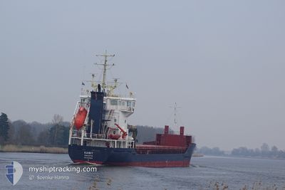
KAIRIT
General Cargo
Current Trip
RULED
| Time Travelled | 9 days |
|---|---|
| Remaining Time | --- |
| Distance Travelled | 25.56 nm |
| Remaining Distance | --- |
| AVG Speed | 10.6 Noeuds |
| MAX Speed | 10.7 Noeuds |
| AVG Wind | 8.7 knots |
| MAX Wind | 19.8 knots |
| MIN Temp | -2.8°C / 26.96°F |
| MAX Temp | 4°C / 39.2°F |
| Tirant d eau | 4 m |
| Position reçue | 7 d depuis |
Current Position
| Longitude | 29.38862° |
|---|---|
| Latitude | 60.03722° |
| Etat | At anchor |
| Vitesse | 0.5 Noeuds |
| Parcours | 69° |
| Zone | Gulf of Finland |
| Station | T-AIS |
| Position reçue | 7 d depuis |
Info
Information
The current position of KAIRIT is in Gulf of Finland with coordinates 60.03722° / 29.38862° as reported on 2024-04-19 04:21 by AIS to our vessel tracker app. The vessel's current speed is 0.5 Noeuds
The vessel KAIRIT (IMO: 9195949, MMSI: 229241000) is a General Cargo that was built in 2000 ( 24 Age ). It's sailing under the flag of [MT] Malta.
In this page you can find informations about the vessels current position, last detected port calls, and current voyage information. If the vessels is not in coverage by AIS you will find the latest position.
The current position of KAIRIT is detected by our AIS receivers and we are not responsible for the reliability of the data. The last position was recorded while the vessel was in Coverage by the Ais receivers of our vessel tracking app.
The current draught of KAIRIT as reported by AIS is 4 meters
Weather
| Temperature | -0.7°C / 30.74°F |
|---|---|
| Wind Speed | 1 knots |
| Direction | 101° E |
| Pressure | 1021 hPa |
| Humidity | 79 % |
| Cloud Coverage | 85 % |
Featured Company
Last Port Calls
| Port | Arrival | Departure | Time In Port |
|---|---|---|---|
| 2024-04-16 04:49 | 2024-04-16 21:23 | 16 h | |
| 2024-04-01 11:05 | 2024-04-02 20:11 | 1 d | |
| 2024-03-22 18:24 | 2024-03-26 23:14 | 4 d | |
| 2024-03-20 01:35 | 2024-03-21 00:46 | 23 h | |
| 2024-03-18 08:08 | 2024-03-18 08:43 | 35 m | |
| 2024-03-14 11:11 | 2024-03-15 21:02 | 1 d | |
| 2024-03-13 00:06 | 2024-03-14 01:19 | 1 d | |
| 2024-03-06 09:28 | 2024-03-08 12:40 | 2 d | |
| 2024-03-02 18:43 | 2024-03-05 13:15 | 2 d | |
| 2024-02-29 06:45 | 2024-02-29 07:49 | 1 h |
Last Trips
| Origin | Departure | Destination | Arrival | Distance | |
|---|---|---|---|---|---|
| 2024-04-02 23:11 | 2024-04-16 07:49 | 178.83 nm | |||
| 2024-03-26 23:14 | 2024-04-01 14:05 | 1242.28 nm | |||
| 2024-03-21 01:46 | 2024-03-22 18:24 | 398.72 nm | |||
| 2024-03-18 09:43 | 2024-03-20 02:35 | 353.97 nm | |||
| 2024-03-15 23:02 | 2024-03-18 09:08 | 577.20 nm | |||
| 2024-03-14 03:19 | 2024-03-14 13:11 | 100.28 nm | |||
| 2024-03-08 13:40 | 2024-03-13 02:06 | 855.65 nm | |||
| 2024-03-05 14:15 | 2024-03-06 10:28 | 193.19 nm | |||
| 2024-02-29 08:49 | 2024-03-02 19:43 | 355.05 nm | |||
| 2024-02-27 13:40 | 2024-02-29 07:45 | 408.05 nm |
Events
| Heure | Evenement | Détails | Position/ Destination | Info |
|---|---|---|---|---|
| 2024-04-21 02:18 | Démarrage | 10.7 nm, North West of BRONKA |
60.03517 / 29.39297
RULED
|
Vitesse: 7.5 kn Parcours: 124° |
| 2024-04-19 04:21 | Hors de la zone couverte |
60.03722 / 29.38862
Gulf of Finland
|
Vitesse: 0.5 kn Parcours: 122.9° |
|
| 2024-04-19 04:21 | Dans la zone couverte |
60.03722 / 29.38862
Gulf of Finland
|
Vitesse: 0.5 kn Parcours: 122.9° |
|
| 2024-04-18 18:14 | Hors de la zone couverte |
60.03737 / 29.38892
Gulf of Finland
|
Vitesse: 0.5 kn Parcours: 225.7° |
|
| 2024-04-18 18:14 | Dans la zone couverte |
60.03737 / 29.38892
Gulf of Finland
|
Vitesse: 0.5 kn Parcours: 225.7° |
|
| 2024-04-18 12:59 | Etat Changé | Default At anchor |
60.03787 / 29.38898
RULED
|
Vitesse: 0.1 kn Parcours: 84° |
| 2024-04-18 12:23 | Hors de la zone couverte |
60.03763 / 29.38885
Gulf of Finland
|
Vitesse: 0.1 kn Parcours: 252.4° |
|
| 2024-04-18 07:53 | Etat Changé | At anchor Default |
60.03740 / 29.38898
RULED
|
Vitesse: Parcours: 81° |
| 2024-04-18 07:25 | Etat Changé | Default At anchor |
60.03750 / 29.38887
RULED
|
Vitesse: 1.3 kn Parcours: 76° |
| 2024-04-18 07:21 | Tirant d'eau modifié | 4 3.8 |
60.03724 / 29.38899
RULED
|
Vitesse: 1.3 kn Parcours: 76° |