
JULIE
General Cargo
Current Trip
| Time Travelled | 3 days |
|---|---|
| Remaining Time | --- |
| Distance Travelled | 902.15 nm |
| Remaining Distance | --- |
| AVG Speed | 11.4 Noeuds |
| MAX Speed | 15 Noeuds |
| AVG Wind | 10.5 knots |
| MAX Wind | 20 knots |
| MIN Temp | 13.3°C / 55.94°F |
| MAX Temp | 28.4°C / 83.12°F |
| Tirant d eau | 7.6 m |
| Position reçue | 21 h, 6 m depuis |
Current Position
| Longitude | -5.43219° |
|---|---|
| Latitude | 54.84779° |
| Etat | Under way using engine |
| Vitesse | 10.5 Noeuds |
| Parcours | 328° |
| Zone | Inner Seas off the West Coast of Scotland |
| Station | T-AIS |
| Position reçue | 21 h, 6 m depuis |
Info
Information
The current position of JULIE is in Inner Seas off the West Coast of Scotland with coordinates 54.84779° / -5.43219° as reported on 2024-08-31 04:41 by AIS to our vessel tracker app. The vessel's current speed is 10.5 Noeuds and is heading at the port of HUSAVIK. The estimated time of arrival as calculated by MyShipTracking vessel tracking app is 2024-09-03 20:00 LT
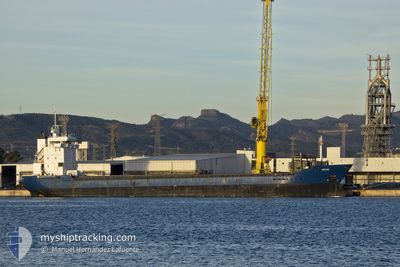
The vessel JULIE (IMO: 9277307, MMSI: 255805981) is a General Cargo that was built in 2003 ( 21 Age ). It's sailing under the flag of [PT] Portugal.
In this page you can find informations about the vessels current position, last detected port calls, and current voyage information. If the vessels is not in coverage by AIS you will find the latest position.
The current position of JULIE is detected by our AIS receivers and we are not responsible for the reliability of the data. The last position was recorded while the vessel was in Coverage by the Ais receivers of our vessel tracking app.
The current draught of JULIE as reported by AIS is 7.6 meters
Weather
| Temperature | 14.3°C / 57.74°F |
|---|---|
| Wind Speed | 19 knots |
| Direction | 156° SSE |
| Pressure | 1020.1 hPa |
| Humidity | 82.8 % |
| Cloud Coverage | 1 % |
Featured Company
Last Port Calls
| Port | Arrival | Departure | Time In Port |
|---|---|---|---|
| 2024-08-24 07:22 | 2024-08-28 13:21 | 4 d | |
| 2024-08-20 09:17 | 2024-08-21 02:41 | 17 h | |
| 2024-08-18 21:02 | 2024-08-19 19:24 | 22 h | |
| 2024-08-13 10:10 | 2024-08-15 13:44 | 2 d | |
| 2024-08-09 09:39 | 2024-08-11 16:09 | 2 d | |
| 2024-08-03 23:04 | 2024-08-05 09:11 | 1 d | |
| 2024-07-31 15:01 | 2024-07-31 19:07 | 4 h | |
| 2024-07-29 06:37 | 2024-07-29 22:30 | 15 h | |
| 2024-07-26 11:31 | 2024-07-26 22:00 | 10 h | |
| 2024-07-22 07:53 | 2024-07-23 16:35 | 1 d |
Most Visited Ports (Last year)
| Port | Arrivals | |
|---|---|---|
| 9 | ||
| 8 | ||
| 8 | ||
| 7 | ||
| 6 | ||
| 4 |
Last Trips
| Origin | Departure | Destination | Arrival | Distance | |
|---|---|---|---|---|---|
| 2024-08-21 04:41 | 2024-08-24 09:22 | 761.04 nm | |||
| 2024-08-19 21:24 | 2024-08-20 11:17 | 123.03 nm | |||
| 2024-08-15 15:44 | 2024-08-18 23:02 | 416.70 nm | |||
| 2024-08-11 18:09 | 2024-08-13 12:10 | 168.86 nm | |||
| 2024-08-05 11:11 | 2024-08-09 11:39 | 770.42 nm | |||
| 2024-07-31 21:07 | 2024-08-04 01:04 | 417.98 nm | |||
| 2024-07-29 23:30 | 2024-07-31 17:01 | 465.43 nm | |||
| 2024-07-27 00:00 | 2024-07-29 07:37 | 596.71 nm | |||
| 2024-07-23 16:35 | 2024-07-26 13:31 | 713.15 nm | |||
| 2024-07-12 05:01 | 2024-07-22 07:53 | 2465.70 nm |
Events
| Heure | Evenement | Détails | Position/ Destination | Info |
|---|---|---|---|---|
| 2024-08-31 04:47 | Etat Changé | Default Under way using engine |
54.86097 / -5.44671
HUSAVIK
|
Vitesse: 10.5 kn Parcours: 328° |
| 2024-08-31 04:41 | Hors de la zone couverte |
54.84779 / -5.43219
Inner Seas off the West Coast of Scotland
HUSAVIK
|
Vitesse: 10.5 kn Parcours: 328° |
|
| 2024-08-31 04:23 | Etat Changé | Under way using engine Default |
54.80116 / -5.38373
HUSAVIK
|
Vitesse: 11 kn Parcours: 328° |
| 2024-08-31 04:23 | Etat Changé | Default Under way using engine |
54.79986 / -5.38233
HUSAVIK
|
Vitesse: 11.1 kn Parcours: 329.8° |
| 2024-08-31 04:03 | Etat Changé | Under way using engine Default |
54.74553 / -5.33821
HUSAVIK
|
Vitesse: 11.3 kn Parcours: 342° |
| 2024-08-31 04:03 | Etat Changé | Default Under way using engine |
54.74449 / -5.33762
HUSAVIK
|
Vitesse: 11.2 kn Parcours: 341.4° |
| 2024-08-31 03:42 | Etat Changé | Under way using engine Default |
54.68167 / -5.30297
HUSAVIK
|
Vitesse: 11.4 kn Parcours: 343° |
| 2024-08-31 03:39 | Etat Changé | Default Under way using engine |
54.67312 / -5.29860
HUSAVIK
|
Vitesse: 11.4 kn Parcours: 343.1° |
| 2024-08-31 02:40 | Changement de zone | United Kingdom part of the Inner Seas off the West Coast of Scotland United Kingdom part of the Irish Sea and St. George's Channel |
54.49268 / -5.20316
Inner Seas off the West Coast of Scotland
HUSAVIK
|
Vitesse: 11.5 kn Parcours: 342.6° |
| 2024-08-31 01:47 | Etat Changé | Under way using engine Default |
54.32367 / -5.17683
HUSAVIK
|
Vitesse: 11.4 kn Parcours: 356° |