
JOLLY ARGENTO
Container Ship
Current Trip
| Time Travelled | 1 day |
|---|---|
| Remaining Time | 1 day |
| Distance Travelled | 379.33 nm |
| Remaining Distance | 612.25 nm |
| AVG Speed | 13.4 Noeuds |
| MAX Speed | 14.5 Noeuds |
| AVG Wind | 5.6 knots |
| MAX Wind | 15.4 knots |
| MIN Temp | 15.2°C / 59.36°F |
| MAX Temp | 23°C / 73.4°F |
| Tirant d eau | 9.7 m |
| Position reçue | 34 m depuis |
Current Position
| Longitude | 19.35463° |
|---|---|
| Latitude | 36.35785° |
| Etat | Under way using engine |
| Vitesse | 13.4 Noeuds |
| Parcours | 117.3° |
| Zone | Mediterranean Sea - Eastern Basin |
| Station | T-AIS |
| Position reçue | 34 m depuis |
Info
Information
The current position of JOLLY ARGENTO is in Mediterranean Sea - Eastern Basin with coordinates 36.35785° / 19.35463° as reported on 2024-06-05 08:20 by AIS to our vessel tracker app. The vessel's current speed is 13.4 Noeuds and is heading at the port of ALEXANDRIA. The estimated time of arrival as calculated by MyShipTracking vessel tracking app is 2024-06-07 07:13 LT
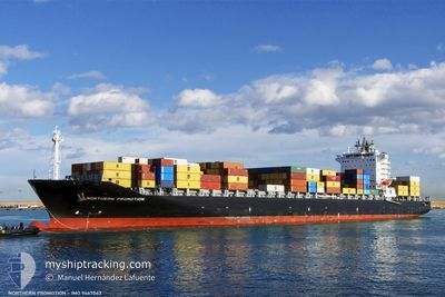
The vessel JOLLY ARGENTO (IMO: 9467043, MMSI: 255805666) is a Container Ship that was built in 2010 ( 14 Age ). It's sailing under the flag of [PT] Portugal.
In this page you can find informations about the vessels current position, last detected port calls, and current voyage information. If the vessels is not in coverage by AIS you will find the latest position.
The current position of JOLLY ARGENTO is detected by our AIS receivers and we are not responsible for the reliability of the data. The last position was recorded while the vessel was in Coverage by the Ais receivers of our vessel tracking app.
The current draught of JOLLY ARGENTO as reported by AIS is 9.7 meters
Weather
| Temperature | 22.7°C / 72.86°F |
|---|---|
| Wind Speed | 13 knots |
| Direction | 11° N |
| Pressure | 1014 hPa |
| Humidity | 79.2 % |
| Cloud Coverage | 4 % |
Featured Company
Last Port Calls
| Port | Arrival | Departure | Time In Port |
|---|---|---|---|
| 2024-06-03 03:41 | 2024-06-04 04:42 | 1 d | |
| 2024-05-26 07:45 | 2024-06-01 13:36 | 6 d | |
| 2024-05-20 02:18 | 2024-05-20 11:16 | 8 h | |
| 2024-05-16 16:09 | 2024-05-17 22:45 | 1 d | |
| 2024-05-05 10:11 | 2024-05-08 01:07 | 2 d | |
| 2024-04-29 19:37 | 2024-04-30 18:03 | 22 h | |
| 2024-04-23 11:39 | 2024-04-28 00:51 | 4 d |
Most Visited Ports (Last year)
| Port | Arrivals | |
|---|---|---|
| 6 | ||
| 5 | ||
| 5 | ||
| 4 | ||
| 4 | ||
| 3 |
Last Trips
| Origin | Departure | Destination | Arrival | Distance | |
|---|---|---|---|---|---|
| 2024-06-01 15:36 | 2024-06-03 05:41 | 378.65 nm | |||
| 2024-05-18 01:45 | 2024-05-26 09:45 | 2156.86 nm | |||
| 2024-05-18 01:45 | 2024-05-20 04:18 | 630.56 nm | |||
| 2024-05-08 04:07 | 2024-05-16 19:09 | 2816.03 nm | |||
| 2024-04-30 20:03 | 2024-05-05 13:11 | 1517.32 nm | |||
| 2024-04-28 02:51 | 2024-04-29 21:37 | 351.78 nm | |||
| 2024-03-24 16:48 | 2024-04-23 13:39 | 2579.83 nm |
Events
| Heure | Evenement | Détails | Position/ Destination | Info |
|---|---|---|---|---|
| 2024-06-05 08:23 | Etat Changé | Default Under way using engine |
36.35216 / 19.36840
EGALY
|
Vitesse: 13.4 kn Parcours: 117.3° |
| 2024-06-05 08:20 | Etat Changé | Under way using engine Default |
36.35785 / 19.35463
EGALY
|
Vitesse: 13.3 kn Parcours: 118° |
| 2024-06-05 08:03 | Etat Changé | Default Under way using engine |
36.38652 / 19.28597
EGALY
|
Vitesse: 13.4 kn Parcours: 117.8° |
| 2024-06-05 08:00 | Changement de zone | Greek part of the Mediterranean Sea - Eastern Basin Greek part of the Ionian Sea |
36.39290 / 19.27095
Mediterranean Sea - Eastern Basin
EGALY
|
Vitesse: 13.4 kn Parcours: 117.8° |
| 2024-06-05 08:00 | Etat Changé | Under way using engine Default |
36.39290 / 19.27095
EGALY
|
Vitesse: 13.5 kn Parcours: 118° |
| 2024-06-05 07:43 | Dans la zone couverte |
36.39290 / 19.27095
Mediterranean Sea - Eastern Basin
EGALY
|
Vitesse: 13.4 kn Parcours: 117.8° |
|
| 2024-06-05 06:56 | Etat Changé | Default Under way using engine |
36.50539 / 19.01241
EGALY
|
Vitesse: 12.9 kn Parcours: 119.7° |
| 2024-06-05 06:52 | Etat Changé | Under way using engine Default |
36.51215 / 18.99766
EGALY
|
Vitesse: 12.9 kn Parcours: 117° |
| 2024-06-05 06:52 | Hors de la zone couverte |
36.51215 / 18.99766
Ionian Sea
EGALY
|
Vitesse: 12.9 kn Parcours: 119.7° |
|
| 2024-06-05 06:15 | Etat Changé | Default Under way using engine |
36.56999 / 18.85094
EGALY
|
Vitesse: 12.7 kn Parcours: 114.8° |